Civil parish in Basildon, England
| Great Burstead and South Green | |
|---|---|
| Civil parish | |
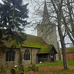
 Great Burstead church Great Burstead church | |
| Coordinates: 51°36′15″N 0°25′31″E / 51.604078°N 0.42522669°E / 51.604078; 0.42522669 | |
| Country | England |
| Primary council | Basildon |
| County | Essex |
| Region | East of England |
| Great Burstead and South Green | 1996 |
| Status | Parish |
| Main settlements | Great Burstead, Noak Hill and South Green |
| Area | |
| • Total | 7.420 km (2.865 sq mi) |
| Population | |
| • Total | 5,968 |
| • Density | 800/km (2,100/sq mi) |
| Website | http://www.greatbursteadsouthgreen-vc.gov.uk/ |
Great Burstead and South Green is a civil parish in the Basildon district, in the county of Essex, England. The parish includes the settlements of Great Burstead, Noak Hill and South Green. In 2011 the parish had a population of 5968. The parish touches Billericay, Little Burstead, Noak Bridge and Ramsden Crays. There are 14 listed buildings in Great Burstead and South Green.
History
The parish was formed on 1 September 1996 from part of the unparished area of Basildon.
References
- "Great Burstead and South Green". City Population De. Retrieved 24 September 2021.
- "Great Burstead and South Green". Ordnance Survey. Retrieved 24 September 2021.
- "Listed buildings in Great Burstead and South Green, Basildon, Essex". British Listed Buildings. Retrieved 24 September 2021.
- "The Basildon (Parishes) Order 1996" (PDF). Local Government Boundary Commission for England. Retrieved 24 September 2021.
- "Brentwood Registration District". UKBMD. Retrieved 24 September 2021.
External links
This Essex location article is a stub. You can help Misplaced Pages by expanding it. |