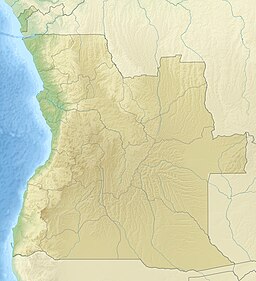
| Tigres Strait | |
|---|---|
| Estreito dos Tigres (Portuguese) | |
 | |
| Coordinates | 16°38′S 11°46′E / 16.633°S 11.767°E / -16.633; 11.767 |
| Ocean/sea sources | Atlantic Ocean |
| Basin countries | Angola |
| Max. length | 35 km (22 mi) |
| Max. width | 9 km (5.6 mi) |
| Islands | Tigres Island |
| References | |
The Tigres Strait, formerly known as Tigres Bay or Great Fish Bay, is a strait in Angola, located in Namibe Province, serving as a separation between the Angolan mainland and the Tigres Island.
Geography
It once had a small peninsula on its eastern side, with its isthmus in the south and a well established fishing village named Saint Martin of the Tigers (in Portuguese: São Martinho dos Tigres). The ocean broke through the isthmus of the peninsula in 1962 and the water line was severed. Tigres became an island overnight, Tigres Island, the largest island of Angola.
Currently, most of the area of the former bay has become a strait between the island and the mainland. Of the original bay, only a small inlet open to the north —the Saco dos Tigres— remains at the southern end.
History
On 6 December 1904 the Russian fleet proceeding to the pacific to fight the Battle of Tsushima of stopped at the bay to take on coal. They left the following afternoon. The British HMS Barrosa arrived the next day looking for the fleet before heading to Moçâmedes.
See also
References
- GoogleEarth
- "Baia dos Tigres". Mapcarta. Retrieved 10 October 2016.
- Baía dos Tigres é uma aldeia fantasma. Jornal de Angola. 10 de janeiro de 2019.
- "Cool Waters". sites.google.com. Retrieved 2017-07-13.
- "Ilha dos Tigres". Mapcarta. Retrieved 10 October 2016.
- "Saco dos Tigres". Mapcarta. Retrieved 14 October 2016.
- ^ Pleshakov, Constantine (2002). The Tsar's Last Armada. Oxford: Basic Books. pp. 140–141. ISBN 1-903985-31-5.
This Angola location article is a stub. You can help Misplaced Pages by expanding it. |