| This article needs additional citations for verification. Please help improve this article by adding citations to reliable sources. Unsourced material may be challenged and removed. Find sources: "Great Trowlesworthy Tor" – news · newspapers · books · scholar · JSTOR (July 2017) (Learn how and when to remove this message) |
| Great Trowlesworthy Tor | |
|---|---|
 | |
| Highest point | |
| Elevation | 357 m (1,171 ft) |
| Coordinates | 50°27′43″N 4°00′09″W / 50.461944°N 4.002564°W / 50.461944; -4.002564 |
| Geography | |
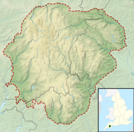
| Location | Dartmoor, England |
| OS grid | SX579643 |
| Topo map | OS Explorer OL28: Dartmoor |
| Climbing | |
| Easiest route | From Trowlesworthy Farm |
Great Trowlesworthy Tor is a granite tor on the southwestern edge of Dartmoor. It is located near the popular Cadover Bridge and is a popular walking destination. It is common for the Dartmoor Pony and other cattle to be roaming around the tor. Little Trowlesworthy Tor, height 330m, is on its western slope and is known to hold a disused flagpole that was used to celebrate Devonport's independence from Plymouth in the 1920s.
References
- "Great Trowlesworthy Tor". 9 July 2015.
This Devon location article is a stub. You can help Misplaced Pages by expanding it. |
This article about a specific United Kingdom geological feature is a stub. You can help Misplaced Pages by expanding it. |