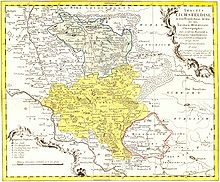
Ortsteil of Mühlhausen in Thuringia, Germany
| Höngeda | |
|---|---|
| Ortsteil of Mühlhausen | |
 The Prussian milestone in Höngeda The Prussian milestone in Höngeda | |
| Location of Höngeda | |
  | |
| Coordinates: 51°10′55″N 10°30′12″E / 51.18194°N 10.50333°E / 51.18194; 10.50333 | |
| Country | Germany |
| State | Thuringia |
| District | Unstrut-Hainich-Kreis |
| Town | Mühlhausen |
| First mentioned | 876 |
| Government | |
| • Ortsteilbürgermeister | Falk Güte |
| Elevation | 198 m (650 ft) |
| Population | |
| • Total | 723 |
| Time zone | UTC+01:00 (CET) |
| • Summer (DST) | UTC+02:00 (CEST) |
| Postal codes | 99998 |
| Dialling codes | 03601 |
| Vehicle registration | UH, LSZ, MHL |
| Website | muehlhausen.de |
Höngeda (pronounced [ˈhœŋɛdaː]) is a village and quarter of the town of Mühlhausen in Thuringia, central Germany.
Geography
Höngeda is located southeast of Mühlhausen along the Landesstraße (state's road) 247 from Mühlhausen to Gotha in the Thuringian Basin and in the two-kilometre-wide Unstrut lowlands. The area is a flat, undulating farmland. Poplars break up the landscape.
History


Already on 18 May 876, Höngeda was first mentioned in a document. On 4 June 1300, Landgrave Frederick I sold the village, together with Grabe and Bollstedt, to the imperial city of Mühlhausen. In 1565, there were 30 (male) inhabitants in Höngeda. In 1802, Höngeda, together with Mühlhausen, fell to the Kingdom of Prussia, from 1807 to 1813 to the Kingdom of Westphalia (Dorla canton) created by Napoleon, and after the Congress of Vienna in 1816, it was assigned to the district of Mühlhausen i. Th. in the Prussian province of Saxony.
Höngeda has always been an agriculturally oriented village, which after the fall of communism adopted new forms of land ownership. Small-scale industry has settled in the village. Animal enclosures and the gondola pond are attractions in the surrounding area.
On 30 June 1994, Höngeda was integrated into the new municipality of Weinbergen. Since 1 January 2019, it has been a quarter of the town of Mühlhausen due to the accession of the municipality of Weinbergen to the town.
Sights
Notable people
- Karl Gottlieb Hildebrandt [de] (1858–1925), physicist, school director, and university lecturer
- Walter Burghardt [de] (1885–1938), politician (NSDAP)
- Klaus Listemann [de] (born 1940 in Höngeda), Major General of the Nationale Volksarmee (National People's Army) of the German Democratic Republic
References
- ^ "Der Ortsteil Höngeda" [The quarter of Höngeda] (in German). Stadt Mühlhausen. Retrieved 15 May 2022.
- "Einwohnerstatistik" [Population figures] (in German). Stadt Mühlhausen. Retrieved 8 June 2022.
- Kahl, Wolfgang (2010). Ersterwähnung Thüringer Städte und Dörfer. Ein Handbuch [First mentions of Thuringia's towns and villages. A handbook] (in German) (5th ed.). Bad Langensalza: Rockstuhl. p. 128. ISBN 978-3-86777-202-0.
- Jordan, Reinhard, ed. (1900). Chronik der Stadt Mühlhausen in Thüringen [Chronicle of the town of Mühlhausen in Thuringia] (in German). Vol. 1: (–1525). Mühlhausen: Danner. p. 65.
- Jordan, Reinhard, ed. (1900). Chronik der Stadt Mühlhausen in Thüringen [Chronicle of the town of Mühlhausen in Thuringia] (in German). Vol. 1: (–1525). Mühlhausen: Danner. p. 41.
- Statistisches Bundesamt, ed. (1995). Gemeinden 1994 und ihre Veränderungen seit 1. Januar 1948 in den neuen Ländern [Municipalities in 1994 and their changes since 1 January 1948 in the new states] (in German). Stuttgart: Metzler-Poeschel. ISBN 3-8246-0321-7.
External links
![]() Media related to Höngeda at Wikimedia Commons
Media related to Höngeda at Wikimedia Commons