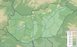
| Hűvösvölgy | |
|---|---|
| Neighbourhood | |
 | |
 | |
| Coordinates: 47°32′27″N 18°57′48″E / 47.540833°N 18.963333°E / 47.540833; 18.963333 | |
| Country | |
| County | Budapest |
| District | 2nd District |
| Area | |
| • Total | 1.089 km (0.420 sq mi) |
| Population | |
| • Total | 1,656 |
| • Density | 592/km (1,530/sq mi) |
| Time zone | UTC+1 (CET) |
| • Summer (DST) | UTC+2 (CEST) |
| Postal code | 1020 |
| Area code | (+36) 1 |
Hűvösvölgy is a neighbourhood in the 2nd District of Budapest. The area is a popular hiking destination and is also an important transport hub. The suburb is known for its terminus of the Budapest Children's Railway. A public transport terminus connects settlements north of the Buda (Nagykovácsi, Remeteszőlős, Solymár) with Buda city centre.
References
- Aranyosi, István. "For Active Families: Solymár - Hűvösvölgy". Outdooractive. Retrieved 10 June 2021.
- "Home". MÁV Zrt Széchenyi-hegyi Gyermekvasút. MAV csoport. Retrieved 10 June 2021.
- "Ideiglenes forgalmi rend Hűvösvölgyben". villamosok.hu (in Hungarian). Retrieved 10 June 2021.
This Budapest location article is a stub. You can help Misplaced Pages by expanding it. |