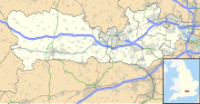
| Site of Special Scientific Interest | |
 | |
 | |
| Location | Berkshire |
|---|---|
| Grid reference | SU 414 662 |
| Coordinates | 51°23′35″N 1°24′22″W / 51.393°N 1.406°W / 51.393; -1.406 |
| Interest | Geological |
| Area | 0.2 hectares (0.49 acres) |
| Notification | 1985 |
| Location map | Magic Map |
Hamstead Marshall Pit is a 0.2-hectare (0.49-acre) geological Site of Special Scientific Interest north of Hamstead Marshall in Berkshire. It is a Geological Conservation Review site.
This former gravel pit exposes gravels of the River Kennet, which were deposited around 450,000 years ago, during the Anglian ice age. Flint hand axes found on the site may be even older, showing that early humans were active in the Middle Palaeolithic in the area.
References
- ^ "Designated Sites View: Hamstead Marshall Pit". Sites of Special Scientific Interest. Natural England. Retrieved 2 March 2020.
- "Map of Hamstead Marshall Pit". Sites of Special Scientific Interest. Natural England. Retrieved 2 March 2020.
- "Hamstead Marshall Gravel Pit (Quaternary of the Thames)". Geological Conservation Review. Joint Nature Conservation Committee. Retrieved 4 October 2019.
- Hosfield, Robert (January 2007). "Lower/Middle Palaeolithic (Berkshire)" (PDF). Oxford Archaeology.