| Haughin Creek Tributary to Big Anne Creek | |
|---|---|
  | |
| Location | |
| Country | United States |
| State | Nebraska |
| County | Keya Paha |
| Physical characteristics | |
| Source | Coon Creek divide |
| • location | about 7 miles southeast of Bothwell School |
| • coordinates | 42°49′29.00″N 099°22′25.00″W / 42.8247222°N 99.3736111°W / 42.8247222; -99.3736111 |
| • elevation | 2,080 ft (630 m) |
| Mouth | Big Anne Creek |
| • location | about 3 miles north of Mariaville, Nebraska |
| • coordinates | 42°47′28.00″N 099°20′17.38″W / 42.7911111°N 99.3381611°W / 42.7911111; -99.3381611 |
| • elevation | 1,818 ft (554 m) |
| Length | 3.28 mi (5.28 km) |
| Basin size | 4.78 square miles (12.4 km) |
| Discharge | |
| • location | Big Anne Creek |
| • average | 0.63 cu ft/s (0.018 m/s) at mouth with Big Anne Creek |
| Basin features | |
| Progression | Big Anne Creek → Niobrara River → Missouri River → Mississippi |
| River system | Niobrara |
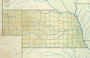
Haughin Creek is a 3.28 mi (5.28 km) long second-order tributary to Big Anne Creek in Keya Paha County, Nebraska. This is the only stream of this name in the United States.
Haughin Creek rises on the Coon Creek divide at about 7 miles (11 km) southeast of Bothwell School in Keya Paha County and then flows generally southeast to join Big Anne Creek about 3 miles (4.8 km) north of Mariaville, Nebraska.
Watershed
Haughin Creek drains 4.78 square miles (12.4 km) of area, receives about 23.8 in/year (60 cm/year) of precipitation, and is about 3.90% forested.
See also
References
- ^ "Geographic Names Information System". edits.nationalmap.gov. US Geological Survey. Retrieved 9 November 2022.
- "ArcGIS Web Application". epa.maps.arcgis.com. US EPA. Retrieved November 9, 2022.
- ^ "Haughin Creek Watershed Report". watersgeo.epa.gov. US EPA. Retrieved 9 November 2022.
This article related to a river in Nebraska is a stub. You can help Misplaced Pages by expanding it. |