| Henleyville, California | |
|---|---|
| Unincorporated community | |
 | |
| Coordinates: 39°57′43″N 122°19′36″W / 39.96194°N 122.32667°W / 39.96194; -122.32667 | |
| Country | |
| State | |
| County | Tehama County |
| Elevation | 133 m (436 ft) |
Henleyville is an unincorporated community in Tehama County, in the U.S. state of California.
History
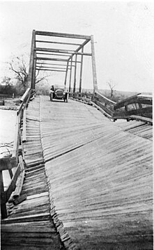
Henleyville was one of the communities in Tehama County homesteaded by settlers in the 1860s and 1870s. It was likely named after William N. Henley, who was from Indiana and registered to vote at "Henleys" on August 3, 1866.
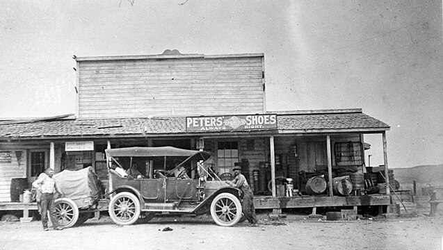
A post office occupied the same building as the general store, and was in operation at Henleyville from 1873 to 1878, and from 1880 until 1936.
In October 1881, the Howell School in Henleyville had one teacher and 15 students, including five boys and ten girls.
According to the Red Bluff Daily News, the first death by lightning recorded in Tehama County occurred on October 4, 1901, four miles west of Henleyville, killing an 18 year old at a blacksmith shop, as well as the horse he was shoeing.
When writer Pearl S. Buck won the Nobel Prize in Literature in 1938, the Red Bluff Daily News reported that she was a niece of area resident Thomas L. Sydenstricker and once visited his Henleyville home.
Population
Based on 1990 census data, a United States Department of Agriculture report found that the population of the Henleyville-Paskenta-Sunnyside "block group aggregation" was 1,697.
Gallery
References
- U.S. Geological Survey Geographic Names Information System: Henleyville, California
- ^ Smith, Josie (2016). Tehama County. Arcadia Publishing. ISBN 9781540201430.
- Gudde, Erwin Gustav (1998). California Place Names. Berkeley and Los Angeles: University of California Press. p. 163. ISBN 0-520-21316-5.
- "Place Names" (PDF). Archived from the original (PDF) on 8 May 2017. Retrieved 25 March 2018.
- "Henleyville Hints". Weekly Sentinel. Red Bluff, California. November 3, 1888. Retrieved 2023-11-04 – via Newspapers.com.
- "Red Bluff Yesterdays". Red Bluff Daily News. November 13, 1968. p. 15. Retrieved 2023-11-05 – via Internet Archive.
- Donoghoe, Ellen M. (April 2003). "Delimiting Communities in the Pacific Northwest" (PDF). United States Department of Agriculture, Forest Service. Retrieved 2023-11-03.
| Municipalities and communities of Tehama County, California, United States | ||
|---|---|---|
| County seat: Red Bluff | ||
| Cities |  | |
| CDPs | ||
| Unincorporated communities | ||
| Historic communities | ||
| Footnotes | ‡This populated place also has portions in an adjacent county or counties | |
39°57′43″N 122°19′36″W / 39.96194°N 122.32667°W / 39.96194; -122.32667
Category:
