| Telečka
Телечка (Serbian) Bácsgyulafalva (Hungarian) | |
|---|---|
| Village (Selo) | |
 The Saint Mary Catholic Church. The Saint Mary Catholic Church. | |
   | |
| Coordinates: 45°48′N 19°23′E / 45.800°N 19.383°E / 45.800; 19.383 | |
| Country | |
| Province | |
| Region | Bačka |
| District | West Bačka |
| Municipality | Sombor |
| Population | |
| • Total | 2,084 |
| Time zone | UTC+1 (CET) |
| • Summer (DST) | UTC+2 (CEST) |
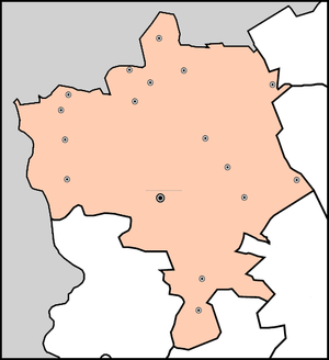
 Sombor
Kljajićevo
Čonoplja
Svetozar Miletić
Telečka
Bački Monoštor
Bezdan
Kolut
Bački Breg
Gakovo
Kruševlje
Stanišić
Aleksa Šantić
Rastina
Riđica
Stapar
Doroslovo
Municipality
Sombor
Kljajićevo
Čonoplja
Svetozar Miletić
Telečka
Bački Monoštor
Bezdan
Kolut
Bački Breg
Gakovo
Kruševlje
Stanišić
Aleksa Šantić
Rastina
Riđica
Stapar
Doroslovo
Municipalityof Sombor
●
Telečka (Serbian Cyrillic: Телечка, Hungarian: Bácsgyulafalva) is a village in Serbia. It is in the Sombor municipality, in the West Bačka District, Vojvodina province. The village has a Hungarian ethnic majority and its population is 2,084 people (2002 census). It is surrounded by a sandy region, also referred to as Telečka, or Telečka sands.
History
Settlement was built in 1883-1884 by Hungarian colonists. First census was conducted in 1890 and it recorded population of 2,479 inhabitants. Before the First World War this village was part of Bács-Bodrog County (Kingdom of Hungary, Austria-Hungary). Since 1918, it is part of the Kingdom of Serbs, Croats and Slovenes (later renamed to Yugoslavia). Today, the village has a Hungarian ethnic majority with more than 70% of the population.
Ethnic groups (2002 census)
- Hungarians = 1,508 (72.36%)
- Serbs = 429 (20.59%)
- Romani = 37 (1.78%)
- Yugoslavs = 23 (1.10%)
- Croats = 13 (0.62%)
- others.
Historical population

- 1961: 2,996
- 1971: 2,665
- 1981: 2,429
- 1991: 2,138
See also
References
- Slobodan Ćurčić, Broj stanovnika Vojvodine, Novi Sad, 1996.
External links
| Cities, towns and villages in the West Bačka District | ||
|---|---|---|
| Sombor |  | |
| Apatin | ||
| Kula | ||
| Odžaci | ||
| bold are municipalities or cities | ||
45°48′N 19°23′E / 45.800°N 19.383°E / 45.800; 19.383
This West Bačka District, Vojvodina location article is a stub. You can help Misplaced Pages by expanding it. |