City in Illinois, United States
| Hillsboro, Illinois | |
|---|---|
| City | |
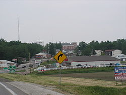
 Entering from the northwest on Illinois Route 16 Entering from the northwest on Illinois Route 16 | |
| Motto(s): "Pride, Progress, Prosperity" | |
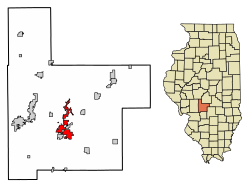
 Location in Montgomery County, Illinois Location in Montgomery County, Illinois | |
 | |
| Coordinates: 39°10′31″N 89°28′20″W / 39.17528°N 89.47222°W / 39.17528; -89.47222 | |
| Country | United States |
| State | Illinois |
| County | Montgomery |
| Townships | Hillsboro, East Fork, Butler Grove, Irving |
| Government | |
| • Mayor | Don Downs |
| Area | |
| • Total | 10.17 sq mi (26.35 km) |
| • Land | 8.42 sq mi (21.82 km) |
| • Water | 1.75 sq mi (4.53 km) |
| Elevation | 587 ft (179 m) |
| Population | |
| • Total | 5,902 |
| • Density | 700.62/sq mi (270.50/km) |
| Time zone | UTC-6 (CST) |
| • Summer (DST) | UTC-5 (CDT) |
| ZIP code | 62049 |
| Area code | 217 |
| FIPS code | 17-35047 |
| GNIS feature ID | 2394386 |
| Wikimedia Commons | Hillsboro, Illinois |
| Website | www |
Hillsboro is a city in and the county seat of Montgomery County, Illinois, United States. The population was 5,902 at the 2020 census.
History
The community was founded in 1823 and incorporated on March 26, 1913.
There is some doubt about the origin of the city's name. The local terrain is quite hilly, as a result of the drainage of the Shoal Creek watershed, causing widespread belief that this is the name's source. Alternatively, there is the belief that it was named for Hillsborough, North Carolina, the home of some of the early settlers, including Hiram Rountree and John Nussman.
Geography
Hillsboro is located south of the center of Montgomery County at 39°9′54″N 89°29′4″W / 39.16500°N 89.48444°W / 39.16500; -89.48444 (39.164973, −89.484572). It is bordered to the east by Schram City and to the south by Taylor Springs.
Illinois Route 16 passes through the city center, leading west 9 miles (14 km) to Litchfield and northeast 28 miles (45 km) to Pana. Illinois Route 127 enters Hillsboro from the northwest with IL 16 but continues south as Vandalia Road; IL 127 leads north-northwest 12 miles (19 km) to Raymond and south 20 miles (32 km) to Greenville. Vandalia is 27 miles (43 km) to the southeast via Illinois Route 185.
According to the U.S. Census Bureau, Hillsboro has a total area of 10.4 square miles (27 km), of which 8.7 square miles (23 km) are land and 1.8 square miles (4.7 km), or 16.84%, are water. The Middle Fork of Shoal Creek passes just west of the city limits, flowing south toward the Kaskaskia River. Lake Glenn Shoals, north of the city, is a reservoir on the Middle Fork, and the Hillsboro city limits extend north more than 6 miles (10 km) to encompass the lake. Lake Hillsboro is a smaller reservoir on a tributary of the Middle Fork, northeast of the city center.
Climate
| Climate data for Hillsboro, Illinois (1991–2020 normals, extremes 1895–present) | |||||||||||||
|---|---|---|---|---|---|---|---|---|---|---|---|---|---|
| Month | Jan | Feb | Mar | Apr | May | Jun | Jul | Aug | Sep | Oct | Nov | Dec | Year |
| Record high °F (°C) | 75 (24) |
79 (26) |
90 (32) |
92 (33) |
99 (37) |
106 (41) |
114 (46) |
112 (44) |
105 (41) |
95 (35) |
83 (28) |
74 (23) |
114 (46) |
| Mean daily maximum °F (°C) | 38.4 (3.6) |
44.5 (6.9) |
55.4 (13.0) |
68.3 (20.2) |
77.7 (25.4) |
86.0 (30.0) |
88.7 (31.5) |
87.3 (30.7) |
81.7 (27.6) |
69.7 (20.9) |
54.6 (12.6) |
42.8 (6.0) |
66.3 (19.1) |
| Daily mean °F (°C) | 29.9 (−1.2) |
34.9 (1.6) |
44.8 (7.1) |
56.2 (13.4) |
66.0 (18.9) |
74.6 (23.7) |
77.6 (25.3) |
76.0 (24.4) |
69.2 (20.7) |
57.8 (14.3) |
44.9 (7.2) |
34.6 (1.4) |
55.5 (13.1) |
| Mean daily minimum °F (°C) | 21.4 (−5.9) |
25.4 (−3.7) |
34.2 (1.2) |
44.1 (6.7) |
54.3 (12.4) |
63.3 (17.4) |
66.6 (19.2) |
64.7 (18.2) |
56.7 (13.7) |
45.8 (7.7) |
35.2 (1.8) |
26.4 (−3.1) |
44.8 (7.1) |
| Record low °F (°C) | −21 (−29) |
−22 (−30) |
−10 (−23) |
18 (−8) |
28 (−2) |
37 (3) |
45 (7) |
39 (4) |
26 (−3) |
17 (−8) |
−5 (−21) |
−20 (−29) |
−22 (−30) |
| Average precipitation inches (mm) | 2.52 (64) |
2.61 (66) |
3.05 (77) |
5.03 (128) |
5.06 (129) |
3.83 (97) |
3.74 (95) |
3.14 (80) |
3.30 (84) |
3.41 (87) |
3.76 (96) |
2.62 (67) |
42.07 (1,069) |
| Average precipitation days (≥ 0.01 in) | 6.3 | 6.3 | 8.4 | 9.6 | 11.2 | 8.6 | 7.3 | 6.6 | 5.9 | 7.3 | 6.6 | 6.8 | 90.9 |
| Source: NOAA | |||||||||||||
Demographics
| Census | Pop. | Note | %± |
|---|---|---|---|
| 1860 | 853 | — | |
| 1880 | 1,803 | — | |
| 1900 | 1,937 | — | |
| 1910 | 3,424 | 76.8% | |
| 1920 | 5,074 | 48.2% | |
| 1930 | 4,435 | −12.6% | |
| 1940 | 4,514 | 1.8% | |
| 1950 | 4,141 | −8.3% | |
| 1960 | 4,232 | 2.2% | |
| 1970 | 4,267 | 0.8% | |
| 1980 | 4,408 | 3.3% | |
| 1990 | 4,400 | −0.2% | |
| 2000 | 4,359 | −0.9% | |
| 2010 | 6,207 | 42.4% | |
| 2020 | 5,902 | −4.9% | |
| U.S. Decennial Census | |||
As of the census of 2000, there were 4,359 people, 1,800 households, and 1,189 families residing in the city. The population density was 1,214.9 inhabitants per square mile (469.1/km). There were 1,944 housing units at an average density of 541.8 per square mile (209.2/km). The racial makeup of the city was 97.22% White, 1.10% African American, 0.32% Native American, 0.37% Asian, 0.07% Pacific Islander, 0.39% from other races, and 0.53% from two or more races. Hispanic or Latino of any race were 1.19% of the population.
There were 1,800 households, out of which 33.1% had children under the age of 18 living with them, 50.2% were married couples living together, 11.9% had a female householder with no husband present, and 33.9% were non-families. 30.0% of all households were made up of individuals, and 14.8% had someone living alone who was 65 years of age or older. The average household size was 2.36 and the average family size was 2.91.
In the city, the population was spread out, with 25.8% under the age of 18, 8.4% from 18 to 24, 27.2% from 25 to 44, 21.0% from 45 to 64, and 17.6% who were 65 years of age or older. The median age was 38 years. For every 100 females, there were 85.7 males. For every 100 females age 18 and over, there were 80.3 males.
The median income for a household in the city was $33,075, and the median income for a family was $40,135. Males had a median income of $31,821 versus $18,668 for females. The per capita income for the city was $17,458. About 14.3% of families and 17.2% of the population were below the poverty line, including 24.9% of those under age 18 and 11.9% of those age 65 or over.
Protected areas
The Bremer Wildlife Sanctuary, north of Hillsboro, is the southeastern terminus of the Arches Rail Trail. The 3-mile-long (5 km) rail trail connects the Hillsboro area with nearby Butler.
Notable people
- Harry Bellaver (1905–1993), stage, film, and television actor
- Stephen D. Canady (1865–1923), Illinois state legislator and businessman
- John R. Challacombe (1845–1935), Illinois state legislator and businessman
- Otto Funk (1868–1934), violinist
- Brian Graden (born 1963), President of Entertainment, MTV Networks
- Mary Hartline (1926-2020), early television star
- Matt Hughes (born 1973), 2x UFC Welterweight Champion
- Mark Hughes (born 1973), mixed martial artist
- Ralph Isselhardt (1910–1972), football player
- Wickliffe Kitchell (1789-1869), Illinois lawyer and politician
- Jesse J. Phillips (1837–1901), Chief Justice of the Illinois Supreme Court
- Norman W. Ray (born 1942), United States admiral
- John H. Rountree (1805–1890), Wisconsin legislator
- John Tillson (1825-1892), Illinois legislator and lawyer
- Stan Wallace (1931-1999), defensive back for Chicago Bears in 1950s
- John Meek Whitehead (1852–1924), Wisconsin state senator
References
- ^ "City of Hillsboro, Illinois". City of Hillsboro, Illinois. Retrieved August 31, 2012.
- ^ U.S. Geological Survey Geographic Names Information System: Hillsboro, Illinois
- "City Officials – the City of Hillsboro, Illinois". Retrieved June 26, 2021.
- ^ "2022 U.S. Gazetteer Files: Illinois". United States Census Bureau. Retrieved March 20, 2023.
- ^ "P1. Race – Hillsboro city, Illinois: 2020 DEC Redistricting Data (PL 94-171)". U.S. Census Bureau. Retrieved March 20, 2023.
- "Find a County". National Association of Counties. Archived from the original on May 31, 2011. Retrieved June 7, 2011.
- "Hillsboro, Illinois". City-Data.com. Retrieved August 31, 2012.
- "History | Hillsboro, Illinois". Archived from the original on November 1, 2013. Retrieved June 16, 2013.
- "US Gazetteer files: 2010, 2000, and 1990". United States Census Bureau. February 12, 2011. Retrieved April 23, 2011.
- "NowData – NOAA Online Weather Data". National Oceanic and Atmospheric Administration. Retrieved July 24, 2021.
- "Station: Hillsboro, IL". U.S. Climate Normals 2020: U.S. Monthly Climate Normals (1991-2020). National Oceanic and Atmospheric Administration. Retrieved July 24, 2021.
- "Census of Population and Housing". Census.gov. Retrieved June 4, 2015.
- "U.S. Census website". United States Census Bureau. Retrieved January 31, 2008.
- "Helen & Betty Bremer Wildlife Sanctuary".
- Slepica, Nancy Bliss (October 18, 2012). "Arches Trail Now Open To The Public". The Journal-News.
- "Otto Funk". Historical Society of Montgomery County, Illinois. Archived from the original on August 17, 2011. Retrieved August 31, 2012.
External links
- Official website
- Hillsboro Community School District No. 3
- Hillsboro Illinois Historical Society of Montgomery County Illinois
- City-data.com
| Municipalities and communities of Montgomery County, Illinois, United States | ||
|---|---|---|
| County seat: Hillsboro | ||
| Cities | ||
| Villages | ||
| Townships | ||
| Unincorporated communities | ||
| Footnotes | ‡This populated place also has portions in an adjacent county or counties | |
