| Kampyli | |
|---|---|
 | |
| Coordinates: 35°18′05″N 33°06′25″E / 35.30139°N 33.10694°E / 35.30139; 33.10694 | |
| Country (de jure) | |
| • District | Kyrenia District |
| Country (de facto) | |
| • District | Girne District |
| Population | |
| • Total | 194 |
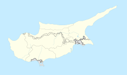
Kampyli (Greek: Καμπυλή; Turkish: Hisarköy “castle village”, previously Kambilli) is a small Turkish Cypriot village in Cyprus, located approximately 3 km (1.9 mi) east of Myrtou. It is under the de facto control of Northern Cyprus. In 1831, 30% of the village's inhabitants were Maronites. They all left by 1940, and, around that time, Muslim families from Larnakas tis Lapithou moved into Kampyli. As of 2011, Kampyli had population of 194.
References
- In 1983, the Turkish Republic of Northern Cyprus unilaterally declared independence from the Republic of Cyprus. The de facto state is not recognised by any UN state except Turkey.
- "KKTC 2011 Nüfus ve Konut Sayımı" [TRNC 2011 Population and Housing Census] (PDF) (in Turkish). TRNC State Planning Organization. 6 August 2013. Archived from the original (PDF) on 6 November 2013.
- "KAMBYLI". Internal Displacement in Cyprus. PRIO Cyprus Centre. Retrieved 25 January 2015.
This Cyprus location article is a stub. You can help Misplaced Pages by expanding it. |
