| This article relies largely or entirely on a single source. Relevant discussion may be found on the talk page. Please help improve this article by introducing citations to additional sources. Find sources: "Hochwilde" – news · newspapers · books · scholar · JSTOR (November 2024) |
| Hochwilde | |
|---|---|
| Altissima | |
 | |
| Highest point | |
| Elevation | 3,482 m (11,424 ft) |
| Prominence | 343 m (1,125 ft) |
| Parent peak | Schalfkogel |
| Listing | Alpine mountains above 3000 m |
| Coordinates | 46°45′59″N 11°1′25″E / 46.76639°N 11.02361°E / 46.76639; 11.02361 |
| Geography | |
| Location | Tyrol, Austria / South Tyrol, Italy |
| Parent range | Ötztal Alps |
| Climbing | |
| First ascent | 1858 by J. Ganahl with peasants and shepherds |
| Easiest route | South ridge from the Stettiner Hütte [de] (marked route) |
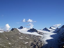
The Hochwilde or Hohe Wilde (Italian: Altissima) is a mountain in the Ötztal Alps on the border between Tyrol, Austria, and South Tyrol, Italy.

References
- Klier, Walter (2006). Ötztaler Alpen. Bergverlag Rother. ISBN 978-3-7633-1123-1.
External links
![]() Media related to Hochwilde at Wikimedia Commons
Media related to Hochwilde at Wikimedia Commons
- Austrian Alpenverein (in German)
- Alpenverein South Tyrol (in German)
This Tyrol location article is a stub. You can help Misplaced Pages by expanding it. |
This article about a mountain, mountain range, or peak located in Trentino-Alto Adige/Südtirol is a stub. You can help Misplaced Pages by expanding it. |