| Horton Creek | |
|---|---|
 | |
| Location | |
| Country | United States |
| State | Arizona |
| Physical characteristics | |
| Source | |
| • location | spring |
| • elevation | 6,700 ft (2,000 m) |
| Mouth | |
| • location | confluence with Tonto Creek |
| • elevation | 5,400 ft (1,600 m) |
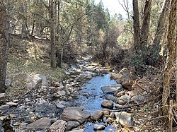
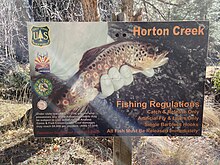
Horton Creek is located in the Mogollon Rim area of the state of Arizona. The closest town Payson is 20 miles (32 km) away. The facilities are maintained by Tonto National Forest division of the USDA Forest Service.


Fish species

References
- Information and Education Division (2007), Arizona Fishin' Holes, Phoenix, AZ: Arizona Game and Fish Department
External links
- Arizona Fishing Locations Map
- Arizona Boating Locations Facilities Map
- U.S. Geological Survey Geographic Names Information System: Horton Creek (Arizona)
34°20′24″N 111°05′43″W / 34.34000°N 111.09528°W / 34.34000; -111.09528
Categories: