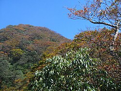
| Xueshan Range | |
|---|---|
| Snow Mountain Range | |
 | |
| Highest point | |
| Elevation | 3,886 m (12,749 ft) |
| Naming | |
| Native name | 雪山山脈 (Chinese) |
| Geography | |
 | |
| Location | Taiwan |
| Geology | |
| Mountain type | Mountain range |
| Xueshan Range | |||||||||
|---|---|---|---|---|---|---|---|---|---|
| Traditional Chinese | 雪山山脈 | ||||||||
| Simplified Chinese | 雪山山脉 | ||||||||
| Literal meaning | Snowy Mountain Range | ||||||||
| |||||||||
The Xueshan Range is a mountain range in northern Taiwan. It faces the Chungyang Range on the southeast. The tallest peak of Xueshan Range is Mount Xue/Sekuwan, which has a height of 3,886 m (12,749 ft). Shei-Pa National Park is located around the peaks of Xueshan and Dabajianshan.
Names
The current name derives from the pinyin romanization of the Chinese name of the range's highest peak, Xueshan. The same name is sometimes written Hsüeh-shan or calqued as the Snow or Snowy Mountain Range. Under the Qing, the range was also known variously as the Middle, Western, Dodds, or Mt Sylvia Range.
List of peaks
There are 54 peaks taller than 3,000 m (9,843 ft) among the Xueshan Range, 19 of which are numbered among the 100 Peaks of Taiwan:
- Xueshan Main Peak (雪山主峰), 3,886 m (12,749 ft)
- Xueshan Eastern Peak (雪山東峰), 3,201 m (10,502 ft)
- Xueshan Northern Peak (雪山北峰), 3,703 m (12,149 ft)
- Daxueshan (大雪山), 3,530 m (11,581 ft)
- Zhongxueshan (中雪山), 3,173 m (10,410 ft)
- Huoshishan (火石山), 3,310 m (10,860 ft)
- Touyingshan (頭鷹山), 3,510 m (11,516 ft)
- Zhijiayangdashan (志佳陽大山), 3,289 m (10,791 ft)
- Dabajianshan (大霸尖山), 3,490 m (11,450 ft)
- Xiaobajianshan (小霸尖山), 3,445 m (11,302 ft)
- Baigudashan (白姑大山), 3,342 m (10,965 ft)
- Yizeshan (伊澤山), 3,497 m (11,473 ft)
- Dajianshan (大劍山), 3,594 m (11,791 ft)
- Jianshan (劍山]), 3,253 m (10,673 ft)
- Jiayangshan (佳陽山), 3,314 m (10,873 ft)
- Pintianshan (品田山), 3,524 m (11,562 ft)
- Chiyoushan (池有山), 3,303 m (10,837 ft)
- Taoshan (桃山), 3,325 m (10,909 ft)
- Kalayeshan (喀拉業山), 3,133 m (10,279 ft)
See also
References
Citations
- EB (1879), p. 416.
- Braithwaite (1907), p. 106.
Bibliography
- "Formosa" , Encyclopaedia Britannica, 9th ed., Vol. IX, New York: Charles Scribner's Sons, 1879, pp. 415–17.
- Takekoshi, Yosaburo (1907), Braithwaite, George (ed.), Japanese Rule in Formosa, London: Longmans, Green, & Co.
| Topography of Taiwan | ||
|---|---|---|
| Mountain ranges |
|  |
| Plateaus and hill lands | ||
| Plains | ||
| Basins | ||
| Volcano groups | ||
| * The place names listed above are mainly romanized as Wade–Giles that used in most of academic articles. | ||
24°23′10″N 121°13′49″E / 24.38611°N 121.23028°E / 24.38611; 121.23028
This article about a location in Taiwan is a stub. You can help Misplaced Pages by expanding it. |