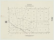
Cadastral in South Australia
| Hundred of Roby South Australia | |||||||||||||||
|---|---|---|---|---|---|---|---|---|---|---|---|---|---|---|---|
 | |||||||||||||||
| Coordinates | 35°25′16″S 139°45′25″E / 35.421°S 139.757°E / -35.421; 139.757 | ||||||||||||||
| Established | March 30, 1899 (1899-03-30) | ||||||||||||||
| Area | 143 square miles (370 km) | ||||||||||||||
| LGA(s) | Coorong District Council | ||||||||||||||
| County | County of Buccleuch | ||||||||||||||
| |||||||||||||||
The Hundred of Roby is a hundred within the County of Buccleuch in the Mallee region of South Australia.

The only township within the hundred is Coomandook, a settlement about 120 kilometres (75 mi) east-south-east of Adelaide on Dukes Highway. Parts of the localities of Cooke Plains, Sherlock, Peake, and Yumali also lie within the hundred.
Local government
In 1911 the District Council of Peake was proclaimed and the Hundred of Roby became one of four wards within the new council area. When Peake was amalgamated with the district councils of Coonalpyn Downs and Meningie in 1997 the hundred became part of the much larger Coorong District Council.
References
- ^ "Placename Details: Hundred of Roby". Property Location Browser Report. Government of South Australia. 29 January 2009. SA0035042. Archived from the original on 7 December 2015. Retrieved 15 April 2019.
This South Australia geography article is a stub. You can help Misplaced Pages by expanding it. |