 Route 402
 | ||||
|---|---|---|---|---|
| Noveleta–Naic–Tagaytay Road | ||||
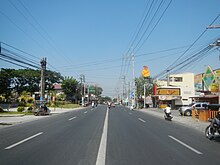
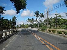
 A portion of Indang–Mendez Road, one of the component roads of N402 A portion of Indang–Mendez Road, one of the component roads of N402 | ||||
| Route information | ||||
| Maintained by Department of Public Works and Highways (DPWH) - Cavite 1st District Engineering Office and Cavite 2nd District Engineering Office | ||||
| Length | 49.42 km (30.71 mi) | |||
| Major junctions | ||||
| North end | ||||
| Major intersections |
| |||
| South end | ||||
| Location | ||||
| Country | Philippines | |||
| Major cities | Tagaytay | |||
| Towns | Tanza, Naic, Indang, Mendez | |||
| Highway system | ||||
| ||||
| ||||
National Route 402 (N402) forms part of the Philippine highway network. It runs through the rural municipalities of Cavite.
Route description
N402 covers the Tanza to Tagaytay segment of Noveleta–Naic–Tagaytay Road, according to the Department of Public Works and Highways.
Tanza to Naic
Main article: Antero Soriano Highway
N402 starts at N64 (Antero Soriano Highway) as Santa Cruz Street, a one-way street into the población of Tanza. In front of the entrance to the Diocesan Shrine of Saint Augustine, it then turns southwest as San Agustin Street, becomes a two-way street at its intersection with Santo Domingo Street. It meets the Biwas Roundabout past the Tanza Bridge, and once again meets Antero Soriano Highway at the Tanza Junction and proceeds towards Naic.
Naic to Indang

Within the población of Naic, N402 turns southwest towards J. Poblete Street (some of its segments is also known as Sabang Road) and then, in front of the Naic Church, veers southeast as Capt. Ciriaco Nazareno Street. It then intersects with Governor's Drive and proceeds towards Indang as Naic–Indang Road. It then enters the población of Indang alternatively known as A. Mojica Street and ends at De Ocampo Street. It then continues as De Ocampo Street, San Miguel Street, and A. Mabini Street, veers southeast in front of Indang Church as San Gregorio Street, and continues as San Gregorio Extension.
Indang to Mendez

At the end of San Gregorio Extension, the road intersects Trece Martires–Indang Road and proceeds southeast towards Mendez as Indang–Mendez Road. It then enters the municipality of Mendez, where it becomes a one-way southbound street known as C. Llamado Street and Osorio Street before ending at the latter's junction with J.P. Rizal Street in Mendez población.
Mendez to Tagaytay

At the junction of J.P. Rizal and Osorio Streets, the road proceeds southeast towards Tagaytay as Mendez–Tagaytay Road. The Tagaytay segment is also known as Tagaytay–Cavite via Mendez Road. It finally terminates at Tagaytay–Nasugbu Highway at Mendez Crossing, Tagaytay.
History
The direct predecessor of N402 is Highway 25, which connected Bacoor with Tagaytay via Naic especially during the 20th century.
Intersections
The entire route is located in Cavite.
| City/Municipality | km | mi | Destinations | Notes | |
|---|---|---|---|---|---|
| Tanza | Northern terminus | ||||
| 33.296 | 20.689 | Tanza Bridge | |||
| N402 shifts from San Agustin Street to Antero Soriano Highway | |||||
| 37.286 | 23.168 | Obispo Bridge | |||
| 39.721 | 24.681 | Calibuyo Bridge | |||
| Tanza–Naic boundary | 43.452 | 27.000 | Timalan bridge. Cavite 1st District Engineering Office–Cavite 2nd District Engineering Office highway boundary. | ||
| Naic | 43.180 | 26.831 | Bisaya Bridge | ||
| 43.395 | 26.964 | Palanas Bridge | |||
| 46.000 | 28.583 | Naic kilometer zero | |||
| Antero Soriano Highway | Y-intersection towards Naic Junction. N402 shifts from Antero Soriano Highway to J. Poblete Street. | ||||
| Sabang Road | Y-intersection towards Naic Junction | ||||
| N402 shifts from Capt. C. Nazareno Street to Naic–Indang Road. | |||||
| 49.000 | 30.447 | Route 402 reassurance sign. | |||
| 57.000 | 35.418 | Route 402 reassurance sign. | |||
| Indang | Burgos Street / Gusi Peace Prize International Avenue – Alfonso, Calumpang Cerca (Indang) | 5-way junction; one-way entrance into Burgos Street, which serves as alternative route to Indang town proper and Alfonso | |||
| De Ocampo Street – Alfonso | South end of Naic–Indang Road; continues south as A. Mojica Street. De Ocampo Street is one-way westbound. | ||||
| A. Mabini Street / San Miguel Street | Serves as entry point of motorists to N402 from Naic–Indang Road and Indang–Alfonso Road | ||||
| R. Jeciel Street – Indang Church, Cavite State University, Trece Martires | Serves as entry point of motorists from Naic–Indang Road and Indang–Alfonso Road | ||||
| 65.000 | 40.389 | Route 402 reassurance sign. | |||
| 66.000 | 41.010 | Indang Kilometer Zero | |||
| Indang–Alfonso Road – Alfonso | |||||
| N402 shifts from San Gregorio Extension to Indang–Mendez Road. | |||||
| Mendez | 73.000 | 45.360 | Route 402 reassurance sign | ||
| Osorio Street / Llamado Street | One-way intersection. N402 shifts from Indang–Mendez Road to Mendez–Tagaytay Road. | ||||
| 75.000 | 46.603 | Mendez kilometer zero | |||
| Cavite–Tagaytay–Batangas Expressway | Future Mendez Exit of CTBEX | ||||
| Tagaytay | 76.321– 64.119 | 47.424– 39.842 | Kilometer number reverses | ||
| 61.690 | 38.332 | Southern terminus | |||
1.000 mi = 1.609 km; 1.000 km = 0.621 mi
| |||||
References
- "Cavite 2nd". www.dpwh.gov.ph. Archived from the original on January 8, 2018. Retrieved June 15, 2020.
- "Cavite". www.dpwh.gov.ph. Archived from the original on January 9, 2018. Retrieved June 15, 2020.
- ^ "Road and Bridge Inventory". www.dpwh.gov.ph. Retrieved June 15, 2020.
- Southern Luzon Western Sheet (Map). 1:200000. Washington D.C.: US Geodetic Survey. 1941. Retrieved July 4, 2023.
| Expressways |
| ||||||||
|---|---|---|---|---|---|---|---|---|---|
| National roads |
| ||||||||
| Arterial Routes |
| ||||||||