| Indre Sula | |
|---|---|
 Indre Sula (right), seen from Vassnebba/Grånebba. Ytre Sula to the left. Indre Sula (right), seen from Vassnebba/Grånebba. Ytre Sula to the left. | |
| Highest point | |
| Elevation | 1,325 m (4,347 ft) |
| Coordinates | 62°51′15″N 8°44′57″E / 62.8542°N 8.7493°E / 62.8542; 8.7493 |
| Geography | |
  | |
| Location | Møre og Romsdal, Norway |
| Parent range | Trollheimen |
| Topo map | 1420 I Snota |
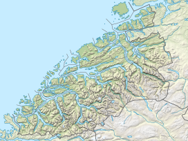
Indre Sula is a mountain in the municipality of Surnadal in Møre og Romsdal county, Norway. It is part of the Trollheimen mountain range, and it lies just north of the village of Todalsøra and the Todalsfjorden.
Indre Sula, meaning "Inner Sula", lies next to Ytre Sula, meaning "Outer Sula". The route from Indre Sula to Ytre Sula is scrambling.
References
- "Indre Sula, Surnadal (Møre og Romsdal)" (in Norwegian). yr.no. Retrieved 2019-04-21.
- "Indre Sula" (in Norwegian). yr.no. Retrieved 2010-12-07.
This Møre og Romsdal location article is a stub. You can help Misplaced Pages by expanding it. |