| 石貫ナギノ横穴群 | |
 Ishinukinagi Cave Tombs Ishinukinagi Cave Tombs | |
  | |
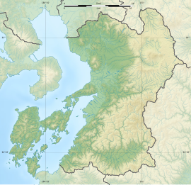
| Location | Tamana, Kumamoto, Japan |
|---|---|
| Region | Kyushu |
| Coordinates | 32°58′03″N 130°33′53″E / 32.96750°N 130.56472°E / 32.96750; 130.56472 |
| Type | corridor-type kofun [ja] (横穴式石室, yokoana-shiki sekishitsu) |
| Site notes | |
| Public access | Yes |
| National Historic Site of Japan | |
The Ishinukinagi Cave Tombs (石貫ナギノ横穴群, Ishinukinagi no yokoana-gun) is an archaeological site containing 45 Kofun period Corridor-type kofun [ja] (横穴式石室, yokoana-shiki sekishitsu) located in the Ishinuki neighborhood of the city of Tamana, Kumamoto, Japan. It was granted protection as a National Historic Site in 1921.
Overview
The Ishinukinagi Cave Tombs are located about 5 kilometers north from the urban center of Tamana on a seven-meter cliff face of Mount Aso tuff that continues on the right bank of the middle reaches of the Hanegi River for approximately 250 meters. There are 45 cave tombs on the eastern side of the cliff, clustered into groups of as many as 14 and as few as 3, and they vary in size. Along with neighboring Ishinuki Anakannon Cave Tombs, they reflect the continental characteristics of the area after the introduction of Buddhism into Japan. The highest tombs are located 5 meters above ground, and the lower ones are mostly buried underground. Most of the entrances have double or triple arches or are trapezoidal with rounded corners. Inside, continuous patterns such as concentric circles, triangles, circles, and diamonds are engraved into the walls and are painted with red pigment. Some of the interior and exterior walls of the stone-roofed tomb at the back of the burial chamber are engraved with bows, arrows, and shields and are thought to be the tombs of powerful clans that held sway in this region at the end of the Kofun period.
The site si approximately 3.7 kilometers north of Shin-Tamana Station on the Kyushu Shinkansen.
See also
References
- "石貫ナギノ横穴群". Cultural Heritage Online (in Japanese). Agency for Cultural Affairs. Retrieved 5 December 2023.
- Isomura, Yukio; Sakai, Hideya (2012). (国指定史跡事典) National Historic Site Encyclopedia. 学生社. ISBN 4311750404.(in Japanese)
External links
- Tamana City home page (in Japanese)