| Iwahig River Balsahan River | |
|---|---|
 Iwahig River Operational Map 1st Edition - NARA Iwahig River Operational Map 1st Edition - NARA | |
  | |
| Location | |
| Country | Philippines |
| Region | Palawan |
| Physical characteristics | |
| Source | |
| • coordinates | 9°08′58″N 118°4′52″E / 9.14944°N 118.08111°E / 9.14944; 118.08111 |
| • elevation | 8 metres (26 ft) |
| Mouth | Sulu Sea |
| • coordinates | 8°37′32″N 117°31′53″E / 8.625489°N 117.531424°E / 8.625489; 117.531424 |
| Length | 4.14 kilometres (2.57 mi) |
| Basin size | 22,859 ha (228.59 km) |
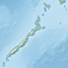
The Iwahig River, also known as Balsahan River, is a watershed located in the Iwahig Penal Colony in Palawan, Philippines. It has an elevation of 8 metres (26 ft) with an approximate length of 4.14 kilometres (2.57 mi) The river basin is a 22,859-hectare (56,490-acre) watershed encompassing the city of Puerto Princesa in Palawan province.
Topography
The basin area has a gentle a slope to steep slopes with an elevation range of 10 metres (33 ft) to more than 300 metres (980 ft) above sea level. Soil types includes Guimbalaon clay, Taburos clay and Bay clay loam. The basin's large area are unclassified with its mountainous land with a closed canopy of trees that covers almost the entire basin.
Flooding
The towns of Iwahig ang Montible were found susceptible to flooding by the study conducted by the Mines and Geosciences Bureau.
References
- Dangan-Galon, Floredel; Dolorosa, Roger (2014). "Species richness of bivalves and gastropods in Iwahig River-Estuary, Palawan, the Philippines" (PDF). International Journal of Fisheries and Aquatic Studies. 2 (1): 207–215. ISSN 2347-5129. Archived from the original (PDF) on October 13, 2017. Retrieved December 4, 2021.
- ^ "LiDAR-Surveys-and-Flood-Mapping-of-Iwahig-Penal-Rive" (PDF). University of the Philippines Training Center for Applied Geodesy and Photogrammetry. Retrieved December 4, 2021.
- Japan International Cooperation Agency; Department of Energy, Republic of the Philippines; Provincial Government of Palawan, Republic of the Philippines (September 2004). The Master Plan Study of Power Development In Palawan Province Republic of the Philippines (PDF) (Report). Chubu Electric Power Co., Nomura Research Institute. Retrieved December 4, 2021.