| Jayu Quta | |
|---|---|
 | |
| Highest point | |
| Elevation | 3,650 m (11,980 ft) |
| Coordinates | 19°27′47″S 67°25′55″W / 19.463°S 67.432°W / -19.463; -67.432 |
| Geography | |
  | |
| Parent range | Andes |
| Geology | |
| Mountain type | Maar |
| Last eruption | Unknown |
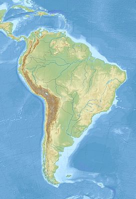
Jayu Quta (Aymara jayu salt, quta lake, "salt lake", also spelled Jayo Khota, Jayu Khota, Jayu Kkota) is a maar partially filled with water, in the Bolivian Altiplano, north of the Salar de Uyuni and east of the Salar de Coipasa. It is situated in the Oruro Department, Ladislao Cabrera Province, Salinas de Garci Mendoza Municipality, Villa Esperanza Canton. It was originally misidentified as a meteorite impact crater.
A smaller maar, named Ñiq'i Quta ("mud lake", Nekhe Khota, Nekhe Kkota), is located southwest of Jayu Quta.
Volcanic activity of phreatomagmatic nature formed the maars, probably during the Holocene. During this activity, basalt-trachyandesite rocks were ejected, including xenoliths consisting of granite. These maars belong to a group of volcanic centres in the Altiplano. These centres mostly consist of lava flows of trachyandesitic to dacitic composition.
The maars appear to form a lineament with Ch'iyar Qullu. However, in terms of Pb isotope ratios and geochemistry the eruption products of the maars bear no resemblance to these at Chiyar Qullu. Potassium-argon dating has yielded an age of less than 128,000 years ago on a lava bomb on Ñiq'i Quta.
See also
References
- ^ "Laguna Jayu Khota". Global Volcanism Program. Smithsonian Institution. Retrieved 2012-04-29.
- Radio San Gabriel, "Instituto Radiofonico de Promoción Aymara" (IRPA) 1993, Republicado por Instituto de las Lenguas y Literaturas Andinas-Amazónicas (ILLLA-A) 2011, Transcripción del Vocabulario de la Lengua Aymara, P. Ludovico Bertonio 1612 (Spanish-Aymara-Aymara-Spanish dictionary)
- Davidson, Jon P.; de Silva, Shanaka L. (April 1995). "Late Cenozoic magmatism of the Bolivian Altiplano". Contributions to Mineralogy and Petrology. 119 (4): 390. Bibcode:1995CoMP..119..387D. doi:10.1007/BF00286937. S2CID 140667305.
- Hoke, Leonore; Lamb, Simon; Entenmann, Jurgen; Davidson, Jon P.; de Silva, Shanaka L. (1993). "Volcanic rocks from the Bolivian Altiplano: Insights into crustal structure, contamination, and magma genesis: Comment and Reply". Geology. 21 (12): 1129. Bibcode:1993Geo....21.1147H. doi:10.1130/0091-7613(1993)021<1147:VRFTBA>2.3.CO;2.
- Hoke, Leonore; Lamb, Simon (July 2007). "Cenozoic behind-arc volcanism in the Bolivian Andes, South America: implications for mantle melt generation and lithospheric structure". Journal of the Geological Society. 164 (4): 801. Bibcode:2007JGSoc.164..795H. doi:10.1144/0016-76492006-092. ISSN 0016-7649. S2CID 131307172.
External links
This Oruro Department location article is a stub. You can help Misplaced Pages by expanding it. |
