| Joinville-le-Pont | |
|---|---|
| Commune | |
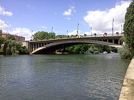
 The bridge of Joinville-le-Pont The bridge of Joinville-le-Pont | |
 Coat of arms Coat of arms | |
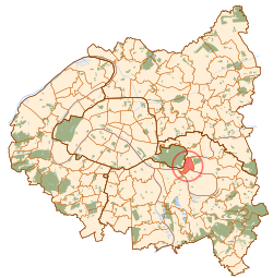
 Paris and inner ring departments Paris and inner ring departments | |
| Location of Joinville-le-Pont | |
  | |
| Coordinates: 48°49′17″N 2°28′22″E / 48.8214°N 2.4728°E / 48.8214; 2.4728 | |
| Country | France |
| Region | Île-de-France |
| Department | Val-de-Marne |
| Arrondissement | Nogent-sur-Marne |
| Canton | Charenton-le-Pont |
| Intercommunality | Grand Paris |
| Government | |
| • Mayor (2020–2026) | Olivier Dosne |
| Area | 2.42 km (0.93 sq mi) |
| Population | 20,413 |
| • Density | 8,400/km (22,000/sq mi) |
| Time zone | UTC+01:00 (CET) |
| • Summer (DST) | UTC+02:00 (CEST) |
| INSEE/Postal code | 94042 /94340 |
| Elevation | 33–61 m (108–200 ft) |
| French Land Register data, which excludes lakes, ponds, glaciers > 1 km (0.386 sq mi or 247 acres) and river estuaries. | |
Joinville-le-Pont (French pronunciation: [ʒwɛ̃vil lə pɔ̃] ) is a commune in the southeastern suburbs of Paris, France. It is located 9.4 km (5.8 mi) from the center of Paris.
History
The commune was created in 1791 under the name La Branche-du-Pont-de-Saint-Maur (literally "The Branch of Saint-Maur's Bridge") by detaching its territory from the commune of Saint-Maur-des-Fossés. The commune was renamed Joinville-le-Pont (literally "Joinville the Bridge") on 29 August 1831. Under Louis-Philippe of France, the Redoute de Gravelle was built in the commune.
In 1929, the commune of Joinville-le-Pont lost more than a third of its territory when the city of Paris annexed the Bois de Vincennes, a part of which belonged to Joinville-le-Pont.
Geography
Climate
Joinville-le-Pont has an oceanic climate (Köppen climate classification Cfb). The average annual temperature in Joinville-le-Pont is 12.9 °C (55.2 °F). The average annual rainfall is 654.0 mm (25.75 in) with December as the wettest month. The temperatures are highest on average in July, at around 21.3 °C (70.3 °F), and lowest in January, at around 5.2 °C (41.4 °F). The highest temperature ever recorded in Joinville-le-Pont was 42.5 °C (108.5 °F) on 25 July 2019; the coldest temperature ever recorded was −15.6 °C (3.9 °F) on 17 January 1985.
| Climate data for Joinville-le-Pont (1991−2020 normals, extremes 1981-present) | |||||||||||||
|---|---|---|---|---|---|---|---|---|---|---|---|---|---|
| Month | Jan | Feb | Mar | Apr | May | Jun | Jul | Aug | Sep | Oct | Nov | Dec | Year |
| Record high °C (°F) | 17.3 (63.1) |
22.5 (72.5) |
27.5 (81.5) |
31.0 (87.8) |
33.4 (92.1) |
38.9 (102.0) |
42.5 (108.5) |
41.0 (105.8) |
35.5 (95.9) |
31.0 (87.8) |
22.5 (72.5) |
17.2 (63.0) |
42.5 (108.5) |
| Mean daily maximum °C (°F) | 7.9 (46.2) |
9.5 (49.1) |
13.7 (56.7) |
17.6 (63.7) |
21.0 (69.8) |
24.3 (75.7) |
26.8 (80.2) |
26.5 (79.7) |
22.5 (72.5) |
17.4 (63.3) |
11.7 (53.1) |
8.1 (46.6) |
17.3 (63.1) |
| Daily mean °C (°F) | 5.2 (41.4) |
6.0 (42.8) |
9.2 (48.6) |
12.4 (54.3) |
15.8 (60.4) |
19.1 (66.4) |
21.3 (70.3) |
21.1 (70.0) |
17.4 (63.3) |
13.3 (55.9) |
8.7 (47.7) |
5.6 (42.1) |
12.9 (55.2) |
| Mean daily minimum °C (°F) | 2.5 (36.5) |
2.5 (36.5) |
4.7 (40.5) |
7.1 (44.8) |
10.6 (51.1) |
13.9 (57.0) |
15.8 (60.4) |
15.6 (60.1) |
12.4 (54.3) |
9.3 (48.7) |
5.6 (42.1) |
3.1 (37.6) |
8.6 (47.5) |
| Record low °C (°F) | −15.6 (3.9) |
−12.1 (10.2) |
−6.6 (20.1) |
−2.5 (27.5) |
1.0 (33.8) |
4.8 (40.6) |
7.5 (45.5) |
6.8 (44.2) |
4.0 (39.2) |
−1.0 (30.2) |
−6.8 (19.8) |
−9.5 (14.9) |
−15.6 (3.9) |
| Average precipitation mm (inches) | 52.0 (2.05) |
47.1 (1.85) |
46.3 (1.82) |
45.4 (1.79) |
62.9 (2.48) |
54.2 (2.13) |
59.1 (2.33) |
55.9 (2.20) |
49.9 (1.96) |
56.2 (2.21) |
59.2 (2.33) |
65.8 (2.59) |
654.0 (25.75) |
| Average precipitation days (≥ 1.0 mm) | 11.7 | 10.7 | 10.2 | 9.2 | 9.2 | 9.0 | 7.7 | 8.2 | 7.9 | 10.2 | 11.3 | 12.5 | 118.0 |
| Source: Météo-France | |||||||||||||
Transport
Joinville-le-Pont is served by Joinville-le-Pont station on Paris RER line A.
Population
| Graphs are unavailable due to technical issues. Updates on reimplementing the Graph extension, which will be known as the Chart extension, can be found on Phabricator and on MediaWiki.org. |
| Year | Pop. | ±% p.a. |
|---|---|---|
| 1968 | 17,467 | — |
| 1975 | 17,608 | +0.11% |
| 1982 | 16,934 | −0.56% |
| 1990 | 16,657 | −0.21% |
| 1999 | 17,117 | +0.30% |
| 2007 | 17,303 | +0.14% |
| 2012 | 18,020 | +0.82% |
| 2017 | 19,133 | +1.21% |
| Source: INSEE | ||
Education
Public schools include:
- Preschools/nurseries (maternelles): Centre, Jean de la Fontaine, Polangis, P’tit Gibus
- Elementaries: Palissy, Parangon, Polangis, and Eugène Voisin
- Junior high schools (collèges): Jean Charcot and Jules Ferry
There is a private school, Groupe Scolaire A.P.E.P., which runs from preschool to senior high school/sixth-form college (lycée).
See also
References
- "Répertoire national des élus: les maires" (in French). data.gouv.fr, Plateforme ouverte des données publiques françaises. 13 September 2022.
- "Populations légales 2021" (in French). The National Institute of Statistics and Economic Studies. 28 December 2023.
- "Fiche Climatologique Statistiques 1991-2020 et records" (PDF). Météo-France. Retrieved August 24, 2022.
- Population en historique depuis 1968, INSEE
- "Écoles maternelles." Joinville-le-Pont. Retrieved on September 10, 2016.
- "Écoles élémentaires." Joinville-le-Pont. Retrieved on September 10, 2016.
- "Collèges." Joinville-le-Pont. Retrieved on September 10, 2016.
- "Établissements privés." Joinville-le-Pont. Retrieved on September 10, 2016.
External links
- Home page (in French)
This Val-de-Marne geographical article is a stub. You can help Misplaced Pages by expanding it. |