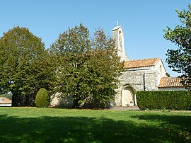
| Juillaguet | |
|---|---|
| Part of Boisné-la-Tude | |
 | |
| Location of Juillaguet | |
  | |
| Coordinates: 45°28′43″N 0°12′49″E / 45.4786°N 0.2136°E / 45.4786; 0.2136 | |
| Country | France |
| Region | Nouvelle-Aquitaine |
| Department | Charente |
| Arrondissement | Angoulême |
| Canton | Tude-et-Lavalette |
| Commune | Boisné-la-Tude |
| Area | 7.27 km (2.81 sq mi) |
| Population | 152 |
| • Density | 21/km (54/sq mi) |
| Time zone | UTC+01:00 (CET) |
| • Summer (DST) | UTC+02:00 (CEST) |
| Postal code | 16320 |
| Elevation | 103–203 m (338–666 ft) (avg. 166 m or 545 ft) |
| French Land Register data, which excludes lakes, ponds, glaciers > 1 km (0.386 sq mi or 247 acres) and river estuaries. | |
Juillaguet (French pronunciation: [ʒɥijaɡɛ]) is a former commune in the Charente department in southwestern France. On 1 January 2016, it was merged into the new commune Boisné-la-Tude.
Population
|
|
See also
References
- Téléchargement du fichier d'ensemble des populations légales en 2019, INSEE
- Arrêté préfectoral 17 November 2015 (in French)
This Charente geographical article is a stub. You can help Misplaced Pages by expanding it. |