| Julianatop | |
|---|---|
 | |
| Highest point | |
| Elevation | 1,280 m (4,200 ft) |
| Listing | Country high point |
| Coordinates | 3°40′58″N 56°32′8″W / 3.68278°N 56.53556°W / 3.68278; -56.53556 |
| Geography | |
| Location | Sipaliwini District, Suriname |
| Parent range | Wilhelmina Mountains |
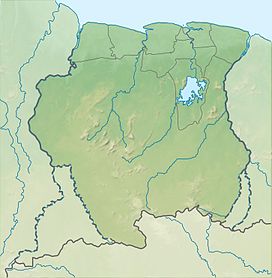
Julianatop (Dutch pronunciation: [jyliˈjaːnaːˌtɔp]) is the highest mountain in Suriname at 1,280 metres (4,199 ft). It is located in the Sipaliwini District. The mountain is named after Juliana of the Netherlands. The Amerindian name of the mountain is Ipinumin (He who stands alone).
The mountain was supposedly climbed by the Amerindian John Tawjoeram during the 1963 Schultz expedition, however there was no trace of John. On 16 September 2006, an expedition set out to climb the mountain and planted the Surinamese flag on the top.
References
- "Sapoen van HVB staat stil bij Javaanse immigratie". Star Nieuws (in Dutch). Retrieved 25 June 2020.
- "DE JULIANATOP IN SURINAME, OP JACHT NAAR HET DUIVELSEI". Nickerie.net (in Dutch). Retrieved 25 June 2020.
- "Surinaamse vlag wappert op de Juliana Top". Waterkant (in Dutch). 16 September 2006.
External links
- Julianatop at Peakbagger
- View of Julianatop Archived 2011-07-16 at the Wayback Machine from this website. (in Dutch) (english translation)
This Suriname location article is a stub. You can help Misplaced Pages by expanding it. |
| Highest points of South America | |
|---|---|
| Sovereign states | |
| Dependencies and other territories | |