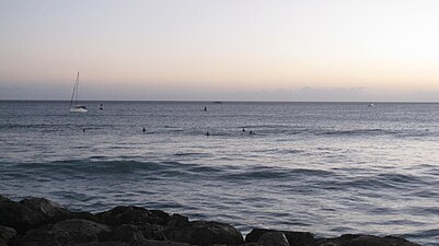
Kakaʻako Waterfront Park, also known as "Point Panic Park", is a public park in Kakaʻako, south of downtown Honolulu, just off Ala Moana Boulevard at the end of Cooke Street. It was opened in November 1992 on the site of a former municipal landfill and consists of 35 acres (140,000 m) of grass-covered rolling hills adjacent to the ocean. There is no sandy beach at this location, and access to the ocean is by concrete stairs. The park has bathrooms, water fountains, free parking, picnic tables, an amphitheatre, pay telephones, paved jogging paths, and two popular surfing spots, "Point Panic" and "Flies".
In October 2017, the park was closed in order to address homeless people setting up encampments there then reopened in January 2018.
Management of Kakaʻako Waterfront Park was done by the Hawaiʻi Community Development Corporation for nearly 20 years. In late 2019, the 40 acres of land that makes up the Kakaʻako Waterfront Park was transferred from the state of Hawaii to the city of Honolulu.
The John A. Burns School of Medicine, part of the University of Hawaiʻi at Mānoa, is located inland and adjacent to the waterfront park.
A Memorial to the Ehime Maru Incident victims is built at the Kakaako Waterfront Park.
Sculptures in the park
- Lahui, a silicon bronze sheet sculpture by Sean K. L. Browne, 1992
- Ano Lani, a bronze sculpture by Frank Sheriff, 1993
- A monument to the dead of the Ehime Maru and USS Greeneville collision
Gallery
See also
References
- Nakaso, Dan (October 4, 2017). "Kakaako Waterfront Park to close indefinitely as homeless population grows". Honolulu Star-Advertiser. Retrieved November 11, 2021.
- "Kakaako Waterfront Park reopens with new signs, security". Honolulu Star-Advertiser. January 8, 2018. Retrieved November 11, 2021.
- Blair, Allyson (October 30, 2019). "State pays city $2.25M to take over Kakaako parks with troubled reputation". www.hawaiinewsnow.com. Retrieved November 11, 2021.
- "City Taking On Kaka'ako Waterfront Park And Its Homeless". Hawai'i Public Radio. October 30, 2019. Retrieved November 11, 2021.
21°17′38″N 157°51′51″W / 21.293901°N 157.864092°W / 21.293901; -157.864092
This Hawaiʻi state location article is a stub. You can help Misplaced Pages by expanding it. |
This article related to Honolulu is a stub. You can help Misplaced Pages by expanding it. |

