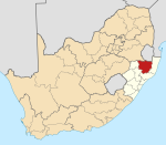
| This article needs additional citations for verification. Please help improve this article by adding citations to reliable sources. Unsourced material may be challenged and removed. Find sources: "Kambula" – news · newspapers · books · scholar · JSTOR (June 2019) (Learn how and when to remove this message) |
| Kambula | |
|---|---|
  | |
| Coordinates: 27°40′23″S 30°43′55″E / 27.673°S 30.732°E / -27.673; 30.732 | |
| Country | South Africa |
| Province | KwaZulu-Natal |
| District | Zululand |
| Municipality | eDumbe |
| Time zone | UTC+2 (SAST) |
Kambula, Khambula or (Zulu Nkambule) is a town located at 27°40′07″S 30°43′18″E / 27.66863°S 30.72155°E / -27.66863; 30.72155 in the KwaZulu-Natal Province of South Africa.
It is the location where the Battle of Kambula was fought in 1879, the result of which was a British Empire victory over the Zulu people.
References
- "Battle of Kambula | South African history | Britannica". www.britannica.com. Retrieved 2022-10-23.
| Municipalities and communities of Zululand District Municipality, KwaZulu-Natal | ||
|---|---|---|
| District seat: Ulundi | ||
| Ulundi |  | |
| Nongoma | ||
| Abaqulusi | ||
| uPhongolo | ||
| EDumbe | ||