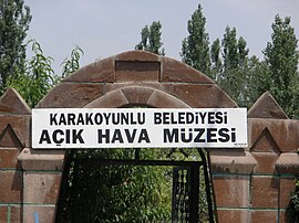
| Karakoyunlu | |
|---|---|
| Municipality | |
 | |
 | |
| Coordinates: 39°58′21″N 44°10′22″E / 39.97250°N 44.17278°E / 39.97250; 44.17278 | |
| Country | Turkey |
| Province | Iğdır |
| District | Karakoyunlu |
| Government | |
| • Mayor | Bayramali Ballı (MHP) |
| Elevation | 848 m (2,782 ft) |
| Population | 2,728 |
| Time zone | UTC+3 (TRT) |
| Postal code | 76700 |
| Area code | 0476 |
| Website | www |
Karakoyunlu is a town in Iğdır Province in the Eastern Anatolia region of Turkey. It is the seat of Karakoyunlu District. Its population is 2,728 (2022). The town is populated by Azerbaijanis.
Statues with ram heads
Gravestones with ram heads existing in almost all old cemeteries in Iğdır Plain are remnants from the Kara Koyunlu period. These commemorate brave, heroic persons and young persons who died at a young age.
Population
| Year | Pop. | ±% p.a. |
|---|---|---|
| 1980 | 2,231 | — |
| 1985 | 2,813 | +4.75% |
| 1990 | 4,110 | +7.88% |
| 1997 | 5,159 | +3.30% |
| 2007 | 2,649 | −6.45% |
| 2012 | 2,664 | +0.11% |
| 2017 | 2,804 | +1.03% |
| 2022 | 2,728 | −0.55% |
| Source: Population censuses (1980-1997) and TÜIK (2007-2022) | ||
References
- ^ "Population Of Municipalities, Villages And Quarters". TÜIK. Retrieved 24 March 2023.
- İlçe Belediyesi, Turkey Civil Administration Departments Inventory. Retrieved 1 March 2023.
- Peter Alfred, Andrews; Benninghaus, Rüdiger, eds. (1989). Ethnic Groups in the Republic of Turkey. p. 296.
- "Introduction of Iğdır", Iğdır Municipality Publishing, 2003
- "1980 General Census" (PDF) (in Turkish). Turkish Statistical Institute. 1980. Archived (PDF) from the original on 17 June 2022.
- "1985 General Census" (PDF) (in Turkish). Turkish Statistical Institute. 1986. Archived (PDF) from the original on 22 May 2021.
- "1990 General Census" (PDF) (in Turkish). Turkish Statistical Institute. 1991. Archived (PDF) from the original on 31 August 2021.
- "1997 Population Count" (PDF) (in Turkish). Turkish Statistical Institute. 1999. Archived (PDF) from the original on 30 October 2022.
External links
- (in Turkish) Official website of the Karakoyunlu Municipality
- (in Turkish) Iğdır's News website (in Turkish)
| Municipalities | |
|---|---|
| Villages |
|
This article about an Eastern Anatolia Region of Turkey location is a stub. You can help Misplaced Pages by expanding it. |