| This article needs additional citations for verification. Please help improve this article by adding citations to reliable sources. Unsourced material may be challenged and removed. Find sources: "Karamay, Karamay" – news · newspapers · books · scholar · JSTOR (April 2023) (Learn how and when to remove this message) |
| Karamay 克拉玛依区 • قاراماي رايونى | |
|---|---|
| District | |
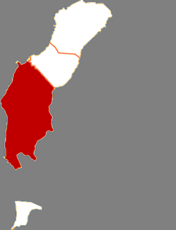
 Karamay District in Karamay Karamay District in Karamay | |
   | |
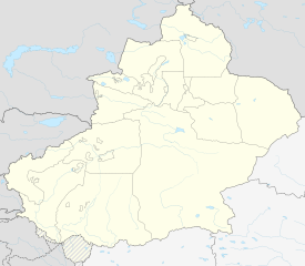
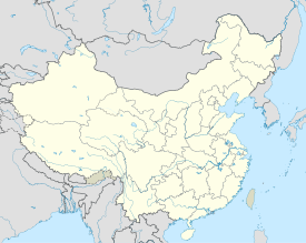
| Coordinates: 45°36′N 84°52′E / 45.600°N 84.867°E / 45.600; 84.867 | |
| Country | China |
| Autonomous region | Xinjiang |
| Prefecture-level city | Karamay |
| District seat | Tianshan Road Subdistrict |
| Area | |
| • Total | 3,253 km (1,256 sq mi) |
| Population | |
| • Total | 337,188 |
| • Density | 100/km (270/sq mi) |
| Time zone | UTC+8 (China Standard) |
| Website | www |
| Karamay, Karamay | |||||||||
|---|---|---|---|---|---|---|---|---|---|
| Chinese name | |||||||||
| Simplified Chinese | 克拉玛依区 | ||||||||
| Traditional Chinese | 克拉瑪依區 | ||||||||
| |||||||||
| Uyghur name | |||||||||
| Uyghur | قاراماي رايونى | ||||||||
| |||||||||
Karamay District (Uyghur: قاراماي رايونى, romanized: Qaramay Rayoni, K̡aramay Rayoni, Қарамай Райони) is a district of Karamay City, Xinjiang, China. It contains an area of 5,351 km. According to the 2002 census, it had a population of 150,000.
Administrative divisions
Karamay District contains 7 subdistricts, 1 township:
| Name | Simplified Chinese | Hanyu Pinyin | Uyghur (UEY) | Uyghur Latin (ULY) | Administrative division code | |
|---|---|---|---|---|---|---|
| Subdistricts | ||||||
| Tianshan Road Subdistrict | 天山路街道 | Tiānshānlù Jiēdào | تەڭرىتاغ يولى كوچا باشقارمىسى | Tengritagh yoli kocha bashqarmisi | 650203001 | |
| Shengli Road Subdistrict | 胜利路街道 | Shènglìlù Jiēdào | غەلىبىيەت يولى كوچا باشقارمىسى | Ghelibiyet yoli kocha bashqarmisi | 650203002 | |
| Kunlun Road Subdistrict | 昆仑路街道 | Kūnlúnlù Jiēdào | كۇئېنلۇن يولى كوچا باشقارمىسى | Kuënlun yoli kocha bashqarmisi | 650203003 | |
| Yinhe Road Subdistrict | 银河路街道 | Yínhélù Jiēdào | سامانيولى كوچا باشقارمىسى | Samanyoli kocha bashqarmisi | 650203004 | |
| Wuwuxinzhen Subdistrict | 五五新镇街道 | Wǔwǔxīnzhèn Jiēdào | ئەللىكبەش بازىرى كوچا باشقارمىسى | Ellikbesh baziri kocha bashqarmisi | 650203007 | |
| Yingbin Subdistrict | 迎宾街道 | Yíngbīn Jiēdào | مەرھابا كوچا باشقارمىسى | Merhaba kocha bashqarmisi | 650203007 | |
| Guhai Subdistrict | 古海街道 | Gǔhǎi Jiēdào | 650203008 | |||
| Town | ||||||
| Xiaoguai Township | 小拐乡 | Xiǎoguǎi Xiāng | شۆگەي يېزىسى | Shögey yëzisi | 650203200 | |
Notes
- Locals in Xinjiang frequently observe UTC+6 (Xinjiang Time), 2 hours behind Beijing.
References
| County-level divisions of Xinjiang Uyghur Autonomous Region | |||||||||
|---|---|---|---|---|---|---|---|---|---|
| Ürümqi (capital) | |||||||||
| Prefecture-level cities |
| ||||||||
| Sub-provincial autonomous prefecture |
| ||||||||
| Prefectures |
| ||||||||
| Autonomous prefectures |
| ||||||||
| XPCC administered |
| ||||||||
| |||||||||
This Xinjiang location article is a stub. You can help Misplaced Pages by expanding it. |