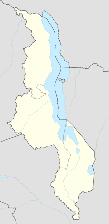
| Katumbi Airport | |||||||||||
|---|---|---|---|---|---|---|---|---|---|---|---|
| Summary | |||||||||||
| Airport type | Closed | ||||||||||
| Serves | Katumbi | ||||||||||
| Elevation AMSL | 3,986 ft / 1,215 m | ||||||||||
| Coordinates | 10°49′40″S 33°30′30″E / 10.82778°S 33.50833°E / -10.82778; 33.50833 | ||||||||||
| Map | |||||||||||
 | |||||||||||
| Runways | |||||||||||
| |||||||||||
| Sources: Google Maps OurAirports | |||||||||||
Katumbi Airport (ICAO: FWKB) was an airport 2 kilometres (1.2 mi) southwest of the village of Katumbi, Republic of Malawi.
In aerial views, the runway appears to have been abandoned sometime after 2002. Trees and shrubs are now growing on the runway area, and runway markings have been removed.
See also
References
- Google Maps - Katumbi
- OurAirports - Katumbi Airport closed
- Google Earth Historical Imagery (8/27/2002) - (8/7/2011)
External links
| Airports in Malawi | |
|---|---|
This article about an airport in Malawi is a stub. You can help Misplaced Pages by expanding it. |