| Kefamenanu | |
|---|---|
  | |
| Coordinates: 9°26′48″S 124°28′41″E / 9.44667°S 124.47806°E / -9.44667; 124.47806 | |
| Country | Indonesia |
| Region | Lesser Sunda Islands |
| Province | East Nusa Tenggara |
| Territory | West Timor |
| Regency | North Central Timor Regency |
| Kecamatan | Kota Kefamenanu |
| Area | |
| • Total | 28.57 sq mi (74.00 km) |
| Population | |
| • Total | 47,628 |
| • Density | 1,700/sq mi (640/km) |
| Time zone | UTC+8 (CIT) |
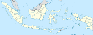
Kefamenanu is a town and capital of the administrative district (kecamatan) of Kota Kefamenanu and of the North Central Timor Regency in West Timor, Indonesia. A road connects it to Halilulik and Kota Atambua to the northeast. It had a population of 43,058 at the 2010 Census and 47,766 at the 2020 Census; the official estimate in mid 2023 was 47,628. The town hosts the University of Timor, one of the two public universities in the Indonesian part of the island.
Climate
Kefamenanu has a tropical savanna climate (Aw) with moderate to little rainfall from April to November and heavy rainfall from December to March.
| Climate data for Kefamenanu | |||||||||||||
|---|---|---|---|---|---|---|---|---|---|---|---|---|---|
| Month | Jan | Feb | Mar | Apr | May | Jun | Jul | Aug | Sep | Oct | Nov | Dec | Year |
| Mean daily maximum °C (°F) | 28.0 (82.4) |
27.6 (81.7) |
28.3 (82.9) |
28.7 (83.7) |
28.5 (83.3) |
27.8 (82.0) |
27.3 (81.1) |
27.6 (81.7) |
28.2 (82.8) |
28.9 (84.0) |
29.3 (84.7) |
28.5 (83.3) |
28.2 (82.8) |
| Daily mean °C (°F) | 25.2 (77.4) |
24.6 (76.3) |
24.9 (76.8) |
24.8 (76.6) |
24.5 (76.1) |
23.7 (74.7) |
22.9 (73.2) |
23.0 (73.4) |
23.6 (74.5) |
24.7 (76.5) |
25.8 (78.4) |
25.5 (77.9) |
24.4 (76.0) |
| Mean daily minimum °C (°F) | 22.4 (72.3) |
21.7 (71.1) |
21.5 (70.7) |
21.0 (69.8) |
20.6 (69.1) |
19.7 (67.5) |
18.6 (65.5) |
18.5 (65.3) |
19.0 (66.2) |
20.5 (68.9) |
22.3 (72.1) |
22.6 (72.7) |
20.7 (69.3) |
| Average rainfall mm (inches) | 268 (10.6) |
234 (9.2) |
200 (7.9) |
98 (3.9) |
65 (2.6) |
35 (1.4) |
28 (1.1) |
10 (0.4) |
5 (0.2) |
28 (1.1) |
94 (3.7) |
244 (9.6) |
1,309 (51.7) |
| Source: Climate-Data.org | |||||||||||||
References
- Badan Pusat Statistik, Jakarta, 26 September 2024, Kecamatan Kota Kefamenanu Dalam Angka 2024 (Katalog-BPS 1102001.5305030)
- Biro Pusat Statistik, Jakarta, 2011.
- Badan Pusat Statistik, Jakarta, 2021.
- Badan Pusat Statistik, Jakarta, 26 September 2024, Kecamatan Kota Kefamenanu Dalam Angka 2024 (Katalog-BPS 1102001.5305030)
- "Climate: Kefamenanu". Climate-Data.org. Retrieved 17 November 2020.
This East Nusa Tenggara location article is a stub. You can help Misplaced Pages by expanding it. |