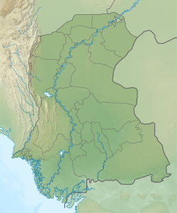
| Khorwah Khore Wah | |
|---|---|
| Village | |
  | |
| Coordinates: 24°45′10″N 68°24′55″E / 24.752685°N 68.415223°E / 24.752685; 68.415223 | |
| Country | Pakistan |
| Region | Sindh |
| District | Badin |
| Population | |
| • Total | 7,574 |
| Time zone | UTC+5 (PST) |
| • Summer (DST) | UTC+6 (PDT) |
Khorwah, also spelled Khore Wah, is a village and deh in Shaheed Fazil Rahu taluka of Badin District, Sindh, Pakistan. As of 2017, it has a population of 7,574, in 1,404 households. It is located about 26 miles south of Tando Muhammad Khan by road, with other roads connecting it to Badin, Mirpur Bathoro, and Bulri Shah Karim.
Khorwah is the seat of a tapedar circle, which also includes the villages of Lakhi, Miano Karath, Narbut, and Nokhi. It is also the seat of a Union Council, which has a total population of 39,475.
Khorwah was founded in the late 1700s by Kamal Khor. As of 1874, it was described as a village held directly by the British government, and it had a population of 914 people, including 649 Hindus and 235 Muslims. Most residents were agriculturalists, along with a few merchants and shopkeepers. It was not as significant producer of manufacturing goods or a trading centre, although there was local trade in cloth, grain, and ghee. Some ghee and rice did also get traded long-distance, but only very little. It was then the seat of a tappedar in the pargana of Guni, and it also had a police lines.
Notes
- The 1874 gazetteer said it was "supposed to have been built about 98 years ago", or about 1776.
References
- ^ "Geographic Names Search WebApp". Search for "Khorwah" here.
- ^ Population and household detail from block to tehsil level (Badin District) (PDF). 2017. p. 16. Retrieved 23 May 2021.
- "List of Dehs in Sindh" (PDF). Sindh Zameen. Retrieved 23 May 2021.
- ^ Hughes, A.W. (1874). A Gazetteer of the Province of Sindh. London: George Bell and Sons. pp. 424–5. Retrieved 25 December 2021.
- "Union Council wise Thematic Analysis". Department of Health, Government of Sindh. Retrieved 23 May 2021.
| Populated places in Badin District | |
|---|---|
| Talukas | |
| Populated places | |
| See also: Agham Kot | |
This Pakistan location article is a stub. You can help Misplaced Pages by expanding it. |