| Kikhchik Кихчик | |
|---|---|
| Former urban-type settlement | |
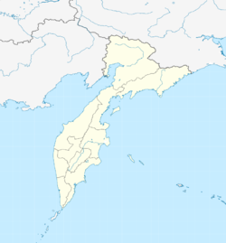
| Location of Kikhchik | |
  | |
| Coordinates: 53°25′15″N 156°02′25″E / 53.42083°N 156.04028°E / 53.42083; 156.04028 | |
| Country | Russia |
| Federal subject | Kamchatka Krai |
| Administrative district | Ust-Bolsheretsky District |
| Founded | 1926 |
| Elevation | 4 m (13 ft) |
Kikhchik (Russian: Кихчик) is a former urban-type settlement in Ust-Bolsheretsky District, Kamchatka Krai, Far East Russia. It lies on the southwest coast of the Kamchatka Peninsula on the Sea of Okhotsk. Established in 1926 on the river Kikhchik, a fish canning factory was built by the Soviets here and it attained town status in 1940. Kikhchik had a secondary school, two elementary schools, a hospital, a club, a nursery, a kindergarten, three libraries, a canteen, a bakery, a bathhouse, 6 shops and 3 stalls, and an agricultural farm. By 1959 it had a population of 2606, which had declined to 709 by 1970. On August 28, 1972, the settlement of Kikhchik was abandoned.
References
- В. П. Кусков. Кихчик // Краткий топонимический словарь Камчатской области : (Из истории происхождения географических названий) / В. П. Кусков; Камчатский отдел Географического общества СССР; . — Петропавловск-Камчатский : Дальневосточное книжное издательство, 1967. — С. 47. — 3000 экз. (in Russian)
- С. И. Вахрин. Трагедия камчатского берега. — СПб: Свое издательство, 2017. — С. 344. — 493 с. — ISBN 978-5-4386-1333-6. (in Russian)
- "Всесоюзная перепись населения 1959 г." Demoscope.ru (in Russian). Retrieved 1 February 2020.
- "Всесоюзная перепись населения 1970 г." Demoscope.ru (in Russian). Retrieved 1 February 2020.
This Kamchatka Krai location article is a stub. You can help Misplaced Pages by expanding it. |