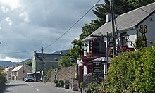
Kilgarrylander (Irish: Cill Gharraí an Lóndraigh) is a civil parish and electoral division in County Kerry, Ireland. Located on the north side of Castlemaine Harbour, it has an area of approximately 60 square kilometres (23 sq mi) and is in the historical barony of Trughanacmy. Population centres in Kilgarrylander civil parish include Fybagh and Boolteens.
References
- "Cill Gharraí an Lóndraigh / Kilgarrylander". logainm.ie. Placenames Database of Ireland. Retrieved 4 April 2024.
- Lewis, Samuel, ed. (1837). "Kilgarrilander". A Topographical Dictionary of Ireland. Dublin: Lewis – via libraryireland.com.
- "Civil Parish of Kilgarrylander, Co. Kerry". townlands.ie. Retrieved 4 April 2024.
- "Sub-units of: Cill Gharraí an Lóndraigh/Kilgarrylander". logainm.ie. Placenames Database of Ireland. Retrieved 4 April 2024.
52°10′08″N 9°47′10″W / 52.169°N 9.786°W / 52.169; -9.786
This article related to the geography of County Kerry, Ireland is a stub. You can help Misplaced Pages by expanding it. |