Census-designated place in Pennsylvania, United States
| Kiskimere, Pennsylvania | |
|---|---|
| Census-designated place | |
  | |
| Coordinates: 40°37′11″N 79°35′01″W / 40.61972°N 79.58361°W / 40.61972; -79.58361 | |
| Country | United States |
| State | Pennsylvania |
| County | Armstrong |
| Township | Parks |
| Area | |
| • Total | 0.35 sq mi (0.92 km) |
| • Land | 0.31 sq mi (0.79 km) |
| • Water | 0.05 sq mi (0.12 km) |
| Population | |
| • Total | 135 |
| • Density | 439.74/sq mi (170.02/km) |
| Time zone | UTC-5 (Eastern (EST)) |
| • Summer (DST) | UTC-4 (EDT) |
| FIPS code | 42-39960 |
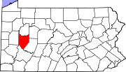
Kiskimere is a census-designated place located in Parks Township, Armstrong County, in the U.S. state of Pennsylvania. As of the 2020 census the population was 135. The community is located on the east bank of the Kiskiminetas River and is bordered by the community of Pleasant View to the south. To the west, across the river, is Allegheny Township in Westmoreland County.
Pennsylvania Route 66 (River Road) passes through Kiskimere, leading 3 miles (5 km) northwest (downstream) to Leechburg and 2.5 miles (4.0 km) southeast (upstream) to North Vandergrift.
Demographics
| Census | Pop. | Note | %± |
|---|---|---|---|
| 2020 | 135 | — | |
| U.S. Decennial Census | |||
References
- "ArcGIS REST Services Directory". United States Census Bureau. Retrieved October 12, 2022.
- "Census Population API". United States Census Bureau. Retrieved October 12, 2022.
- "2010 Census". Archived from the original on December 23, 2013. Retrieved July 10, 2016.
- Bureau, US Census. "Census.gov". www.census.gov. Retrieved July 8, 2017.
{{cite web}}:|last=has generic name (help) - https://data.census.gov/table?q=Kiskimere+CDP;+Pennsylvania
- "Census of Population and Housing". Census.gov. Retrieved June 4, 2016.
This Armstrong County, Pennsylvania state location article is a stub. You can help Misplaced Pages by expanding it. |
