| This article needs additional citations for verification. Please help improve this article by adding citations to reliable sources. Unsourced material may be challenged and removed. Find sources: "Kokurakita-ku, Kitakyūshū" – news · newspapers · books · scholar · JSTOR (May 2009) (Learn how and when to remove this message) |


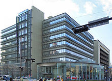
Kokurakita-ku (小倉北区) is a ward of Kitakyūshū, Fukuoka, Japan. It is the north part of what used to be Kokura City before the merger of five cities to create the new city of Kitakyūshū in 1963. JR Kyūshū's Kokura Station is the main rail hub of Kitakyūshū, and the Sanyō Shinkansen stops there. It has a population of 184,545 persons as of the 2000 national census and an area of 39.27 km².
Industry & Commerce
The largest commercial and shopping areas of Kitakyūshū, mainly in Uomachi (魚町 "fish town"), are clustered around Kokura Station.
The two main department stores are Colet (next to Kokura Station) and Izutsuya (next to the Murasaki River and opposite Riverwalk Kitakyūshū). The Tanga Market is a traditional open-air market where fresh fish, meat and vegetables are the main produce for sale.

Headquarters of companies include
- TOTO Ltd. - south of Riverwalk
- Zenrin - in Riverwalk
- Asahi Shimbun (West area) - in Riverwalk
- The head office of StarFlyer Inc. was in the Shin Kokura Building in Kome-machi. In 2010 the airline announced that the headquarters will move to Kitakyushu Airport.
Tourism
Kokura Castle (built by the Hosokawa family in 1602) and the Riverwalk Kitakyūshū shopping complex (completed in 2003) are about a ten-minute walk from JR Kokura Station. So also is the house once inhabited by Mori Ōgai when he was a doctor to the Kokura garrison and wrote Kokura Nikki ("Kokura Diary").
The Kitakyūshū Monorail terminus is in Kokura Station and serves the commuters and residents living in Kokurakita and Kokuraminami Wards.
Crime and safety
The Kudo-kai yakuza syndicate is headquartered in Kokurakita. A designated yakuza group, the Kudo-kai is the largest yakuza syndicate in the Kitakyushu area.
Education
| This section needs expansion. You can help by adding to it. (October 2015) |
The ward has a North Korean kindergarten, Kokura Korean Kindergarten (小倉朝鮮幼稚園).
Photo gallery
-
 Riverwalk Kitakyūshū and Kokura Castle moat
-
Tokiwabashi
-
 Kokura Station
-
Kokura-kita Police Station
-
 COLET(former Kokura Isetan)
-
Cherry blossoms (sakura) and the keep of Kokura Castle, March 2002
-
 Matsumoto Seicho Memorial Museum
-
 Mori Ōgai house
-
Zenrin head office
-
 Kokura Gion Daiko statue at Kokura Station
-
 Fukuju-ji, an Ōbaku Zen temple
-
Tanga Market
See also
References
- "Corporate Data Archived 2016-02-11 at the Wayback Machine." TOTO. Retrieved on April 9, 2014.
- "Company Profile." StarFlyer. Retrieved on May 26, 2009. "Location Shin-Kokura Bldg.,2-2-1 Komemachi Kokurakita-ku, Kitakyusyu-shi Fukuoka 802-0003 JPN"
- "会社概要." StarFlyer. March 24, 2008. Retrieved on December 20, 2010. "本社 〒802-0003 福岡県北九州市小倉北区米町二丁目2番1号 新小倉ビル JR小倉駅より徒歩10分."
- "スターフライヤー、北九州空港へ本社移転-業務効率化目指し今秋に Archived 2011-08-11 at the Wayback Machine." Hangata Communications. January 4, 2010. Retrieved on February 15, 2010. "同社の本社機能についてはかねてより2011年に同空港内への移転計画が伝えられていたが、予定を早めて今年秋に実施することを決めたもの。"
- "2010 Police White Paper Chapter 2 : Furtherance of Organized Crime Countermeasures", 2010, National Police Agency (in Japanese)
- "Japan's mobsters get a big-screen reality check with policeman's film", July 22, 2006, The Independent
- "ウリハッキョ一覧 Archived 2005-11-06 at the Wayback Machine" (Archive). Chongryon. Retrieved on October 14, 2015.
External links
- Kokura Kita Ward Office Archived 2006-02-08 at the Wayback Machine - official site in Japanese
- Matsumoto Seicho Memorial Museum Archived 2020-01-02 at the Wayback Machine - near Kokura castle
- Riverwalk Kitakyushu Archived 2005-02-03 at the Wayback Machine (Japanese)
- Uomachi Shopping Arcade (Japanese, some English)
| Fukuoka (capital) | ||||
| Fukuoka |
| |||
| Kitakyushu |
| |||
| Core city | ||||
| Cities | ||||
| Districts | ||||
| List of mergers in Fukuoka Prefecture | ||||
33°52′51″N 130°52′25″E / 33.88083°N 130.87361°E / 33.88083; 130.87361
Category: