| Kokyar
كۆكيار يېزىسى 柯克亚乡Kök-yar, Kekeya | |
|---|---|
| Township | |
| Chinese transcription(s) | |
 | |
| Coordinates: 37°23′20″N 77°10′13″E / 37.388987°N 77.17024836°E / 37.388987; 77.17024836 | |
| Country | China |
| Province | Xinjiang |
| Prefecture | Kashgar / Kashi |
| County | Kargilik / Yecheng |
| Villages | 18 |
| Area | |
| • Total | 3,662.5 km (1,414.1 sq mi) |
| Elevation | 2,200−3,500 m (7,200−11,500 ft) |
| Population | |
| • Total | 19,451 |
| • Density | 5.3/km (14/sq mi) |
| Ethnic groups | |
| • Major ethnic groups | Uyghur, Mountain Tajik (China) |
| Time zone | UTC+8 (CST) |
Kokyar (Kɵkyar, Көкяр, كۆكيار, Kök-yar, Kök-yār, 库克牙, Pinyin: Kùkèyá; 柯克亚乡, Kēkèyà Xiāng) is a township headquartered at a small oasis at the base of the Kunlun Mountains in southern Kargilik County, Kashgar Prefecture, southwestern Xinjiang, China.
History
In 1958, Kokyar Commune (柯克亚公社) was established.
In 1985, Kokyar Commune became Kokyar Township.
On July 6, 2016, a massive landslide killed thirty-five residents from village 6 in Kokyar Township, around 170 kilometres (110 mi) from the county seat. It took several days for rescue operations to reopen the road into the village. 352 residents were relocated.
In 2016-2017, Akemeiqite village (阿克美其特村) was disestablished and Nu'er'abati (努尔阿巴提村) was established, Amanxia (阿曼夏村) was disestablished and Halasitan village ( Error: {{Lang}}: invalid parameter: |3= (help)) was established, and Muchang village (牧场村) was established.
In 2019, a cooperative farm (种植合作社) was established in Halasitan village (哈拉斯坦村).
Geography
Kokyar is a small oasis, only about 50 km (31 mi) south of Karghalik, with cultivation limited to:
- ". . . a narrow strip of ground less than half a mile across and under five miles in length, enclosed between absolutely barren slopes at the bottom of a narrow valley. The people, reckoned at about two hundred households, depend largely for their sustenance on cattle and sheep kept far away in the mountains. Nor is the configuration of the valley such that a much extended cultivation can be assumed even for an earlier period when a moister climate prevailed."
Kokyar was the first oasis reached in the Taklamakan basin after travelling the winter route north from the Karakoram Pass via Bazar Dara or from northern Hunza Valley to Yarkand along the frozen Yarkand River.
To the north, Kokyar Township borders Kargilik Town (Kageleke, Qaghiliq), to the east Ushsharbash Town (Wuxiabashi), and to the west Chipan Township (Qipan).
The average altitude in the township is between 2,200 m (7,200 ft) and 3,500 m (11,500 ft) above sea level.
Administrative divisions
| The examples and perspective in this section may not include all significant viewpoints. Please improve the article or discuss the issue. (April 2020) (Learn how and when to remove this message) |
As of 2019, Kokyar Township includes eighteen villages divided into four areas (片区) (Mandarin Chinese pinyin-derived names except where noted):
Areas (片区):
- Kekeya (柯克亚), Momuke (莫木克), Guosasi (果萨斯), Xihefu (西合甫)
Villages (村):
- Ying'awati (英阿瓦提村) 37°24′18″N 77°11′59″E / 37.404986°N 77.199704°E / 37.404986; 77.199704
- Kekeya (柯克亚村) 37°24′05″N 77°12′10″E / 37.401356°N 77.202839°E / 37.401356; 77.202839
- Outunsu / Otan-su / Otansu (欧吞苏村) 37°22′27″N 77°08′56″E / 37.374174°N 77.148958°E / 37.374174; 77.148958
- Pusa (普萨村)
- Nu'er'abati (努尔阿巴提村)
- Yusaisi (玉赛斯村) 37°14′08″N 76°44′19″E / 37.235645°N 76.738717°E / 37.235645; 76.738717
- Ta'er'agezi (塔尔阿格孜村) 37°20′34″N 76°42′46″E / 37.342652°N 76.712765°E / 37.342652; 76.712765
- Guosasi (果萨斯村) 37°22′06″N 76°45′04″E / 37.36846°N 76.750988°E / 37.36846; 76.750988
- Aqikebailedu'er (阿其克拜勒都尔村) 37°18′02″N 76°49′23″E / 37.300449°N 76.823194°E / 37.300449; 76.823194
- Kalayoulegun (喀拉尤勒滚村) 37°21′07″N 76°54′34″E / 37.351824°N 76.909504°E / 37.351824; 76.909504
- Momuke (莫木克村) 37°22′02″N 76°56′56″E / 37.367275°N 76.948913°E / 37.367275; 76.948913
- Dunzila (墩孜拉村) 37°28′13″N 77°00′59″E / 37.470185°N 77.016502°E / 37.470185; 77.016502
- Yusilüshi (玉斯吕什村) 37°30′18″N 77°02′57″E / 37.505111°N 77.049218°E / 37.505111; 77.049218
- Halasitan (哈拉斯坦村)
- Igizya (Yigeziya; ئىگىزيا كەنت / 依格孜亚村) 37°32′11″N 77°06′04″E / 37.536328°N 77.100979°E / 37.536328; 77.100979
- Awatibage (阿瓦提巴格村) 37°32′41″N 77°07′51″E / 37.544601°N 77.130776°E / 37.544601; 77.130776
- Yanbuke (颜布克村) 37°33′43″N 77°08′39″E / 37.561903°N 77.144053°E / 37.561903; 77.144053
- Muchang (牧场村)
As of 2009, there were seventeen villages in Kokyar:
- Ying'awati (英阿瓦提村), Kekeya (柯克亚村), Outunsu (欧吞苏村), Pusa (普萨村), Akmeqit / Akemeiqite (阿克美其特村) 37°06′30″N 77°00′23″E / 37.108309°N 77.006252°E / 37.108309; 77.006252, Yusaisi (玉赛斯村), Ta'er'agezi (塔尔阿格孜村), Guosasi (果萨斯村), Aqikebailedu'er (阿其克拜勒都尔村), Kalayoulegun (喀拉尤勒滚村), Momuke (莫木克村), Dunzila (墩孜拉村), Yusilüshi (玉斯吕什村), Amanxia (阿曼夏村) 37°31′16″N 77°04′36″E / 37.521029°N 77.076725°E / 37.521029; 77.076725, Yigeziya (依格孜亚村), Awatibage (阿瓦提巴格村), Yanbuke (颜布克村)
Demographics
| Year | Pop. | ±% p.a. |
|---|---|---|
| 2000 | 17,785 | — |
| 2010 | 19,451 | +0.90% |
As of 1997, 96.9% of the residents of Kokyar Township were Uyghur.
Some Mountain Tajiks (China) live in Kokyar Township.
Economy
There are orchards containing apricot, mulberry and other fruit trees and fields of wheat and oats and stands of willow and poplar trees. The people produce excellent felts which are famous throughout Turkestan which obviously contribute significantly to the economy. The people speak 'Taghlik' or "hill Turki" (Uyghur). There are many long-lived trees in the area.
As of 2015, persons engaged in agriculture made up 93.1% of the population of the township and there was 16,800 mu of arable land.
Kokyar (Kekeya) Oil and Gas Field was discovered in the 1970s.
Transportation
Historical maps
Historical English-language maps including Kokyar:
-
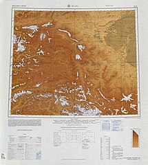
 Map including Kokyar (labeled as 庫庫雅) (c. 1759)
-
 Map including Kokyar (labeled as K'u-k'u-ya) from the International Map of the World (AMS, 1966)
-
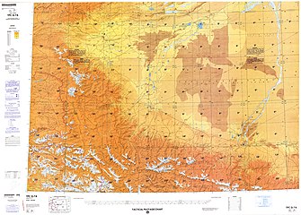
 Map including Kokyar (labeled as K'u-k'u-ya) (ACIC, 1969)
-
 From the Operational Navigation Chart; map including Kokyar (K'u-k'o-ya) (DMA, 1980)
-
 Map including Kokyar (K'u-k'o-ya) (DMA, 1984)
See also
Notes
- From map: "DELINEATION OF INTERNATIONAL BOUNDARIES MUST NOT BE CONSIDERED AUTHORITATIVE"
- From map: "The representation of international boundaries is not necessarily authoritative."
- From map: "The representation of international boundaries is not necessarily authoritative"
References
- ^ 2019年统计用区划代码和城乡划分代码:柯克亚乡 [2019 Statistical Area Numbers and Rural-Urban Area Numbers: Kokyar Township] (in Simplified Chinese). National Bureau of Statistics of the People's Republic of China. 2019. Retrieved 16 April 2020.
统计用区划代码 城乡分类代码 名称 653126213200 220 英阿瓦提村委会 653126213201 210 柯克亚村委会 653126213202 220 欧吞苏村委会 653126213203 220 普萨村委会 653126213204 220 努尔阿巴提村委会 653126213205 220 玉赛斯村委会 653126213206 220 塔尔阿格孜村委会 653126213207 220 果萨斯村委会 653126213208 220 阿其克拜勒都尔村委会 653126213209 220 喀拉尤勒滚村委会 653126213210 220 莫木克村委会 653126213211 220 墩孜拉村委会 653126213212 220 玉斯吕什村委会 653126213213 220 哈拉斯坦村委会 653126213214 220 依格孜亚村委会 653126213215 220 阿瓦提巴格村委会 653126213216 220 颜布克村委会 653126213217 220 牧场村委会
- ^ 柯克亚乡简介. 叶城县人民政府网 (in Simplified Chinese). 17 August 2015. Retrieved 16 April 2020.
叶城县柯克亚乡位于叶城县西南部,地处昆仑山北麓腹地,全乡总面积3662.5平方公里,219国道穿乡而过,东临乌夏巴什镇、南通西藏阿里地区,西与棋盘乡接壤、北连叶城县城,乡政府驻地距叶城县城67公里,全乡耕地面积16800亩,{...}平均海拔在2200—3500米之间{...}行政区划 下辖柯克亚、莫木克、果萨斯、西合甫4个片区17个行政村,52个村民小组{...}农业户口19580人,占全乡人口的93.1%, {...},有维吾尔族和塔吉克族等2个民族。
- ^ 1997年叶城县行政区划. XZQH.org (in Simplified Chinese). 19 November 2010. Retrieved 12 April 2020.
柯克亚乡 民国时期为柯克亚乡,1950年属乌夏巴什7区,1958年析建柯克亚公社,1985年改乡。位于县城西南58千米。面积3662平方千米,人口1.6万,其中维吾尔族占96.9%,辖英阿瓦提、柯克亚、欧吞苏、普萨、阿克美其特、玉赛斯、塔尔阿格孜、果萨斯、阿其克拜勒都尔、喀拉尤勒滚、莫木克、墩孜拉、玉斯吕什、阿曼夏、依格孜亚、阿瓦提巴格、颜布克17个行政村。219国道过境。古迹有建于清代中叶米尔孜阿巴伯克尔古城堡。
- ^ 叶城县历史沿革. XZQH.org (in Simplified Chinese). 14 November 2010. Retrieved 31 January 2020.
2000年第五次人口普查,叶城县常住总人口370229人,{...}柯克亚乡17785人、{...}2010年第六次人口普查,叶城县常住总人口454328人,其中:{...}柯克亚乡19451人,
- ^ Complete Atlas Of The World (3 ed.). Penguin Random House. 2016. p. 238 – via Internet Archive.
Kokyar{...}Akmeqit
- Complete Atlas of the World (2 ed.). DK. 2012. p. 231. ISBN 9781465401304 – via Google Books.
Kokyar
- ^ Aurel Stein (1912). Ruins of Desert Cathay: Personal narrative of explorations in Central Asia and westernmost China. Vol. 1. Macmillan. p. 145-150 – via Internet Archive.
- 艾爾伯特.馮.李.寇克 Albert von Le Coq (2000). 新疆地埋寶藏記 [Buried Treasures of Chinese Turkestan]. Vol. 5. 馬可孛羅. p. 268. ISBN 9578278438.
Kokyar 庫克牙
- "Landslide kills 35 in China's Xinjiang". 人民网. 8 July 2016. Retrieved 16 April 2020.
- "35 killed in landslide in China's Xinjiang province". The Economic Times. 8 July 2016. Retrieved 16 April 2020.
- KJM Varma (8 July 2016). "35 Killed in Landslide in China's Xinjiang Province". Outlook. Retrieved 16 April 2020.
- 暴雨酿祸 新疆爆发泥石流夺35人命. NTV7 (in Simplified Chinese). 8 July 2016. Archived from the original on 2021-12-15. Retrieved 18 April 2020 – via YouTube.
- "Villagers evacuated after landslide kills 35 in China's Xinjiang". China Daily. 10 July 2016. Retrieved 16 April 2020.
- 陈山, ed. (12 July 2016). 柯克亚乡泥石流灾害 叶城公路管理局迅速抢通道路. China Internet Information Center (in Simplified Chinese). Retrieved 16 April 2020.
- "352 villagers relocated after massive landslide in Xinjiang". China Internet Information Center. 11 July 2016. Retrieved 16 April 2020.
- 2016年统计用区划代码和城乡划分代码:柯克亚乡 [2016 Statistical Area Numbers and Rural-Urban Area Numbers: Kokyar Township] (in Simplified Chinese). National Bureau of Statistics of the People's Republic of China. 2016. Retrieved 18 April 2020.
- 2016年统计用区划代码和城乡划分代码:柯克亚乡 [2017 Statistical Area Numbers and Rural-Urban Area Numbers: Kokyar Township] (in Simplified Chinese). National Bureau of Statistics of the People's Republic of China. 2017. Retrieved 18 April 2020.
- Wang Guan 王冠 (13 April 2020). 哈拉斯坦村的脱贫路. Xinjiang People's Broadcasting Station (in Simplified Chinese). Retrieved 18 April 2020.
- Hill (2009), p. 196.
- Stein (1921), Vol. I, p. 86.
- Hill (2009), pp. 200; 207.
- Amjed Jaaved (2 February 2020). "Sino-Indian relations in flux?". Modern Diplomacy. Retrieved 16 April 2020.
In Aksai Chin the road passes through Shabidulla (once the outpost of the State of Jammu and Kashmir) and ends at Kokyar where Sinkiang begins (Even though the journey is difficult and arduous, the Chinese use it in preference to the Keriya route which passes East of Aksai Chin and also links Rhutog in western Tibet to Khotan in Sinkiang.
- Filippo De Filippi (1931). Italian Expedition To The Himalaya, Karakoram And Eastern Turkestan (1913 - 1914). p. 461.
When the horses had trotted a good distance, we saw far away foliage of two contiguous oases, Otansu and Kök Yar.
- قۇربانجان قېيۇم, ed. (19 January 2020). كۆچكەن كەنت ئاھالىلىرىنىڭ خۇشاللىقى كۆپ. Xinjiang Daily (in Uyghur). Retrieved 12 May 2020.
ھەبىبۇللا ئائىلىسى ئىلگىرى قاغىلىق ناھىيەسىنىڭ كۆكيار يېزىسى ئىگىزيا كەنتىدىكى ئارخىپ تۇرغۇزۇلۇپ كارتا بېجىرىلگەن نامرات ئائىلە بولۇپ،
- 2009年统计用区划代码和城乡划分代码:柯克亚乡 [2009 Statistical Area Numbers and Rural-Urban Area Numbers: Kokyar Township] (in Simplified Chinese). National Bureau of Statistics of the People's Republic of China. 2009. Retrieved 17 April 2020.
代码 城乡分类 名称 653126213200 220 英阿瓦提村委会 653126213201 210 柯克亚村委会 653126213202 220 欧吞苏村委会 653126213203 220 普萨村委会 653126213204 220 阿克美其特村委会 653126213205 220 玉赛斯村委会 653126213206 220 塔尔阿格孜村委会 653126213207 220 果萨斯村委会 653126213208 220 阿其克拜勒都尔村委会 653126213209 220 喀拉尤勒滚村委会 653126213210 220 莫木克村委会 653126213211 220 墩孜拉村委会 653126213212 220 玉斯吕什村委会 653126213213 220 阿曼夏村委会 653126213214 220 依格孜亚村委会 653126213215 220 阿瓦提巴格村委会 653126213216 220 颜布克村委会
- Wang Sufen (23 November 2017). "The Walnut Trees of Xinjiang". Youlin Magazine. Retrieved 16 April 2020.
An ancient walnut tree in Kekeya Township of Yecheng (Kargilik) County is flourishing and full of vitality to this day. Within just a kilometer of this, there are over a hundred ancient walnut trees, which are more than 500 years old.
- Jinxing Dai (2016). Giant Coal-Derived Gas Fields and Their Gas Sources in China. Elsevier. p. 320. ISBN 978-0-12-805093-4 – via Google Books.
- Mao Huahe (22 July 2019). The Ebb and Flow of Chinese Petroleum: A Story Told by a Witness. BRILL. p. 264. ISBN 9789004402737 – via Google Books.
Further reading
- Hill, John E. (2009) Through the Jade Gate to Rome: A Study of the Silk Routes during the Later Han Dynasty, 1st to 2nd Centuries CE. BookSurge, Charleston, South Carolina. ISBN 978-1-4392-2134-1.
- Stein, M. Aurel (1921). Serindia: Detailed report of explorations in Central Asia and westernmost China, 5 vols. M. Aurel Stein. 1921. London. Oxford. Clarendon Press. Reprint: Delhi. Motilal Banarsidass. 1980.