Village in Tamil Nadu, India
| Kolukkumalai | |
|---|---|
| village | |
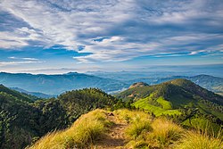
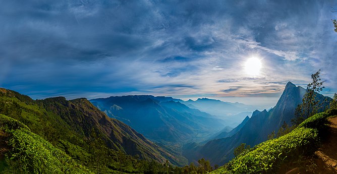
 The View of Western Ghats from the Kolukkumalai Peak The View of Western Ghats from the Kolukkumalai Peak | |
  | |
| Coordinates: 10°04′30″N 77°13′16″E / 10.075°N 77.221°E / 10.075; 77.221 | |
| Country | |
| State | Tamil Nadu |
| District | Theni |
| Government | |
| • Body | Panchayath |
| Elevation | 2,160 m (7,090 ft) |
| Languages | |
| • Official | Tamil |
| Time zone | UTC+5:30 (IST) |
| PIN | 625582 |
| Vehicle registration | TN-60 |
Kolukkumalai is a small village/hamlet in Bodinayakanur Taluk in the Theni district of the Indian state of Tamil Nadu. It is home to the highest tea plantation in the world with the tea grown here possessing a special flavour and freshness because of the high altitude. It is located near Munnar in Idukki district of Kerala.
Geography
Kolukkumalai is about 7,130 feet (2,170 m) above sea level and lies some 32 kilometres (20 mi) from Munnar. The hill top village is accessible only by jeep due to rugged and rain drenched roads covering up to 17 kms. Kolukkumalai is located in Theni district of Tamil Nadu. The approach road is through Suryanelli near Munnar in Idukki district of Kerala.
Tourism

Visitor attractions include:
Colleges
- Cardamom Planters' Associations College, Bodinayakanur
- Government Engineering College, Bodinayakanur
Schools
- P.U. Primary School Kurangani
Administration and Politics
This place belongs to Kottagudi Panchayath of Bodinayakanur taluk. It had 139 voters as on 2014. This village belongs to Bodinayakanur assembly seat. A TNSTC bus starts at 4 am in Theni towards Suryanelli which is the only bus from the state it belongs to. KSRTC buses run regularly to Suryanelli

See also
References
- "The hills are alive ... In Munnar". 5 January 2016.
External links
 Media related to Kolukkumalai at Wikimedia Commons