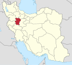
Rural District in Hamadan, Iran
| Kolyai Rural District Persian: دهستان كليائي | |
|---|---|
| Rural District | |
 | |
| Coordinates: 34°49′27″N 47°53′19″E / 34.82417°N 47.88861°E / 34.82417; 47.88861 | |
| Country | Iran |
| Province | Hamadan |
| County | Asadabad |
| District | Pirsalman |
| Capital | Tavilan-e Sofla |
| Population | |
| • Total | 3,028 |
| Time zone | UTC+3:30 (IRST) |
Kolyai Rural District (Persian: دهستان كليائي) is in Pirsalman District of Asadabad County, Hamadan province, Iran. Its capital is the village of Tavilan-e Sofla.
Demographics
Ethnicity
The rural district is populated by Kurds.
Population
At the time of the 2006 National Census, the rural district's population (as a part of the Central District) was 3,909 in 871 households. There were 3,354 inhabitants in 914 households at the following census of 2011, by which time the rural district had been separated from the district in the formation of Pirsalman District. The 2016 census measured the population of the rural district as 3,028 in 950 households. The most populous of its 14 villages was Tavilan-e Sofla, with 927 people.
See also
References
- OpenStreetMap contributors (14 November 2024). "Kolyai Rural District (Asadabad County)" (Map). OpenStreetMap (in Persian). Retrieved 14 November 2024.
- ^ Census of the Islamic Republic of Iran, 1395 (2016): Hamadan Province. amar.org.ir (Report) (in Persian). The Statistical Center of Iran. Archived from the original (Excel) on 21 April 2021. Retrieved 19 December 2022.
- ^ Davodi, Parviz (1 July 2009). "The government approved three changes in the national divisions of Hamadan province". farsnews.ir (in Persian). Ministry of the Interior, Cabinet of Ministers. Archived from the original on 6 November 2023. Retrieved 6 November 2023 – via Fars Media Corporation.
- Habibi, Hassan (c. 2018) . Creation of 48 rural districts in several rural areas of the country. qavanin.ir (Report) (in Persian). Ministry of the Interior, Political-Defense Commission of the Government Council. Resolution 93808/T907. Archived from the original on 28 November 2018. Retrieved 2 January 2024 – via Laws and Regulations Portal of the Islamic Republic of Iran.
- Fattah, Ismaïl Kamandâr (2000). Les dialectes kurdes méridionaux. Acta Iranica 37. p. 5.
- Census of the Islamic Republic of Iran, 1385 (2006): Hamadan Province. amar.org.ir (Report) (in Persian). The Statistical Center of Iran. Archived from the original (Excel) on 20 September 2011. Retrieved 25 September 2022.
- Census of the Islamic Republic of Iran, 1390 (2011): Hamadan Province. irandataportal.syr.edu (Report) (in Persian). The Statistical Center of Iran. Archived from the original (Excel) on 17 January 2023. Retrieved 19 December 2022 – via Iran Data Portal, Syracuse University.
| Hamadan province, Iran | |||||||||||||||||||||
|---|---|---|---|---|---|---|---|---|---|---|---|---|---|---|---|---|---|---|---|---|---|
| Capital |  | ||||||||||||||||||||
| Counties and cities |
| ||||||||||||||||||||
| Sights |
| ||||||||||||||||||||
| populated places | |||||||||||||||||||||
| Capital | |||||||||||||||||||
|---|---|---|---|---|---|---|---|---|---|---|---|---|---|---|---|---|---|---|---|
| Districts |
| ||||||||||||||||||
This Asadabad County location article is a stub. You can help Misplaced Pages by expanding it. |