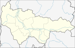
| Kondinskoye Кондинское | |
|---|---|
| Urban-type settlement | |
| Location of Kondinskoye | |
  | |
| Coordinates: 59°39′00″N 67°24′36″E / 59.65000°N 67.41000°E / 59.65000; 67.41000 | |
| Country | Russia |
| Federal subject | Khanty-Mansi Autonomous Okrug |
| Administrative district | Kondinsky District |
| Founded | 1847 |
| Population | |
| • Total | 3,616 |
| Time zone | UTC+5 (MSK+2 |
| Postal code(s) | 628210 |
| OKTMO ID | 71816151051 |
Kondinskoye (Russian: Кондинское; Mansi: Мотус, Motus) is an urban locality (an urban-type settlement) in Kondinsky District of Khanty–Mansi Autonomous Okrug, Russia. Population: 3,616 (2010 Census); 4,086 (2002 Census); 5,125 (1989 Soviet census).
References
- ^ Russian Federal State Statistics Service (2011). Всероссийская перепись населения 2010 года. Том 1 [2010 All-Russian Population Census, vol. 1]. Всероссийская перепись населения 2010 года (in Russian). Federal State Statistics Service.
- "Об исчислении времени". Официальный интернет-портал правовой информации (in Russian). June 3, 2011. Retrieved January 19, 2019.
- Почта России. Информационно-вычислительный центр ОАСУ РПО. (Russian Post). Поиск объектов почтовой связи (Postal Objects Search) (in Russian)
- Государственный комитет Российской Федерации по статистике. Комитет Российской Федерации по стандартизации, метрологии и сертификации. №ОК 019-95 1 января 1997 г. «Общероссийский классификатор объектов административно-территориального деления. Код 71 100», в ред. изменения №278/2015 от 1 января 2016 г.. (State Statistics Committee of the Russian Federation. Committee of the Russian Federation on Standardization, Metrology, and Certification. #OK 019-95 January 1, 1997 Russian Classification of Objects of Administrative Division (OKATO). Code 71 100, as amended by the Amendment #278/2015 of January 1, 2016. ).
- Federal State Statistics Service (May 21, 2004). Численность населения России, субъектов Российской Федерации в составе федеральных округов, районов, городских поселений, сельских населённых пунктов – районных центров и сельских населённых пунктов с населением 3 тысячи и более человек [Population of Russia, Its Federal Districts, Federal Subjects, Districts, Urban Localities, Rural Localities—Administrative Centers, and Rural Localities with Population of Over 3,000] (XLS). Всероссийская перепись населения 2002 года (in Russian).
- Всесоюзная перепись населения 1989 г. Численность наличного населения союзных и автономных республик, автономных областей и округов, краёв, областей, районов, городских поселений и сёл-райцентров [All Union Population Census of 1989: Present Population of Union and Autonomous Republics, Autonomous Oblasts and Okrugs, Krais, Oblasts, Districts, Urban Settlements, and Villages Serving as District Administrative Centers]. Всесоюзная перепись населения 1989 года (in Russian). Институт демографии Национального исследовательского университета: Высшая школа экономики . 1989 – via Demoscope Weekly.
| Administrative divisions of Khanty-Mansi Autonomous Okrug | |||
|---|---|---|---|
| Administrative center: Khanty-Mansiysk • Rural localities | |||
 | Districts | ||
| Cities and towns | |||
| Urban-type settlements | |||
This Khanty-Mansi Autonomous Okrug location article is a stub. You can help Misplaced Pages by expanding it. |