| Kurekchay | |
|---|---|
 | |
| Native name | Kürəkçay (Azerbaijani) |
| Location | |
| Country | Azerbaijan |
| Region | Caucasus |
| District | Goranboy, Goygol, Yevlakh |
| Physical characteristics | |
| Source | Lesser Caucasus |
| • location | Azerbaijan |
| • coordinates | 40°18′35″N 46°14′4″E / 40.30972°N 46.23444°E / 40.30972; 46.23444 |
| Mouth | Kura |
| • location | Azerbaijan |
| • coordinates | 40°43′30″N 47°02′29″E / 40.7251°N 47.0414°E / 40.7251; 47.0414 |
| Length | 186 km (116 mi) |
| Discharge | |
| • location | directly downstream into Kura |
| Basin features | |
| Progression | Kura→ Caspian Sea |
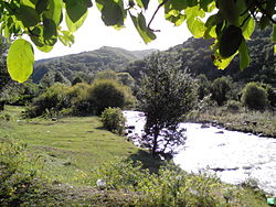
The Kurekchay (Azerbaijani: Kürəkçay) is one of the tributaries of the Kura River located in northwestern Azerbaijan.
On 14 May 1805, on the bank of the river (not far from Ganja), the signing of the Kurekchay Treaty took place, which transferred the Karabakh Khanate to Russian control.
See also
References
- "Azərbaycanın çayları - Azərbaycan Coğrafiya Cəmiyyəti". gsaz.az. Retrieved 2017-10-31.
| Rivers | |
|---|---|
| Lakes | |
| Reservoirs | |
This article related to a river in Azerbaijan is a stub. You can help Misplaced Pages by expanding it. |