| This article does not cite any sources. Please help improve this article by adding citations to reliable sources. Unsourced material may be challenged and removed. Find sources: "La Pintada, Antioquia" – news · newspapers · books · scholar · JSTOR (January 2013) (Learn how and when to remove this message) |
| La Pintada | |
|---|---|
| Municipality and town | |
 | |
 Flag Flag | |
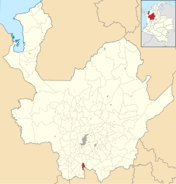
 Location of the municipality and town of La Pintada in the Antioquia Department of Colombia Location of the municipality and town of La Pintada in the Antioquia Department of Colombia | |
 | |
| Coordinates: 5°44′31″N 75°36′19″W / 5.74194°N 75.60528°W / 5.74194; -75.60528 | |
| Country | |
| Department | |
| Subregion | Southwestern |
| Elevation | 600 m (2,000 ft) |
| Time zone | UTC-5 (Colombia Standard Time) |
La Pintada (Spanish pronunciation: [la pinˈtaða]); is a town and municipality in the southwest region of the Antioquia Department of Colombia. It is located 79 miles from Medellín at an altitude of 600 m (2,000 ft) above sea level. It borders the Fredonia and Santa Bárbara municipalities to the north. The Cauca River flows through the municipality.
Places of interest
- Slopes of the Poblanco and Arma rivers
- Yellow hill
- Alejandro López railway station
- El Salto del Caballo
- Acapulco beach
Gallery
| Capital: Medellín | |||||||||||||||||||
| Regions and municipalities |
| ||||||||||||||||||
| Related topics | |||||||||||||||||||
5°45′N 75°36′W / 5.750°N 75.600°W / 5.750; -75.600
This Department of Antioquia location article is a stub. You can help Misplaced Pages by expanding it. |
