| This article relies largely or entirely on a single source. Relevant discussion may be found on the talk page. Please help improve this article by introducing citations to additional sources. Find sources: "Lac d'Allos" – news · newspapers · books · scholar · JSTOR (February 2016) |
| Lac d'Allos Lake of Allos | |
|---|---|
 | |
 Lake of Allos | |
| Location | Parc National du Mercantour, France |
| Coordinates | 44°14′00″N 6°42′30″E / 44.2333°N 6.7083°E / 44.2333; 6.7083 |
| Type | Natural lake |
| Catchment area | 60 ha (150 acres) |
| Basin countries | France |
| Surface area | 60 ha (150 acres) |
| Max. depth | 50 m (160 ft) |
| Surface elevation | 2,230 m (7,320 ft) |
| References | More info |

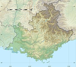
Lac d'Allos is an alpine lake at a height of 2,230 m. It is located in Parc National du Mercantour, departement Alpes-de-Haute-Provence the region Provence-Alpes-Côte d'Azur, France.
Description
Lac d'Allos is a lake in the Alpes-de-Haute-Provence and is dominated by Mont Pelat (3052 meters), it is the largest natural high altitude lake in Europe. It covers 60 hectares and has a depth of 50 m. In the twelfth century, it was called Levedone.
The lake is situated nearby the municipality of Allos.
References
- Philippe Blanchet; Jean-Michel Turc; Rémi Venture (2016). La Provence pour les Nuls poche (in French). edi8. ISBN 9782754089524. Retrieved 2024-07-12.
See also
External links
This Alpes-de-Haute-Provence geographical article is a stub. You can help Misplaced Pages by expanding it. |