| Bouchet lake | |
|---|---|
| Lac du Bouchet | |
 | |
  | |
| Location | Haute-Loire |
| Coordinates | 44°54′33″N 3°47′25″E / 44.90917°N 3.79028°E / 44.90917; 3.79028 |
| Type | crater lake |
| Basin countries | France |
| Surface area | 44 ha (110 acres) |
| Max. depth | 28 m (92 ft) |
| Surface elevation | 1,208 m (3,963 ft) |
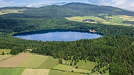
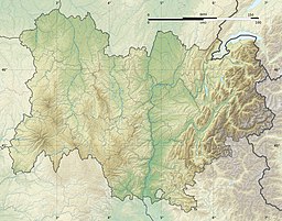
Bouchet lake (or Lake of Bouchet; French: Lac du Bouchet) is located in Haute-Loire, France, near Le Puy-en-Velay, in the Devès massif. It is about 1.6 km (one mile) north of the village of Le Bouchet-Saint-Nicolas. It is situated within the territories of the communes of Cayres and Le Bouchet-Saint-Nicolas.
Bouchet is a crater lake formed from an old volcano, and thus roughly circular. It is a little more than half a mile from rim to rim and surrounded by woodlands. It is at an altitude of 1,208 m (3,963 feet).
External links
- Lake of Bouchet, picture.
This Haute-Loire geographical article is a stub. You can help Misplaced Pages by expanding it. |