| Albigna lake | |
|---|---|
| Lägh da l'Albigna Lago da l'Albigna | |
 | |
    | |
 | |
| Location | Bregaglia, Graubünden |
| Coordinates | 46°19′48″N 9°38′51″E / 46.33000°N 9.64750°E / 46.33000; 9.64750 |
| Type | reservoir |
| Primary inflows | mountain streams |
| Primary outflows | Albigna |
| Catchment area | 20.5 km (7.9 sq mi) |
| Basin countries | Switzerland |
| Surface area | 1.13 km (0.44 sq mi) |
| Max. depth | 108 m (354 ft) |
| Surface elevation | 2,163 m (7,096 ft) |
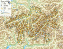
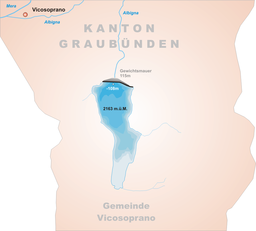
Albigna Lake (German: Albignasee, Italian: Lago da l'Albigna, Romansh: Lägh da l'Albigna) is a reservoir in the canton of Graubünden, Switzerland. It is located in the municipality of Vicosoprano at an elevation of 2,163 metres (7,096 ft) on the southwest side of the Bregaglia valley, northeast of Pizzo Cacciabella. The lake has a surface area of 1.13 square kilometres (280 acres). Its outflow, the Albigna River, is a left tributary of the Mera River.
See also
External links
 Media related to Albigna lake at Wikimedia Commons
This article related to a lake in Graubünden is a stub. You can help Misplaced Pages by expanding it. |