| This article needs additional citations for verification. Please help improve this article by adding citations to reliable sources. Unsourced material may be challenged and removed. Find sources: "Lampa, Peru" – news · newspapers · books · scholar · JSTOR (February 2024) (Learn how and when to remove this message) |
| Lampa, Peru | |
|---|---|
| Town | |
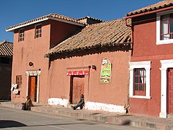
      From top, left to right: Santiago Apostol church in Lampa, mosaic in the entrance to the cathedral, Plaza Grau, Lampa's town hall, 4 de Junio Park and some pink-painted houses From top, left to right: Santiago Apostol church in Lampa, mosaic in the entrance to the cathedral, Plaza Grau, Lampa's town hall, 4 de Junio Park and some pink-painted houses | |
| Nickname: La Ciudad Rosada (The Pink City) | |
 | |
| Coordinates: 15°21′49″S 70°21′56″W / 15.36361°S 70.36556°W / -15.36361; -70.36556 | |
| Country | |
| Region | Puno |
| Province | Lampa |
| District | Lampa |
| Government | |
| • Mayor | Ciriaco Isidro Diaz Arestegui (2019-2022) |
| Elevation | 3,892 m (12,769 ft) |
| Population | |
| • Total | 14,780 |
| Time zone | UTC-5 (PET) |
Lampa is a town in Southern Peru. It is the capital of the Lampa Province in the Puno Region. Lampa is situated near the lake Pukaqucha.
Climate
| Climate data for Lampa, elevation 3,866 m (12,684 ft), (1991–2020) | |||||||||||||
|---|---|---|---|---|---|---|---|---|---|---|---|---|---|
| Month | Jan | Feb | Mar | Apr | May | Jun | Jul | Aug | Sep | Oct | Nov | Dec | Year |
| Mean daily maximum °C (°F) | 16.4 (61.5) |
16.2 (61.2) |
16.2 (61.2) |
16.5 (61.7) |
16.5 (61.7) |
15.9 (60.6) |
16.0 (60.8) |
16.8 (62.2) |
17.7 (63.9) |
18.1 (64.6) |
18.8 (65.8) |
17.8 (64.0) |
16.9 (62.4) |
| Mean daily minimum °C (°F) | 4.2 (39.6) |
4.3 (39.7) |
3.8 (38.8) |
1.5 (34.7) |
−3.0 (26.6) |
−5.6 (21.9) |
−5.9 (21.4) |
−4.5 (23.9) |
−1.8 (28.8) |
0.4 (32.7) |
1.1 (34.0) |
3.1 (37.6) |
−0.2 (31.6) |
| Average precipitation mm (inches) | 142.9 (5.63) |
140.8 (5.54) |
107.1 (4.22) |
48.2 (1.90) |
6.2 (0.24) |
3.7 (0.15) |
3.6 (0.14) |
8.3 (0.33) |
19.8 (0.78) |
52.5 (2.07) |
55.0 (2.17) |
121.3 (4.78) |
709.4 (27.95) |
| Source: National Meteorology and Hydrology Service of Peru | |||||||||||||
References
- Barnbaum, Bruce (11 December 2020). The Essence of Photography, 2nd Edition. Rocky Nook, Inc. ISBN 978-1-68198-637-1.
- "Normales Climáticas Estándares y Medias 1991-2020". National Meteorology and Hydrology Service of Peru. Archived from the original on 21 August 2023. Retrieved 25 October 2023.
External links
15°21′49″S 70°21′56″W / 15.36361°S 70.36556°W / -15.36361; -70.36556
This Puno Region geography article is a stub. You can help Misplaced Pages by expanding it. |
