| Licenciado Benito Juárez | |
|---|---|
| City | |
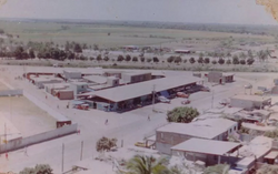
 Villa Juárez when it used to belong to the municipality of Culiacán Villa Juárez when it used to belong to the municipality of Culiacán | |
| Coordinates: 24°39′23″N 107°32′36″W / 24.656445°N 107.543406°W / 24.656445; -107.543406 | |
| Country | Mexico |
| State | Sinaloa |
| Municipality | Navolato |
| Population | |
| • Total | 21,626 |
| Time zone | UTC-7 (Pacific (US Mountain)) |
| Postal code | 80378 |
| Area code | 672 |
Licenciado Benito Juárez or also known as Villa Juárez is a city in the Mexican municipality of Navolato. It has a population of 21,626 and is located at a medium height of 10 meters above sea level. It was part of the Culiacán Municipality until 1982, when it joined Navolato by order of Governor Antonio Toledo Corro.
References
- "Lic. Benito Juárez (Campo Gobierno)". Nuestro Mexico (in Spanish). Retrieved January 25, 2024.
- "Navolato". CONCANACO (in Spanish). Retrieved January 25, 2024.
External links
![]() Media related to Licenciado Benito Juárez, Sinaloa at Wikimedia Commons
Media related to Licenciado Benito Juárez, Sinaloa at Wikimedia Commons
This article about a location in the Mexican state of Sinaloa is a stub. You can help Misplaced Pages by expanding it. |