| This article needs additional citations for verification. Please help improve this article by adding citations to reliable sources. Unsourced material may be challenged and removed. Find sources: "West York Island" – news · newspapers · books · scholar · JSTOR (January 2021) (Learn how and when to remove this message) |
| Disputed island | |
|---|---|
 West York Island West York Island | |
 | |
| Other names | Likas Island (Philippine English) Pulo ng Likas (Filipino) đảo Bến Lạc (Vietnamese) 西月島 / 西月岛 Xīyuè Dǎo (Chinese) |
| Geography | |
| Location | South China Sea |
| Coordinates | 11°05′N 115°0′E / 11.083°N 115.000°E / 11.083; 115.000 (West York Island) |
| Archipelago | Spratly Islands |
| Administration | |
| Region | IV-B - MIMAROPA |
| Province | Palawan |
| Municipality | Kalayaan |
| Claimed by | |
| Additional information | |
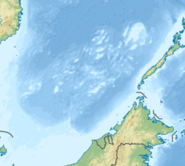
West York Island, also known as Likas Island (Filipino: Pulo ng Likas, lit. 'Island of Naturality'; Mandarin Chinese: 西月島/西月岛; pinyin: Xīyuè Dǎo; Vietnamese: đảo Bến Lạc), and several other names. With an area of 18.6 hectares (46 acres), it is the third largest of the naturally occurring Spratly Islands, and the second largest (after Thitu Island) of the Philippine-occupied islands. It is 530 yards (485 m) wide, 330 yards (302 m) long, and its highest elevation is 30 feet (9 m).
The island is administered by the Philippines as part of Kalayaan, Palawan; it is located 47 miles (76 km) northeast of Pagasa Island (Thitu Island), the location of the Philippine defined major town of Kalayaan. Filipino soldiers are stationed on the island.
The island is also claimed by the People's Republic of China, the Republic of China (Taiwan) and Vietnam.
Structures and environment
West York Island is covered with low vegetation and scrub. Outcrops are visible on the southern and eastern portion of the island during low tides. It is a sanctuary for giant sea turtles that lay their eggs on the island all year round. The high salinity of the groundwater on the island retards the growth of introduced trees like coconuts, ipil-ipil, and other types; only those plants indigenous to the area, (mostly beach types of plants), thrive and survive the hot and humid condition, especially during the dry season.
There are no buildings on the island, except for the ruins of houses built by Japanese soldiers during World War II, and a small Philippine observation post where Filipino soldiers are stationed.
The Philippine Coast Guard constructed 5 lighthouses in the area, and this includes one on West York Island.
Plans
Kalayaan municipal officials have proposed that this island be populated with civilian settlers "within the coming years". If accomplished, it will be the second barangay of Kalayaan (after Thitu Island/Pag-asa). However, only naval vessels are currently capable of reaching the island. An estimate of 300 million pesos (US$7.5M) will be needed to construct an airstrip, a docking site, some land reclamation and other structures necessary to support an isolated community.
See also
- Spratly Islands
- Kalayaan, Palawan
- List of maritime features in the Spratly Islands
- Policies, activities and history of the Philippines in Spratly Islands
References
- Dzurek, Daniel J. (1996). The Spratly Islands Dispute: Who's on First?. IBRU. ISBN 978-1-897643-23-5.
- Elleman, Bruce; Kotkin, Stephen; Schofield, Clive (2015-05-18). Beijing's Power and China's Borders: Twenty Neighbors in Asia. M.E. Sharpe. ISBN 978-0-7656-2766-7.
- Hanson, Arthur J. (1981). Environmental Considerations in Foreign-donor-supported Projects: Some Experiences in Indonesia. East-West Center. ISBN 978-0-86638-023-2.
- Buchholz, Hanns Jürgen (1987). Law of the Sea Zones in the Pacific Ocean. Institute of Southeast Asian Studies. ISBN 978-9971-988-73-9.
- Nepomuceno, Priam (21 April 2021). "WPS security assured with more assets". www.pna.gov.ph. PNA. Retrieved 30 May 2021.
External links
| Spratly Islands | |
|---|---|
| Confrontations | |
| Regions | |
| Occupied features | |
| Unoccupied features | |
| Related articles | |
| South China Sea | |||||||||||||||||
|---|---|---|---|---|---|---|---|---|---|---|---|---|---|---|---|---|---|
| Pratas Island | |||||||||||||||||
| Paracel Islands |
| ||||||||||||||||
| Northeastern SCS | |||||||||||||||||
| Spratly Islands |
| ||||||||||||||||
| Southeastern SCS | |||||||||||||||||
| Southern SCS | |||||||||||||||||
| Tudjuh Archipelago | |||||||||||||||||
| History |
| ||||||||||||||||
| Transport |
| ||||||||||||||||
This article about a location in the Philippines is a stub. You can help Misplaced Pages by expanding it. |