Misplaced Pages

List of Cultural Properties of Japan – structures (Gunma)

Article snapshot taken from Wikipedia with creative commons attribution-sharealike license. Give it a read and then ask your questions in the chat. We can research this topic together.

Map all coordinates using OpenStreetMap

Download coordinates as:

This list is of the Cultural Properties of Japan designated in the category of structures (建造物, kenzōbutsu) for the Prefecture of Gunma.

National Cultural Properties

As of 1 May 2015, twenty one Important Cultural Properties (including one *National Treasure) with sixty component structures have been designated, being of national significance.

Property Date Municipality Comments Image Coordinates Ref.
*Former Tomioka Silk Mill
旧富岡製糸場
kyū-Tomioka seishi jō
1872-4 Tomioka designation comprises nine components: the silk-reeling plant and east and west cocoon warehouses (National Treasures of 1872), and steam boiler plant and water disposal system (1872), director's mansion, dormitory for female instructors, and inspector's house (1873), and iron water tank (1874); inscribed on the UNESCO World Heritage List 36°15′19″N 138°53′15″E / 36.25516924°N 138.88752019°E / 36.25516924; 138.88752019 (Former Tomioka Silk Mill)
Akusawa Family Residence
阿久沢家住宅
Akusawa-ke jūtaku
1661-1750 Maebashi 36°27′05″N 139°10′06″E / 36.45128942°N 139.168407°E / 36.45128942; 139.168407 (Akusawa Family Residence)
Usui Pass Railway Facilities
碓氷峠鉄道施設
Usui-tōge tetsudō shisetsu
1893-1912 Annaka designation comprises seventeen components: five bridges and ten tunnels (1893), and the former Maruyama Substation battery room and machine room (1912) 36°21′18″N 138°42′20″E / 36.35511988°N 138.70551693°E / 36.35511988; 138.70551693 (Usui Pass Railway Facilities)

Kasa Sotōba
笠卒塔婆
kasa sotōba
1356 Shibukawa 36°29′16″N 138°59′42″E / 36.48764278°N 138.99507436°E / 36.48764278; 138.99507436 (Kasa Sotōba)
Nukisaki Jinja
貫前神社
Nukisaki Jinja
1635 Tomioka designation comprises three components: the honden, haiden, and rōmon 36°15′19″N 138°51′28″E / 36.25529121°N 138.85765326°E / 36.25529121; 138.85765326 (Nukisaki Jinja)
Marunuma Dam
丸沼堰堤
Marunuma entei
1931 Katashina 36°49′26″N 139°20′23″E / 36.82386899°N 139.33980622°E / 36.82386899; 139.33980622 (Marunuma Dam)
Former Gunma Prefecture Health Office
旧群馬県衛生所
kyū-Gunma-ken eisei-jo
1878 Kiryū 36°24′44″N 139°18′34″E / 36.41214208°N 139.30953144°E / 36.41214208; 139.30953144 (Former Gunma Prefecture Health Office)
Former Tobe Family Residence
旧戸部家住宅
kyū-Tobe-ke jūtaku
1661-1750 Minakami 36°46′16″N 138°58′06″E / 36.77117319°N 138.96846639°E / 36.77117319; 138.96846639 (Former Tobe Family Residence)
Former Kurosawa Family Residence
旧黒澤家住宅
kyū-Kurosawa-ke jūtaku
1830-67 Ueno 36°05′14″N 138°44′10″E / 36.08709697°N 138.73604627°E / 36.08709697; 138.73604627 (Former Kurosawa Family Residence)
Former Ubukata Family Residence
旧生方家住宅
kyū-Ubukata-ke jūtaku
1661-1750 Numata 36°38′55″N 139°02′24″E / 36.64858917°N 139.03996046°E / 36.64858917; 139.03996046 (Former Ubukata Family Residence)
Former Moteki Family Residence
旧茂木家住宅
kyū-Moteki-ke jūtaku
1661-1750 Tomioka 36°14′51″N 138°50′46″E / 36.24758147°N 138.84598077°E / 36.24758147; 138.84598077 (Former Moteki Family Residence)
Tamamura Hachimangū Honden
玉村八幡宮本殿
Tamamura Hachimangū honden
1573-1614 Tamamura 36°18′18″N 139°06′32″E / 36.30512321°N 139.10888282°E / 36.30512321; 139.10888282 (Tamamura Hachimangū Honden)
Haruna Jinja
榛名神社
Haruna Jinja
1716-1914 Takasaki designation comprises six components: the honsha-heiden-haiden (1914), koku sosha-gakuden (1716–35), kagura-den (1764), sōryūmon (1855), miyuki-den (1856), and zuishinmon (1847) 36°27′31″N 138°51′08″E / 36.45853192°N 138.85220613°E / 36.45853192; 138.85220613 (Haruna Jinja)
Chōraku-ji Hōtō
長楽寺宝塔
Chōrakuji Hōtō
1276 Ōta 36°15′46″N 139°16′30″E / 36.26277744°N 139.27512517°E / 36.26277744; 139.27512517 (Chōrakuji Hōtō)
Tōba
塔婆
Tōba
801 Kiryū 36°25′44″N 139°13′14″E / 36.42900353°N 139.22055117°E / 36.42900353; 139.22055117 (Tōba)
Tōshō-gū
東照宮
Tōshō-gū
1615-44 Ōta designation comprises three components: the honden and karamon (1644), and haiden (1615-24) 36°15′43″N 139°16′30″E / 36.26197776°N 139.27511497°E / 36.26197776; 139.27511497 (Tōshō-gū)
Hikobe Family Residence
彦部家住宅
Hikobe-ke jūtaku
1501-1867 Kiryū designation comprises five components: main residence (1501-1600), nagayamon (1661-1750), and fuyuzumi, bunkogura, and kokugura (1830-1867) 36°22′25″N 139°20′54″E / 36.37351276°N 139.3483196°E / 36.37351276; 139.3483196 (Hikobe Family Residence)
Tomizawa Family Residence
富沢家住宅
Tomizawa-ke jūtaku
1792 Tomioka 36°39′46″N 138°51′19″E / 36.66264036°N 138.85540641°E / 36.66264036; 138.85540641 (Tomizawa Family Residence)
Myōgi Jinja
妙義神社
Myōgi Jinja
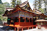
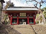
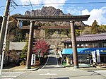
1756-73 Tomioka designation comprises three components: the honden-heiden-haiden and karamon (1756), and sōmon (1773) 36°18′02″N 138°45′45″E / 36.30044636°N 138.76240118°E / 36.30044636; 138.76240118 (Myōgi Jinja)
Yakushi-dō
薬師堂
Yakushi-dō
1867 Nakanojō 36°36′51″N 138°47′56″E / 36.61412397°N 138.79898211°E / 36.61412397; 138.79898211 (Yakushi-dō)
Raiden Jinja Massha Hachimangū Inari Jinja Shaden
雷電神社末社八幡宮稲荷神社社殿
Raiden Jinja massha Hachimangū Inari Jinja shaden
1547 Itakura 36°13′40″N 139°36′28″E / 36.22784194°N 139.60767176°E / 36.22784194; 139.60767176 (Raiden Jinja Massha Hachimangū Inari Jinja Shaden)
This list is complete and up to date as of May 2015.

Prefectural Cultural Properties

As of 24 March 2015, fifty-three properties have been designated at a prefectural level.

Property Date Municipality Comments Image Coordinates Ref.
Tainei-ji Sanmon
泰寧寺山門
Taineiji sanmon
Minakami 36°41′56″N 138°53′40″E / 36.698986°N 138.894417°E / 36.698986; 138.894417 (Tainei-ji Sanmon)
Kūe-ji Sanmon
空恵寺山門
Kūeji sanmon
Shibukawa 36°33′20″N 139°01′04″E / 36.555609°N 139.017783°E / 36.555609; 139.017783 (Kūe-ji Sanmon)
Chōraku-ji Chokushimon
長楽寺の勅使門
Chōrakuji no chokushimon
Ōta 36°15′46″N 139°16′30″E / 36.26277744°N 139.27512517°E / 36.26277744; 139.27512517 (Chōrakuji Chokushimon)
Matsuida Hachimangū Honden
松井田八幡宮本殿
Matsuida Hachimangū honden
Annaka 36°18′59″N 138°47′53″E / 36.316441°N 138.798094°E / 36.316441; 138.798094 (Matsuida Hachimangū Honden)
Fudō-ji Niōmon
不動寺の仁王門
Fudōji Niōmon
Annaka 36°18′58″N 138°48′02″E / 36.316131°N 138.800518°E / 36.316131; 138.800518 (Fudōji Niōmon)
Myōgi Jinja
妙義神社随神門・袖廻廊・銅鳥居・石垣
Myōgi Jinja zuishinmon・sode kairō・dō-torii・ishigaki
Tomioka designation comprises four components: the zuishinmon, kairō, bronze torii, and stone walls 36°18′02″N 138°45′45″E / 36.30044636°N 138.76240118°E / 36.30044636; 138.76240118 (Myōgi Jinja)
Shibukawa Hachimangū Honden
渋川八幡宮本殿
Shibukawa Hachimangū honden
Shibukawa 36°30′06″N 138°59′24″E / 36.501745°N 138.990124°E / 36.501745; 138.990124 (Shibukawa Hachimangū Honden)
Kōzuke Sōja Jinja Honden
上野総社神社本殿
Kōzuke Sōja Jinja honden
Maebashi 36°23′17″N 139°02′16″E / 36.387968°N 139.037907°E / 36.387968; 139.037907 (Kōzuke Sōja Jinja Honden)

Municipal Cultural Properties

As of 1 May 2014, three hundred and eleven properties have been designated at a municipal level.

Registered Cultural Properties

As of 1 May 2015, three hundred and sixteen properties at one hundred and seventeen sites have been registered (as opposed to designated) at a national level.

Property Date Municipality Comments Image Coordinates Ref.
Gunma Prefectural Government Office Building
群馬県庁本庁舎
Gunma-kenchō honchōsha
1928 Maebashi 36°23′28″N 139°03′39″E / 36.39118728°N 139.06082111°E / 36.39118728; 139.06082111 (Gunma Prefectural Government Office Building)
Suidōyama Kinenkan
水道山記念館(旧配水事務所)
Suidōyama kinenkan (kyū-haisui jimusho)
1932 Kiryū former water distribution office 36°25′01″N 139°19′53″E / 36.41689729°N 139.3313877°E / 36.41689729; 139.3313877 (Suidōyama Kinenkan)
MAEHARA 20th
MAEHARA 20th(旧合名会社飯塚織物工場)
Maehara tōentei-su (kyū-gōmeigaisha Iizuka orimono kōjō)
1932 Kiryū former Iizuka Partnership textile factory 36°22′19″N 139°21′03″E / 36.37196779°N 139.35071269°E / 36.37196779; 139.35071269 (MAEHARA 20th)
Kanazen Building
金善ビル
Kanazen biru
1921 Kiryū 36°24′42″N 139°20′21″E / 36.411583°N 139.339294°E / 36.411583; 139.339294 (Kanazen Building)
Cultural Properties of Japan - structures
National Treasures
Important Cultural Properties
Hokkaidō
Tōhoku
Kantō
Chūbu
Kansai
Chūgoku
Shikoku
Kyūshū
Okinawa

See also

References

  1. "Pamphlet on Cultural Properties". Agency for Cultural Affairs. Archived from the original on 26 October 2014. Retrieved 26 May 2015.
  2. 国宝・重要文化財 [Number of National Treasures and Important Cultural Properties by Prefecture] (in Japanese). Agency for Cultural Affairs. 1 May 2015. Archived from the original on 30 June 2011. Retrieved 26 May 2015.
  3. "Database of National Cultural Properties: 国宝・重要文化財(建造物) (群馬県)" (in Japanese). Agency for Cultural Affairs. Archived from the original on 4 December 2015. Retrieved 26 May 2015.
  4. ^ 群馬の文化財 [Cultural Properties of Gunma Prefecture] (in Japanese). Gunma Prefecture. 24 March 2015. Retrieved 26 May 2015.
  5. "Tomioka Silk Mill and Related Sites". UNESCO. Retrieved 26 May 2015.
  6. 都道府県別指定等文化財件数(都道府県分) [Number of Prefectural Cultural Properties by Prefecture] (in Japanese). Agency for Cultural Affairs. 1 May 2014. Archived from the original on 21 September 2013. Retrieved 26 May 2015.
  7. 都道府県別指定等文化財件数(市町村分) [Number of Municipal Cultural Properties by Prefecture] (in Japanese). Agency for Cultural Affairs. 1 May 2014. Archived from the original on 14 May 2015. Retrieved 26 May 2015.
  8. 登録文化財 [Number of Registered Cultural Properties by Prefecture] (in Japanese). Agency for Cultural Affairs. 1 May 2015. Archived from the original on 30 June 2011. Retrieved 26 May 2015.

External links

Categories: