Name
Location
Type
Completed Date designated
Grid ref. Entry number Image
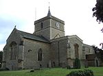
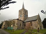
Church of St Cecilia
Adstock , Aylesbury Vale Parish church
12th century
13 July 1966
SP7350930110 51°57′53″N 0°55′53″W / 51.964618°N 0.931498°W / 51.964618; -0.931498 (Church of St Cecilia)
1288520 Church of St Cecilia More images
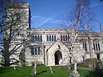
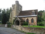
Parish Church of St Mary the Virgin
Ashendon Parish church
Early 12th century
21 December 1967
SP7051114214 51°49′20″N 0°58′42″W / 51.82211°N 0.978371°W / 51.82211; -0.978371 (Parish Church of St Mary the Virgin)
1118370 Parish Church of St Mary the Virgin More images
Church of St Mary
Aylesbury Church
13th century
7 April 1952
SP8170713913 51°49′04″N 0°48′58″W / 51.817882°N 0.816036°W / 51.817882; -0.816036 (Church of St Mary)
1160522 Church of St Mary More images
Church of St James
Bierton, Bierton with Broughton
Parish church
14th century
21 December 1967
SP8361615261 51°49′47″N 0°47′17″W / 51.829717°N 0.788022°W / 51.829717; -0.788022 (Church of St James)
1160435 Church of St James More images
Boarstall Tower
Boarstall House
Early 14th century
25 October 1951
SP6242014248 51°49′24″N 1°05′45″W / 51.823376°N 1.095739°W / 51.823376; -1.095739 (Boarstall Tower)
1124280 Boarstall Tower More images
Castle House
Buckingham Timber-framed house
Late 15th century
13 October 1952
SP6940834015 52°00′01″N 0°59′25″W / 52.000248°N 0.990389°W / 52.000248; -0.990389 (Castle House)
1282698 Castle House More images
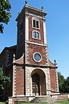
St Peter and St Paul, Buckingham
Buckingham
Church
1777–80
13 October 1952
SP6946833780 51°59′53″N 0°59′22″W / 51.998128°N 0.989562°W / 51.998128; -0.989562 (St Peter and St Paul, Buckingham)
1282713 St Peter and St Paul, Buckingham More images
Thornborough Bridge
Buckingham
Bridge
14th century
25 September 1951
SP7292533163 51°59′32″N 0°56′22″W / 51.992139°N 0.939349°W / 51.992139; -0.939349 (Thornborough Bridge)
1276995 Thornborough Bridge More images
Thornborough Bridge (the part in Buckingham Civil Parish)
Buckingham
Bridge
15th century
13 October 1952
SP7292633163 51°59′32″N 0°56′22″W / 51.992139°N 0.939334°W / 51.992139; -0.939334 (Thornborough Bridge (the part in Buckingham Civil Parish))
1201358 Thornborough Bridge (the part in Buckingham Civil Parish)More images
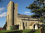
Church of St Mary and St Nicholas
Chetwode Parish church
Early English
13 July 1966
SP6404329800 51°57′47″N 1°04′10″W / 51.963°N 1.069311°W / 51.963; -1.069311 (Church of St Mary and St Nicholas)
1211496 Church of St Mary and St Nicholas More images
Parish Church of St Mary
Chilton Parish church
12th century
21 December 1967
SP6867411608 51°47′56″N 1°00′20″W / 51.798911°N 1.005535°W / 51.798911; -1.005535 (Parish Church of St Mary)
1118356 Parish Church of St Mary More images
Manor House
Creslow House
c .133025 October 1951
SP8116821837 51°53′21″N 0°49′19″W / 51.889189°N 0.821995°W / 51.889189; -0.821995 (Manor House)
1117837 Manor House More images
Parish Church of Saints Peter and Paul
Dinton , Dinton-with-Ford and Upton Parish church
12th century
21 December 1967
SP7668311069 51°47′35″N 0°53′22″W / 51.793027°N 0.889535°W / 51.793027; -0.889535 (Parish Church of Saints Peter and Paul)
1319069 Parish Church of Saints Peter and Paul More images
Dorton House
Dorton Country house
1626
25 October 1951
SP6791713894 51°49′10″N 1°00′58″W / 51.819554°N 1.016064°W / 51.819554; -1.016064 (Dorton House)
1124266 Dorton House More images
Church of St Mary
Drayton Beauchamp Parish church
15th century
21 December 1967
SP9016011884 51°47′54″N 0°41′38″W / 51.798346°N 0.693964°W / 51.798346; -0.693964 (Church of St Mary)
1124210 Church of St Mary More images
Church of St Mary
Edlesborough Parish church
13th century
18 October 1966
SP9700419061 51°51′42″N 0°35′34″W / 51.86171°N 0.592739°W / 51.86171; -0.592739 (Church of St Mary)
1117908 Church of St Mary More images
Parish Church of St Mary
Church End, Haddenham
Parish church
12th century
21 December 1967
SP7416508002 51°45′57″N 0°55′36″W / 51.765795°N 0.926692°W / 51.765795; -0.926692 (Parish Church of St Mary)
1118285 Parish Church of St Mary More images
Church of All Saints
Hillesden Parish church
Mid-15th century
13 July 1966
SP6856928753 51°57′11″N 1°00′13″W / 51.95305°N 1.003657°W / 51.95305; -1.003657 (Church of All Saints)
1288641 Church of All Saints More images
Parish Church of St Nicholas
Ickford Parish church
12th century
21 December 1967
SP6459407372 51°45′41″N 1°03′56″W / 51.761316°N 1.065479°W / 51.761316; -1.065479 (Parish Church of St Nicholas)
1159739 Parish Church of St Nicholas More images
Church of St Mary
Ivinghoe Parish church
13th century
18 October 1966
SP9455316177 51°50′10″N 0°37′45″W / 51.836208°N 0.629108°W / 51.836208; -0.629108 (Church of St Mary)
1117874 Church of St Mary More images
Tythrop Park
Kingsey Country house
Early 17th century
26 August 1949
SP7395307022 51°45′25″N 0°55′48″W / 51.757014°N 0.929972°W / 51.757014; -0.929972 (Tythrop Park)
1159819 Tythrop Park More images
Church of St Mary
Leckhampstead, Buckinghamshire Parish church
Norman
13 July 1966
SP7264037918 52°02′06″N 0°56′33″W / 52.034919°N 0.942492°W / 52.034919; -0.942492 (Church of St Mary)
1214985 Church of St Mary More images
Church of St Nicholas
Lillingstone Dayrell with Luffield Abbey Parish church
Norman
13 July 1966
SP7052839821 52°03′08″N 0°58′22″W / 52.052298°N 0.972882°W / 52.052298; -0.972882 (Church of St Nicholas)
1215097 Church of St Nicholas More images
Church of St Mary
Lillingstone Lovell Parish church
Early 13th century
13 July 1966
SP7124540491 52°03′30″N 0°57′44″W / 52.058229°N 0.962288°W / 52.058229; -0.962288 (Church of St Mary)
1215187 Church of St Mary More images
Church of St Mary
Church End, Long Crendon
Church
13th century
21 December 1967
SP6984009060 51°46′33″N 0°59′21″W / 51.775862°N 0.989141°W / 51.775862; -0.989141 (Church of St Mary)
1214036 Church of St Mary More images
Notley Abbey House
Long Crendon
House
c .116225 October 1951
SP7154709197 51°46′37″N 0°57′52″W / 51.776878°N 0.964376°W / 51.776878; -0.964376 (Notley Abbey House)
1213476 Notley Abbey House More images
Barn adjoining south-east corner of Notley Abbey House
Long Crendon
Barn
13th century
25 October 1951
SP7158009183 51°46′36″N 0°57′50″W / 51.776748°N 0.963901°W / 51.776748; -0.963901 (Barn adjoining south-east corner of Notley Abbey House)
1213478 Barn adjoining south-east corner of Notley Abbey House
Enclosing wall at Notley Abbey House
Long Crendon
Wall
13th century
19 June 1981
SP7156909222 51°46′38″N 0°57′51″W / 51.7771°N 0.964052°W / 51.7771; -0.964052 (Enclosing wall at Notley Abbey House)
1289101 Upload Photo
Dovecote to north-east of Notley Farm
Long Crendon
Dovecote
14th century
25 October 1951
SP7140509317 51°46′41″N 0°57′59″W / 51.777975°N 0.966409°W / 51.777975; -0.966409 (Dovecote to north-east of Notley Farm)
1289102 Dovecote to north-east of Notley Farm More images
Church of St Mary
Ludgershall Parish church
Early 14th century
21 December 1967
SP6598917204 51°50′58″N 1°02′36″W / 51.84954°N 1.043401°W / 51.84954; -1.043401 (Church of St Mary)
1124276 Church of St Mary More images
Church of St Edmund
Maids Moreton Parish church
15th century
13 July 1966
SP7063835166 52°00′38″N 0°58′20″W / 52.010439°N 0.972238°W / 52.010439; -0.972238 (Church of St Edmund)
1215188 Church of St Edmund More images
Mentmore Towers
Mentmore Country house
1851
26 September 1951
SP9025119659 51°52′06″N 0°41′26″W / 51.868217°N 0.690619°W / 51.868217; -0.690619 (Mentmore Towers)
1117863 Mentmore Towers More images
Church of All Saints
Claydon Park, Middle Claydon
Parish church
c .130013 July 1966
SP7189825296 51°55′18″N 0°57′21″W / 51.921554°N 0.955947°W / 51.921554; -0.955947 (Church of All Saints)
1214762 Church of All Saints More images
Claydon House
Claydon Park, Middle Claydon
House
1771
25 September 1951
SP7191725334 51°55′19″N 0°57′20″W / 51.921893°N 0.955663°W / 51.921893; -0.955663 (Claydon House)
1288461 Claydon House More images
Nether Winchendon House
Lower Winchendon, Nether Winchendon
Country house
15th century
25 October 1951
SP7344512077 51°48′09″N 0°56′11″W / 51.802522°N 0.936262°W / 51.802522; -0.936262 (Nether Winchendon House)
1319088 Nether Winchendon House More images
Parish Church of St Nicholas
Lower Winchendon, Nether Winchendon
Parish church
13th century
21 December 1967
SP7326912252 51°48′15″N 0°56′20″W / 51.804118°N 0.938777°W / 51.804118; -0.938777 (Parish Church of St Nicholas)
1159892 Parish Church of St Nicholas More images
Church of St Faith
Newton Longville Parish church
12th century
19 August 1959
SP8477431422 51°58′29″N 0°46′02″W / 51.97481°N 0.767253°W / 51.97481; -0.767253 (Church of St Faith)
1216499 Church of St Faith More images
Church of St Mary
North Marston Parish church
13th century
19 August 1959
SP7770522700 51°53′51″N 0°52′20″W / 51.897439°N 0.87211°W / 51.897439; -0.87211 (Church of St Mary)
1213264 Church of St Mary More images
Church of St Mary
Pitstone Parish church
Mid-13th century
18 October 1966
SP9423114937 51°49′30″N 0°38′03″W / 51.825117°N 0.634117°W / 51.825117; -0.634117 (Church of St Mary)
1117829 Church of St Mary More images
Church of St Mary and the Holy Cross
Quainton Parish church
14th century
21 December 1967
SP7499920155 51°52′30″N 0°54′43″W / 51.874932°N 0.911981°W / 51.874932; -0.911981 (Church of St Mary and the Holy Cross)
1319285 Church of St Mary and the Holy Cross More images
Church of St John
Radclive, Radclive-cum-Chackmore
Parish church
Transitional
13 July 1966
SP6756533925 51°59′59″N 1°01′02″W / 51.999666°N 1.017248°W / 51.999666; -1.017248 (Church of St John)
1211600 Church of St John More images
Church of St Michael
Stewkley Parish church
Mid-12th century
19 August 1959
SP8521126104 51°55′37″N 0°45′44″W / 51.926941°N 0.762209°W / 51.926941; -0.762209 (Church of St Michael)
1214007 Church of St Michael More images
Hartwell House
Hartwell , Stone with Bishopstone and Hartwell Country house
Early 17th century
25 October 1951
SP7960112451 51°48′18″N 0°50′49″W / 51.805043°N 0.846917°W / 51.805043; -0.846917 (Hartwell House)
1118471 Hartwell House More images
Stowe House
Stowe Country house
1680
25 September 1951
SP6746337436 52°01′52″N 1°01′05″W / 52.03124°N 1.018043°W / 52.03124; -1.018043 (Stowe House)
1289788 Stowe House More images
Arches at each end of north front of Stowe House
Stowe Wall
c .174025 September 1951
SP6735437459 52°01′53″N 1°01′11″W / 52.031459°N 1.019627°W / 52.031459; -1.019627 (Arches at each end of north front of Stowe House)
1211919 Arches at each end of north front of Stowe House More images
Captain Cook's Monument
Stowe Gardens , Stowe Monument
c .174013 July 1966
SP6774237338 52°01′49″N 1°00′50″W / 52.030325°N 1.013996°W / 52.030325; -1.013996 (Captain Cook's Monument)
1211939 Captain Cook's Monument More images
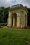
Dido's Cave
Stowe Gardens , Stowe Garden building
1727
13 July 1966
SP6740837189 52°01′44″N 1°01′08″W / 52.029026°N 1.018893°W / 52.029026; -1.018893 (Dido's Cave)
1212154 Dido's Cave More images
Equestrian statue of George I
Stowe Gardens , Stowe Statue
1723
25 September 1951
SP6743737502 52°01′55″N 1°01′06″W / 52.031836°N 1.018409°W / 52.031836; -1.018409 (Equestrian statue of George I)
1211872 Equestrian statue of George I More images
Lord Cobham's Column
Stowe Gardens , Stowe Column
Post c .1740
25 September 1951
SP6792037774 52°02′03″N 1°00′41″W / 52.034222°N 1.011315°W / 52.034222; -1.011315 (Lord Cobham's Column)
1289781 Lord Cobham's Column More images
Queen Caroline's Monument
Stowe Gardens , Stowe Commemorative monument
c .172513 July 1966
SP6717336907 52°01′35″N 1°01′21″W / 52.026519°N 1.022373°W / 52.026519; -1.022373 (Queen Caroline's Monument)
1212190 Queen Caroline's Monument More images
The Boycott Pavilions
Stowe Gardens , Stowe House
c .172825 September 1951
SP6680537034 52°01′40″N 1°01′40″W / 52.027705°N 1.027711°W / 52.027705; -1.027711 (The Boycott Pavilions)
1289656 The Boycott Pavilions More images
The Cascade
Stowe Gardens , Stowe Cascade
1760s
13 July 1966
SP6765636954 52°01′37″N 1°00′55″W / 52.026883°N 1.015325°W / 52.026883; -1.015325 (The Cascade)
1211949 The Cascade More images
The Congreve Monument
Stowe Gardens , Stowe Obelisk
c .173725 September 1951
SP6783737062 52°01′40″N 1°00′46″W / 52.027832°N 1.012666°W / 52.027832; -1.012666 (The Congreve Monument)
1289751 The Congreve Monument More images
The Corinthian Arch
Stowe Gardens , Stowe Arch
1765
13 July 1966
SP6806036302 52°01′16″N 1°00′34″W / 52.020973°N 1.009567°W / 52.020973; -1.009567 (The Corinthian Arch)
1212239 The Corinthian Arch More images
The Doric Arch
Stowe Gardens , Stowe Arch
1767
25 September 1951
SP6766037176 52°01′44″N 1°00′55″W / 52.028878°N 1.015223°W / 52.028878; -1.015223 (The Doric Arch)
1212030 The Doric Arch More images
The Fane of Pastoral Poetry
Stowe Gardens , Stowe Belvedere
1727–28
13 July 1966
SP6774038126 52°02′15″N 1°00′50″W / 52.037408°N 1.013869°W / 52.037408; -1.013869 (The Fane of Pastoral Poetry)
1289758 The Fane of Pastoral Poetry More images
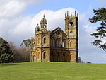
The Gothic Temple
Stowe Gardens , Stowe Pavilion
1748
25 September 1951
SP6791037444 52°01′53″N 1°00′41″W / 52.031257°N 1.011526°W / 52.031257; -1.011526 (The Gothic Temple)
1211945 The Gothic Temple More images
The Grenville Column
Stowe Gardens , Stowe Column
c .174813 July 1966
SP6767437374 52°01′50″N 1°00′54″W / 52.030657°N 1.01498°W / 52.030657; -1.01498 (The Grenville Column)
1289782 The Grenville Column More images
The Hermitage
Stowe Gardens , Stowe Garden feature
Pre-1732
13 July 1966
SP6754636835 52°01′33″N 1°01′01″W / 52.025827°N 1.016951°W / 52.025827; -1.016951 (The Hermitage)
1289654 The Hermitage More images
The Lake Pavilions
Stowe Gardens , Stowe Pavilion
c .173013 July 1966
SP6771836878 52°01′34″N 1°00′52″W / 52.026192°N 1.014437°W / 52.026192; -1.014437 (The Lake Pavilions)
1212104 The Lake Pavilions More images
The Oxford Bridge
Stowe Gardens , Stowe Ornamental bridge
1761
25 September 1951
SP6669936794 52°01′32″N 1°01′45″W / 52.025561°N 1.029302°W / 52.025561; -1.029302 (The Oxford Bridge)
1212221 The Oxford Bridge More images
The Oxford Gates
Stowe Gardens , Stowe Gate lodge
c .173025 September 1951
SP6660836663 52°01′28″N 1°01′50″W / 52.024394°N 1.030654°W / 52.024394; -1.030654 (The Oxford Gates)
1212155 The Oxford Gates More images
The Palladian Bridge
Stowe Gardens , Stowe Bridge
1738
25 September 1951
SP6800437191 52°01′44″N 1°00′37″W / 52.028971°N 1.010207°W / 52.028971; -1.010207 (The Palladian Bridge)
1289750 The Palladian Bridge More images
The Queen's Temple
Stowe Gardens , Stowe Garden temple
1770
25 September 1951
SP6772337696 52°02′01″N 1°00′51″W / 52.033545°N 1.014202°W / 52.033545; -1.014202 (The Queen's Temple)
1211938 The Queen's Temple More images
The Rotondo
Stowe Gardens , Stowe Rotunda
1721
25 September 1951
SP6738737109 52°01′42″N 1°01′09″W / 52.028309°N 1.019215°W / 52.028309; -1.019215 (The Rotondo)
1289655 The Rotondo More images
The Temple of Ancient Virtue
Stowe Gardens , Stowe Garden temple
1730s
25 September 1951
SP6764637296 52°01′48″N 1°00′55″W / 52.029959°N 1.015403°W / 52.029959; -1.015403 (The Temple of Ancient Virtue)
1289786 The Temple of Ancient Virtue More images
The Temple of British Worthies
Stowe Gardens , Stowe Garden temple
c .173525 September 1951
SP6777437264 52°01′47″N 1°00′49″W / 52.029655°N 1.013544°W / 52.029655; -1.013544 (The Temple of British Worthies)
1211946 The Temple of British Worthies More images
The Temple of Concord and Victory
Stowe Gardens , Stowe Garden temple
1749
25 September 1951
SP6750637709 52°02′01″N 1°01′03″W / 52.033688°N 1.017362°W / 52.033688; -1.017362 (The Temple of Concord and Victory)
1289755 The Temple of Concord and Victory More images
The Temple of Friendship
Stowe Gardens , Stowe Garden temple
1739
25 September 1951
SP6801836992 52°01′38″N 1°00′36″W / 52.027181°N 1.010042°W / 52.027181; -1.010042 (The Temple of Friendship)
1211947 The Temple of Friendship More images
The Temple of Venus
Stowe Gardens , Stowe Garden temple
c .173225 September 1951
SP6740736661 52°01′27″N 1°01′08″W / 52.02428°N 1.019011°W / 52.02428; -1.019011 (The Temple of Venus)
1212153 The Temple of Venus More images
Wolfe Obelisk
Stowe Obelisk
c .176013 July 1966
SP6746938661 52°02′32″N 1°01′04″W / 52.042251°N 1.017714°W / 52.042251; -1.017714 (Wolfe Obelisk)
1211785 Wolfe Obelisk More images
Church of St Michael
Thornton Church
14th century
13 July 1966
SP7521036233 52°01′10″N 0°54′19″W / 52.019431°N 0.905404°W / 52.019431; -0.905404 (Church of St Michael)
1232799 Church of St Michael More images
Church of St Mary
Twyford Parish church
12th century
13 July 1966
SP6651126670 51°56′04″N 1°02′02″W / 51.934574°N 1.034001°W / 51.934574; -1.034001 (Church of St Mary)
1215009 Church of St Mary More images
Parish Church of St Mary Magdalene
Upper Winchendon Parish church
12th century
21 December 1967
SP7459614494 51°49′27″N 0°55′09″W / 51.824097°N 0.919053°W / 51.824097; -0.919053 (Parish Church of St Mary Magdalene)
1124721 Parish Church of St Mary Magdalene More images
Waddesdon Manor
Waddesdon Manor Grounds, Waddesdon
Country house
1874–83
21 December 1967
SP7331116514 51°50′33″N 0°56′14″W / 51.842426°N 0.937267°W / 51.842426; -0.937267 (Waddesdon Manor)
1117804 Waddesdon Manor More images
Church of St Giles
Water Stratford Parish church
Norman
13 July 1966
SP6517034294 52°00′12″N 1°03′07″W / 52.003268°N 1.052058°W / 52.003268; -1.052058 (Church of St Giles)
1212825 Church of St Giles More images
Church of St Mary
Weston Turville Parish church
13th century
21 December 1967
SP8593010287 51°47′05″N 0°45′20″W / 51.784655°N 0.755683°W / 51.784655; -0.755683 (Church of St Mary)
1118358 Church of St Mary More images
Church of St Mary
Whaddon Parish church
12th century
19 August 1959
SP8053234074 51°59′57″N 0°49′42″W / 51.999278°N 0.828373°W / 51.999278; -0.828373 (Church of St Mary)
1216538 Church of St Mary More images
Church of All Saints
Wing Parish church
10th century
18 October 1966
SP8802922582 51°53′41″N 0°43′20″W / 51.894846°N 0.722138°W / 51.894846; -0.722138 (Church of All Saints)
1320141 Church of All Saints More images
Winslow Hall
Winslow Country house
1700
19 August 1959
SP7709027590 51°56′29″N 0°52′48″W / 51.941481°N 0.879952°W / 51.941481; -0.879952 (Winslow Hall)
1279357 Winslow Hall More images
Wotton House, with walls to pavilions
Wotton Underwood Country house
1704–14
25 October 1951
SP6854116191 51°50′24″N 1°00′24″W / 51.840127°N 1.006558°W / 51.840127; -1.006558 (Wotton House, with walls to pavilions)
1124221 Wotton House, with walls to pavilions More images
Entrance gates and screen across east front of Wotton House , with gazebo and walls to pavilions
Wotton Underwood Gate
Early 18th century
25 October 1951
SP6859916214 51°50′25″N 1°00′21″W / 51.840327°N 1.005712°W / 51.840327; -1.005712 (Entrance gates and screen across east front of Wotton House, with gazebo and walls to pavilions)
1124222 Upload Photo
South Pavilion, Wotton House
Wotton Underwood
House
1704–14
25 October 1951
SP6858016165 51°50′24″N 1°00′22″W / 51.839889°N 1.005997°W / 51.839889; -1.005997 (South Pavilion, Wotton House)
1332825 South Pavilion, Wotton House More images
The Clock Pavilion, Wotton House
Wotton Underwood
House
1704–14
25 October 1951
SP6856816229 51°50′26″N 1°00′22″W / 51.840465°N 1.006159°W / 51.840465; -1.006159 (The Clock Pavilion, Wotton House)
1275066 The Clock Pavilion, Wotton House More images

![]() Media related to Grade I listed buildings in Buckinghamshire at Wikimedia Commons
Media related to Grade I listed buildings in Buckinghamshire at Wikimedia Commons


