
This is a list of rivers which are at least partially located in Italy. They are organized according to the body of water they drain into, with the exceptions of Sicily and Sardinia, which are listed separately. At the bottom, all of the rivers are also listed alphabetically.
Italian rivers are generally shorter than those of other European regions because Italy is partly a peninsula along which the Apennine chain rises, dividing the waters into two opposite sides. The longest river originating in Italy is the Drava, which flows for 724 km (450 mi), while the river flowing the most kilometers in Italy is the 652 km (405 mi) long Po.
Rivers in Italy total about 1,200, and give rise, compared to other European countries, to a large number of marine mouths. This is due to the relative abundance of rain events in Italy, and to the presence of the Alpine chain rich in snowfields and glaciers in the northern part of the country, in the presence of the Apennines in the center-south and in the coastal extension of Italy.
Characteristics of Italian rivers
Further information: Geography of Italy
- The widest and largest rivers belong to the Alpine region due to the arrangement and elevation of the relief, as well as the depth of the Po Valley.
- Along the peninsula, given the arrangement of the Apennine chain and the different slopes of the two sides, the rivers on the Adriatic and Ionian sides run through short transversal valleys and, except for the Reno, do not exceed 200 km (120 mi) in length, while ten are just over 100 km (62 mi). On the Tyrrhenian side instead, they are on average longer because the Apennine spurs and the sub-Apennine belt are wider.
- The rivers that flow into the Tyrrhenian sea are longer also because for the first stretch, they follow longitudinal valleys (Apennine valleys) and then run transversally with respect to the axis of the chain, in the south-Apennine area.
- Given the location of the springs and the local rainfall regime, the rivers of Italy are divided into:
- Alpine rivers, of glacial origin, subject to flooding in spring and summer because when it is hot the glaciers melt. The lakes that frequently occupy the most depressed parts of the Alpine valleys serve to dampen the rush of the rivers and to clarify their murky waters. In fact, given the rapidity of the valleys from which the rivers descend, the speed of their waters is remarkable and their activity of erosion and transport of rocky debris is sensitive. Decanting is precisely the process by which this material is abandoned in the lakes of which these rivers are tributaries.
- Apennine rivers, subject to sudden spring and autumn floods due to the rains. The lean period is in summer accentuated in the Northern Apennines, almost absolute in the southern one, except for some waterways (Aterno-Pescara, Sele, Volturno, Liri-Garigliano, to be limited to those that flow directly into the sea, to which are added Velino, Nera, Aniene all in the Tiber basin [Wikidata], etc.) which are fed by large karst springs that spring on the edge of areas characterized by permeable fissured rocks. In fact, there are no snowfields and glaciers on the Apennines (the only glacier, albeit small, is that of the Calderone, on the northern side of Corno Grande, in the Gran Sasso d'Italia massif, in Abruzzo); rainwater does not always collect in river beds made up of impermeable ground, that is, such as to allow a fair average annual flow.
- The Sardinian and Sicilian rivers are torrential (full of water in winter and almost dry in summer), with the exception of Tirso, Flumendosa, Coghinas and Simeto.
List of rivers in Italy over 150 km (93 mi)
| Rivers of Italy over 150 km (93 mi) in length | ||||
|---|---|---|---|---|
| № | River | Length | Regions crossed | Type |
| 1º | Po | 652 km (405 mi) | Piedmont, Lombardy, Emilia-Romagna, Veneto | Alpine |
| 2º | Adige | 410 km (250 mi) | Trentino-Alto Adige/Südtirol, Veneto | Alpine |
| 3º | Tiber | 405 km (252 mi) | Emilia-Romagna, Tuscany, Umbria, Lazio | Apennine |
| 4º | Adda | 313 km (194 mi) | Lombardy | Alpine |
| 5º | Oglio | 280 km (170 mi) | Lombardy | Alpine |
| 6º | Tanaro | 276 km (171 mi) | Piedmont, Liguria | Alpine |
| 7º | Ticino | 248 km (154 mi) | Switzerland, Piedmont, Lombardy | Alpine |
| 8º | Arno | 241 km (150 mi) | Tuscany | Apennine |
| 9º | Piave | 231 km (144 mi) | Friuli-Venezia Giulia, Veneto | Alpine |
| 10º | Reno | 212 km (132 mi) | Tuscany, Emilia-Romagna | Apennine |
| 11º | Sarca-Mincio | 203 km (126 mi) | Trentino-Alto Adige/Südtirol, Veneto, Lombardy | Alpine |
| 12º | Volturno | 175 km (109 mi) | Molise, Campania | Apennine |
| 13º | Brenta | 174 km (108 mi) | Trentino-Alto Adige/Südtirol, Veneto | Alpine |
| 14º | Secchia | 172 km (107 mi) | Emilia-Romagna, Lombardy | Apennine |
| 15º | Tagliamento | 170 km (110 mi) | Friuli-Venezia Giulia, Veneto | Alpine |
| 16º | Dora Baltea | 168 km (104 mi) | Aosta Valley, Piedmont | Alpine |
| 17º | Ombrone | 160 km (99 mi) | Tuscany | Apennine |
| 18º | Chiese | 160 km (99 mi) | Trentino-Alto Adige/Südtirol, Lombardy | Alpine |
| 19º | Liri-Garigliano | 158 km (98 mi) | Abruzzo, Lazio, Campania | Apennine |
| 20º | Bormida | 153 km (95 mi) | Liguria, Piedmont | Alpine |
| 21º | Aterno-Pescara | 152 km (94 mi) | Abruzzo | Apennine |
| 22º | Tirso | 152 km (94 mi) | Sardinia | Sardinian |
List of Italian rivers above 50 m/s (1,800 cu ft/s)
| Rivers of Italy above 50 m/s (1,800 cu ft/s) of average flow at the mouth | ||||
|---|---|---|---|---|
| № | River | Flow at the mouth | Regions crossed | Type |
| 1º | Po | 1,540 m/s (54,000 cu ft/s) | Piedmont, Lombardy, Emilia-Romagna, Veneto | Alpine |
| 2º | Ticino | 350 m/s (12,000 cu ft/s) | Switzerland, Piedmont, Lombardy | Alpine |
| 3º | Tiber | 324 m/s (11,400 cu ft/s) | Emilia-Romagna, Tuscany, Umbria, Lazio | Apennine |
| 4º | Adige | 235 m/s (8,300 cu ft/s) | Trentino-Alto Adige/Südtirol, Veneto | Alpine |
| 5º | Adda | 187 m/s (6,600 cu ft/s) | Lombardy | Alpine |
| 6º | Isonzo | 170 m/s (6,000 cu ft/s) | Slovenia, Friuli-Venezia Giulia | Alpine |
| 7º | Nera | 160 m/s (5,700 cu ft/s) | Marche, Umbria, Lazio | Apennine |
| 8º | Oglio | 137 m/s (4,800 cu ft/s) | Lombardy | Alpine |
| 8º | Piave | 137 m/s (4,800 cu ft/s) | Veneto, Friuli-Venezia Giulia | Alpine |
| 10º | Liri-Garigliano | 120 m/s (4,200 cu ft/s) | Abruzzo, Lazio | Apennine |
| 11º | Tanaro | 116 m/s (4,100 cu ft/s) | Liguria, Piedmont | Alpine |
| 12º | Arno | 110 m/s (3,900 cu ft/s) | Tuscany | Apennine |
| 13º | Dora Baltea | 96 m/s (3,400 cu ft/s) | Aosta Valley, Piedmont | Alpine |
| 14º | Reno | 95 m/s (3,400 cu ft/s) | Emilia-Romagna | Apennine |
| 15º | Brenta | 93 m/s (3,300 cu ft/s) | Trentino-Alto Adige/Südtirol, Veneto | Alpine |
| 16º | Livenza | 85 m/s (3,000 cu ft/s) | Friuli-Venezia Giulia, Veneto | Alpine |
| 17º | Volturno | 83 m/s (2,900 cu ft/s) | Molise, Campania | Apennine |
| 18º | Isarco | 78 m/s (2,800 cu ft/s) | Trentino-Alto Adige/Südtirol | Alpine |
| 19º | Sesia | 70 m/s (2,500 cu ft/s) | Piedmont | Alpine |
| 20º | Tagliamento | 70 m/s (2,500 cu ft/s) | Friuli-Venezia Giulia | Alpine |
| 21º | Toce | 70 m/s (2,500 cu ft/s) | Piedmont | Alpine |
| 22º | Sele | 69 m/s (2,400 cu ft/s) | Campania | Apennine |
| 23º | Mincio | 60 m/s (2,100 cu ft/s) | Veneto, Lombardy | Alpine |
| 24º | Velino | 60 m/s (2,100 cu ft/s) | Lazio, Umbria | Apennine |
| 25º | Rienza | 60 m/s (2,100 cu ft/s) | Trentino-Alto Adige/Südtirol | Alpine |
| 26º | Aterno-Pescara | 57 m/s (2,000 cu ft/s) | Abruzzo | Apennine |
| 27º | Sile | 55 m/s (1,900 cu ft/s) | Veneto | Alpine |
Draining into the North Sea
- Reno di Lei
From the artificial Lago di Lei (the barrage itself is part of Switzerland), the Reno di Lei runs for a few kilometers through northern Italy before entering Switzerland again, and drains via the Reno di Avers and the Hinterrhein into the Rhine.
Draining into the Black Sea

- Drava (a short section in Italy, continues into Austria, Slovenia, Croatia and Hungary)
The Drava drains into the Danube on the Croatia–Serbia border.
- Acqua Granda (half in Italy, half in Switzerland)
After entering Switzerland, the Spöl drains into the Inn, which meets the Danube in Germany.
Draining into the Adriatic Sea

For the purposes of this list, the Italian rivers draining into the Adriatic Sea begin at the coastal border between Italy and Slovenia and follow the Adriatic coast of Italy until it reaches Santa Maria di Leuca. Beyond this point, rivers empty into the Ionian Sea rather than the Adriatic. The rivers are ordered according to how far along the coast the river mouth is from the Italian/Slovenian border, the first river having its mouth the closest to the border and the last being closest to Santa Maria di Leuca.
- Timavo (Reka)
- Isonzo (Soča)
- Cormor
- Ausa
- Tagliamento
- Livenza
- Piave
- Brenta
- Bacchiglione
- Adige
- Tartaro-Canalbianco-Po di Levante
- Po
- Reno
- Lamone
- Uniti
- Savio
- Rubicon
- Marecchia
- Ausa
- Marano
- Conca
- Foglia
- Metauro
- Cesano
- Misa
- Musone
- Potenza
- Chienti
- Tenna
- Aso
- Tesino
- Tronto
- Salinello
- Tordino
- Vomano
- Piomba
- Saline
- Aterno-Pescara
- Alento
- Foro
- Moro
- Sangro
- Trigno
- Biferno
- Fortore
- Carapelle
- Ofanto
- Canale Reale
Tributaries of the Adige

Tributaries of the Po
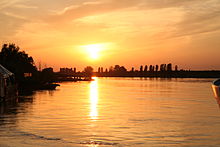
The tributaries of the Po are organized into right- and left-hand tributaries. The lists are ordered from the river closest to the source of the Po to the river closest to the mouth of the Po.
Right-hand tributaries
- Varaita
- Maira
- Grana del Monferrato
- Rotaldo
- Stura del Monferrato
- Tanaro
- Staffora
- Scrivia
- Curone
- Trebbia
- Nure
- Arda
- Taro
- Parma
- Enza
- Crostolo
- Secchia
- Panaro
Left-hand tributaries
- Pellice
- Chisola
- Sangone
- Dora Riparia
- Stura di Lanzo
- Malone
- Orco
- Dora Baltea
- Sesia
- Agogna
- Terdoppio
- Ticino
- Olona
- Lambro
- Adda
- Oglio
- Frigidolfo or Oglio Frigidolfo branch
- Arcanello or Oglio Arcanello branch
- Narcanello or Oglio Narcanello branch
- Valpaghera
- Valgrande
- Ogliolo branch
- Rabbia
- Remulo
- Allione (river)
- Poia (river)
- Re
- Re
- Clegna
- Figna
- Blé
- Palobbia
- Poia (creek)
- Re
- Lanico
- Trobiolo
- Grigna
- Resio
- Davine
- Dezzo
- Re
- Orso
- Supine
- Borlezza (The Borlezza enters Lake Iseo which empties into the Oglio.)
- Rino di Vigolo (The Rino di Vigolo enters Iseo lake which empties into the Oglio.)
- Rino di Predore (The Rino di Predore enters Iseo lake which empties into the Oglio.)
- Bagnadore (The Bagnadore enters Iseo lake which empties into the Oglio.)
- Calchere (The Calchere enters Iseo lake which empties into the Oglio.)
- Cortelo (The Cortelo enters Iseo lake which empties into the Oglio.)
- Opelo (The Opelo enters Iseo lake which empties into the Oglio.)
- Cherio
- Mella
- Chiese
- Caffaro (The Caffaro enters Lake Idro which empties into the Chiese.)
- Re di Anfo (The Re di Anfo enters Lake Idro which empties into the Chiese.)
- Frigidolfo or Oglio Frigidolfo branch
- Mincio
- Sarca (The Sarca enters Lake Garda which empties into the Mincio.)
- Versa
Rivers draining into Lake Maggiore
- Boesio
- Cannobino
- Giona
- Maggia (entirely in Switzerland)
- Melezzo Orientale (partly in Switzerland)
- Isorno (partly in Switzerland)
- Melezzo Orientale (partly in Switzerland)
- Margorabbia
- San Bernardino
- Stronetta
- Toce
- Ticino
- Tresa
Rivers draining into Lake Como
Draining into the Ionian Sea
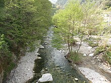
For the purposes of this list, the Italian rivers draining into the Ionian Sea begin at Santa Maria di Leuca in the east and extend to the Strait of Messina in the west. Sicilian rivers are excluded because they are listed in their own section below. The rivers are ordered according to how far east their mouth is, the first river having the easternmost mouth and the last having the westernmost mouth.
- Lato
- Bradano
- Basento
- Cavone
- Agri
- Sinni
- Crati
- Neto
- Esaro
- Stilaro
- Allaro
- Amusa
- Gerace
- Bonamico
- La Verde
- Torno
- Amendolea
- Melito
Draining into the Tyrrhenian Sea

For the purposes of this list, the Italian rivers draining into the Tyrrhenian Sea begin at the Strait of Messina in the south and extend north up to San Pietro Point near Portovenere. Sicilian and Sardinian rivers are excluded from this list because those rivers are in their own sections below. The rivers are ordered according to how far south their mouth is, the first river having the southernmost mouth and the last having the northernmost mouth.
- Marro
- Savuto
- Tusciano
- Sele
- Alento
- Volturno
- Garigliano
- Tiber
- Marta
- Arrone
- Fiora
- Ombrone
- Arno
- Serchio
- Magra
Tributaries of the Tiber

Draining into the Ligurian Sea

For the purposes of this list, the Italian rivers draining into the Ligurian Sea begin at San Pietro Point near Portovenere in the east and extend to the border with France near Monaco. Sardinian rivers are excluded from this list because those rivers are in their own section below. The rivers are ordered according to how close their mouth is to San Pietro Point. The river with its mouth closest to this geographic point is listed first and rivers further away from this point are listed in the order in which their mouth empties into the sea as one proceeds along the coast up to the border with France.
- Entella
- Bisagno
- Polcevera
- Cerusa
- Varatella
- Pora
- Centa
- Merula
- Steria
- San Pietro
- Impero
- Argentina
- Nervia
- Roia (Roya)
Rivers of Sicily

- Alcantara
- Anapo
- Belice
- Calcinara
- Cassibile
- Ciane
- Crinisus
- Dirillo
- Gela
- Helorus
- Imera Settentrionale
- Ippari
- Irminio
- Mazaro
- Platani
- San Leone
- Salso
- Simeto
- Verdura
Rivers of Sardinia

Alphabetical list
- Acquacheta
- Acquafraggia
- Adda
- Adige
- Agogna
- Agri
- Ahr
- Albano
- Alcantara
- Allaro
- Allia
- Allione
- Alvo
- Amendolea
- Amusa
- Anapo
- Aniene
- Antholzerbach
- Anza
- Arcanello
- Arda
- Argentina
- Arno
- Arrone
- Arroscia
- Aso
- Aterno-Pescara
- Ausa, in the Province of Udine
- Ausa, in San Marino and the Province of Rimini
- Avisio
- Bacchiglione
- Bagnadore
- Basentello
- Basento
- Barbaira
- Belbo
- Belice
- Bevera (Bévéra)
- Bidente-Ronco
- Biferno
- Bilioso
- Bisagno
- Biscubio
- Blé
- Boesio
- Bogna
- Bonamico
- Borbera
- Borlezza
- Bormida
- Bormida di Spigno
- Bradano
- Braibach
- Breggia
- Brembo
- Brenta
- Budrio
- Burano
- Busento
- Buthier
- Caffaro
- Calaggio
- Calchere
- Calcinara
- Calore Irpino
- Calore Lucano
- Canale Reale
- Candigliano
- Cannobino
- Carapelle
- Carapellotto
- Cassibile
- Castellano
- Cavone
- Cenischia
- Ceno
- Centa
- Cerami
- Cerusa
- Cervo
- Cesano
- Cherio
- Chiana
- Chiani
- Chiascio
- Chienti
- Chiese
- Chisone
- Ciane
- Cixerri
- Clegna
- Clitunno
- Coghinas
- Conca
- Cormor
- Corno
- Cortelo
- Cosia
- Coscile
- Crati
- Cremera
- Crinisus
- Crostolo
- Curone
- Davine
- Derjon
- Dezzo
- Dirillo
- Dittaino
- Diveria
- Dora Baltea
- Dora di Bardonecchia
- Dora Riparia
- Drava
- Eggentaler Bach
- Elvo
- Enna
- Enza
- Entella
- Erbognone
- Erro
- Esaro (Cosenza)
- Esaro (Crotone)
- Fiastra
- Fiastrone
- Figna
- Fiora
- Fiume di Girgenti
- Fiumelatte
- Flumendosa
- Foglia
- Fortore
- Frigidolfo
- Fucino
- Gorzente
- Gran Ega
- Garga
- Garigliano
- Gattola
- Gela
- Gerace
- Giona
- Gleno
- Grana del Monferrato
- Grande River
- Gravina
- Gravina di Matera
- Grigna
- Grue
- Gsieser Bach
- Helorus
- Idice
- Ippari
- Irminio
- Isarco (Eisack)
- Isonzo (Soča)
- Isorno
- Karlinbach
- Lambro
- Lamone
- Lanico
- Lato
- Lavagna
- La Verde
- Lemme
- Limentra di Sambuca
- Limentra orientale
- Liri
- Liro (This Liro enters Lake Como.)
- Liro (This Liro enters the Mera.)
- Livenza
- Locone
- Lys
- Magra
- Maira
- Malmera
- Malone
- Marano
- Marecchia
- Margorabbia
- Marro
- Marta
- Mazaro
- Melezzo Occidentale
- Melezzo Orientale
- Melito
- Mella
- Mera
- Metauro
- Mincio
- Misa
- Montone
- Mucone
- Musone
- Narcanello
- Natisone
- Nera
- Nervia
- Neto
- Nevola
- Nigoglia
- Nure
- Ofanto
- Oglio
- Ogliolo
- Olona
- Ombrone
- Opelo
- Orba
- Orco
- Orso
- Ose
- Ovesca
- Paglia
- Palobbia
- Panaro
- Parina
- Parma
- Passirio
- Pfitscher Bach
- Pflerscher Bach
- Pfunderer Bach
- Piave
- Piomba
- Piota
- Pioverna
- Platani
- Plima
- Po
- Poia (creek)
- Poia (river)
- Polcevera
- Pora
- Potenza
- Pragser Bach
- Rabbi
- Rabbia
- Rapido (Gari)
- Ram (Rom)
- Re di Anfo
- Re, in Gianico
- Re, in Niardo
- Re, in Sellero
- Re di Tredenus, in Capo di Ponte
- Reinbach
- Remulo
- Reno
- Reno di Lei
- Resio
- Ridnauner Bach
- Rienza (Rienz)
- Rino di Predore
- Rino di Vigolo
- Roia (Roya)
- Rotaldo
- Rubicon
- Sacco
- Salandrella
- Saldurbach
- Saline
- Salinello
- Salso
- Salto
- Samoggia
- San Bernardino
- Sangro
- San Marino
- Sant'Anna
- Santerno
- Sarca
- Savena
- Savio
- Savuto
- Scrivia
- Secchia
- Sele
- Senales (Schnalser Bach)
- Serchio
- Sesia
- Seveso
- Sillaro
- Simeto
- Sinni
- Slizza
- Soana
- Sordo
- Spöl
- Stabina
- Staffora
- Stilaro
- Stirone
- Strona
- Stronetta
- Stura del Monferrato
- Stura di Demonte
- Stura di Lanzo
- Stura di Ovada
- Suldenbach
- Supine
- Tadone
- Tagliamento
- Talfer
- Tammaro
- Tanagro
- Tanaro
- Taro
- Tartaro-Canalbianco-Po di Levante
- Tenna
- Terdoppio
- Tesino
- Tiber
- Ticino
- Timavo (Reka)
- Tinella
- Tirso
- Toce
- Topino
- Tordino
- Torno
- Torre
- Trebbia
- Tresa
- Trigno
- Troina
- Tronto
- Turano [it]
- Tusciano
- Uniti
- Valsura (Falschauer)
- Vara
- Varaita
- Varatella
- Velino
- Verdura
- Versa (This Versa is a tributary of the Po.)
- Versa (This Versa is a tributary of the Tanaro.)
- Villnößer Bach
- Vipacco
- Vitravo
- Volturno
- Vomano
Notes
- "Lista Fiumi in Italia" (in Italian). Retrieved 23 February 2022.
| List of rivers of Europe | |
|---|---|
| Sovereign states |
|
| States with limited recognition | |
| Dependencies and other entities | |