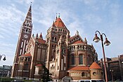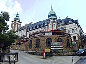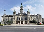
Hungary has 3,152 municipalities as of July 15, 2013: 346 towns (Hungarian term: város [ˈvaːroʃ] , plural: városok [ˈvaːroʃok]; the terminology does not distinguish between cities and towns – the term town is used in official translations) and 2,806 villages (Hungarian: község [ˈkøʃːeːɡ], plural: községek [ˈkøʃːeːɡɛk]) of which 126 are classified as large villages (Hungarian: nagyközség [ˈnɒckøʃːeːɡ], plural: nagyközségek). The number of towns can change, since villages can be elevated to town status by act of the President. The capital Budapest has a special status and is not included in any county while 25 of the towns are so-called cities with county rights. All county seats except Budapest are cities with county rights.
Four of the cities (Budapest, Miskolc, Győr, and Pécs) have agglomerations, and the Hungarian Statistical Office distinguishes seventeen other areas in earlier stages of agglomeration development.
The largest city is the capital, Budapest, while the smallest town is Pálháza with 1038 inhabitants (2010). The largest village is Solymár (population: 10,123 as of 2010). There are more than 100 villages with fewer than 100 inhabitants while the smallest villages have fewer than 20 inhabitants.
Largest cities in Hungary
County seat. Note that there is a total of 19 counties of Hungary + Budapest - the capital Budapest doubles as a county (called Budapest or Budapest város) and the seat of the separate Pest County (Pest vármegye) which surrounds Budapest but does not actually include the capital city.Bold: City with county rights.
Italics: Capital city.
Over 100,000 (large cities)
| City / town | County | Population | Peak population | Metropolitan area (2024) | ||||
|---|---|---|---|---|---|---|---|---|
| 1949 Census | 1990 Census | 2011 Census | 2022 Census | |||||
| 1. | Budapest | Budapest (Pest) | 1,590,316 | 2,016,681 | 1,733,685 | 1,685,342 |
2,113,034 (1989) | 2,860.052 |
| 2. | Debrecen | Hajdú-Bihar | 115,399 | 212,235 | 211,340 | 199,858 |
217,706 (1994) | 257,997 |
| 3. | Szeged | Csongrád-Csanád | 104,867 | 175,301 | 168,048 | 158,797 |
178,878 (1994) | 200,547 |
| 4. | Miskolc | Borsod-Abaúj-Zemplén | 109,841 | 196,442 | 167,754 | 147,533 |
211,345 (1985) | 220,854 |
| 5. | Pécs | Baranya | 89,470 | 170,039 | 156,049 | 139,330 |
172,177 (1994) | 175,843 |
| 6. | Győr | Győr-Moson-Sopron | 69,583 | 129,331 | 129,527 | 127,599 |
133,946 (2020) | 206,705 |
| 7. | Nyíregyháza | Szabolcs-Szatmár-Bereg | 56,334 | 114,152 | 119,746 | 116,282 |
119,746 (2011) | 162,076 |
| 8. | Kecskemét | Bács-Kiskun | 61,730 | 102,516 | 111,411 | 108,120 |
112,233 (2010) | 176,098 |
| Sources: | ||||||||
50,000–100,000 (medium-sized cities)
| City / town | County | Population | Peak population | Metropolitan area (2024) | ||||
|---|---|---|---|---|---|---|---|---|
| 1949 Census | 1990 Census | 2011 Census | 2022 Census | |||||
| 9. | Székesfehérvár | Fejér | 42,260 | 108,958 | 100,570 | 95.045 |
109,762 (1993) | 145,887 |
| 10. | Szombathely | Vas | 47,589 | 85,617 | 78,884 | 78,190 |
85,932 (1994) | 112,078 |
| 11. | Érd | Pest | 16,444 | 43,327 | 63,631 | 71,253 |
71,425 (2022) | Budapest |
| 12. | Szolnok | Jász-Nagykun-Szolnok | 37,520 | 78,328 | 72,953 | 66,061 |
80,859 (1994) | 106,303 |
| 13. | Tatabánya | Komárom-Esztergom | 40,221 | 74,277 | 67,753 | 65,830 |
75,921 (1980) | - |
| 14. | Sopron | Győr-Moson-Sopron | 36,506 | 55,083 | 60,548 | 60,334 |
63,065 (2020) | - |
| 15. | Kaposvár | Somogy | 37,945 | 71,788 | 66,245 | 59,397 |
74,101 (1979) | - |
| 16. | Békéscsaba | Békés | 44,053 | 67,157 | 62,050 | 55,164 |
68,044 (1980) | - |
| 17. | Veszprém | Veszprém | 20,682 | 63,867 | 61,721 | 55,910 |
65,789 (1994) | - |
| 18. | Zalaegerszeg | Zala | 21,668 | 62,212 | 59,499 | 54,428 |
62,908 (1994) | - |
| Source: | ||||||||
50,000–30,000
| City / town | County | Population | Top population | Metropolitan area (2021) | ||||
|---|---|---|---|---|---|---|---|---|
| 1949 Census | 2011 Census | 2022 Census | ||||||
| 19. | Eger | Heves | 32,352 | 56,569 | 49,128 |
63,794 (1994) | - | |
| 20. | Nagykanizsa | Zala | 33,158 | 49,026 | 43,228 |
54,052 (1990) | - | |
| 21. | Dunakeszi | Pest | 11,029 | 40,545 | 43,858 |
43,990 (2021) | Budapest | |
| 22. | Hódmezővásárhely | Csongrád-Csanád | 49,417 | 46,047 | 41,634 |
54,486 (1980) | Szeged | |
| 23. | Dunaújváros | Fejér | 3,949 | 48,484 | 42,099 |
60,736 (1980) | - | |
| 24. | Szigetszentmiklós | Pest | 5,865 | 34,708 | 40,678 |
40,679 (2022) | Budapest | |
| 25. | Cegléd | Pest | 35,237 | 36,645 | 36,200 |
40,644 (1980) | - | |
| 26. | Vác | Pest | 21,287 | 33,831 | 34,449 |
34,866 (1980) | Budapest | |
| 27. | Mosonmagyaróvár | Győr-Moson-Sopron | 16,546 | 32,004 | 33,935 |
34,439 (2021) | - | |
| 28. | Baja | Bács-Kiskun | 27,936 | 36,267 | 33,140 |
39,822 (1994) | - | |
| 29. | Gödöllő | Pest | 12,216 | 32,522 | 32,625 |
32,625 (2022) | Budapest | |
| 30. | Salgótarján | Nógrád | 32,571 | 37,262 | 31,312 |
50,120 (1980) | - | |
| 31. | Ózd | Borsod-Abaúj-Zemplén | 29,184 | 34,481 | 31,022 |
48,636 (1981) | - | |
| Source: | ||||||||
-

 Eger
Eger
-

 Nagykanizsa
-

 Dunakeszi
-

 Hódmezővásárhely
-
 Dunaújváros
-

 Szigetszentmiklós
-

 Cegléd
-

 Mosonmagyaróvár
-

 Baja
Baja
-

 Vác
Vác
-

 Gödöllő
-

 Salgótarján
-

 Ózd
Ózd
29,000 – 24,000
Sources:
- Szekszárd (29 889)
- Hajdúböszörmény (29 374)
- Pápa (29 019)
- Budaörs (28 864)
- Kiskunfélegyháza (28 615)
- Gyula (28 409)
- Esztergom (27 897)
- Szentendre (27 641)
- Gyöngyös (27 576)
- Ajka (26 720)
- Jászberény (26 516)
- Siófok (26 329)
- Orosháza (26 157)
- Kiskunhalas (26 129)
- Szentes (25 808)
- Gyál (25 053)
- Kazincbarcika (24 186)
- Hajdúszoboszló (24 094)
-

 Szekszárd
-
 Hajdúböszörmény
-

 Pápa
Pápa
-

 Budaörs
-
 Kiskunfélegyháza
-

 Gyula
Gyula
-

 Esztergom
-

 Szentendre
-

 Gyöngyös
-

 Ajka
Ajka
-

 Jászberény
-

 Siófok
-

 Orosháza
-

 Kiskunhalas
-

 Szentes
-

 Gyál
Gyál
-

 Kazincbarcika
-
 Hajdúszoboszló
All other towns in Hungary
Sources: 24,000 – 15,000
- Dunaharaszti (23 688)
- Nagykőrös (23,589)
- Tata (23,445)
- Komló (23,388)
- Makó (22,747)
- Vecsés (20,673)
- Törökszentmiklós (20,323)
- Hatvan (20,250)
- Karcag (20,025)
- Keszthely (19,910)
- Várpalota (19,640)
- Békés (19,243)
- Fót (19,216)
- Paks (19,117)
- Komárom (18,786)
- Százhalombatta (18,599)
- Dombóvár (18,461)
- Göd (18,351)
- Oroszlány (17,983)
- Monor (17,960)
- Veresegyház (17,532)
- Balmazújváros (17,421)
- Mohács (17,355)
- Gyömrő (17,236)
- Szigethalom (17,156)
- Hajdúnánás (17,038)
- Mátészalka (16,864)
- Pomáz (16,764)
- Dabas (16,728)
- Mezőtúr (16,502)
- Kisvárda (16,489)
- Mezőkövesd (16,310)
- Csongrád (16,277)
- Szarvas (16,044)
- Kalocsa (15,986)
- Tiszaújváros (15,954)
- Pécel (15,494)
- Tapolca (15,459)
- Balassagyarmat (15,280)
15,000 – 5,000
- Berettyóújfalu (14,816)
- Sárvár (14,797)
- Sátoraljaújhely (14,703)
- Püspökladány (14,511)
- Abony (14,508)
- Kiskőrös (14,109)
- Mór (14,010)
- Budakeszi (13,939)
- Pilisvörösvár (13,903)
- Törökbálint (13,385)
- Bonyhád (13,322)
- Gyomaendrőd (13,133)
- Hajdúsámson (13,039)
- Balatonfüred (13,038)
- Biatorbágy (12,932)
- Tiszavasvári (12,818)
- Hajdúhadház (12,747)
- Újfehértó (12,607)
- Gárdony (12,600)
- Nagykáta (12,384)
- Kistarcsa (12,383)
- Bátonyterenye (12,221)
- Albertirsa (12,188)
- Nyírbátor (12,146)
- Sárospatak (12,067)
- Sárbogárd (12,038)
- Maglód (12,037)
- Bicske (11,984)
- Dorog (11,855)
- Üllő (11,774)
- Tiszakécske (11,743)
- Kőszeg (11,730)
- Pilis (11,518)
- Sajószentpéter (11,491)
- Körmend (11,419)
- Marcali (11,352)
- Lajosmizse (11,342)
- Isaszeg (11,264)
- Kiskunmajsa (11,216)
- Kisújszállás (11,182)
- Tiszafüred (11,091)
- Tolna (11,080)
- Celldömölk (10,827)
- Tiszaföldvár (10,741)
- Barcs (10,698)
- Budakalász (10,673)
- Szigetvár (10,585)
- Heves (10,475)
- Nagyatád (10,468)
- Kapuvár (10,431)
- Csorna (10,406)
- Tököl (10,168)
- Mezőberény (10,148)
- Ráckeve (10,069)
- Kerepes (9,904)
- Sarkad (9,808)
- Halásztelek (9,758)
- Edelény (9,516)
- Ócsa (9,247)
- Pásztó (9,212)
- Nagykálló (9,211)
- Siklós (9,147)
- Szeghalom (9,005)
- Szerencs (8,942)
- Szentgotthárd (8,872)
- Vásárosnamény (8,766)
- Nádudvar (8,697)
- Hajdúdorog (8,622)
- Derecske (8,612)
- Balatonalmádi (8,564)
- Túrkeve (8,563)
- Jánoshalma (8,530)
- Dunaföldvár (8,501)
- Kecel (8,445)
- Jászapáti (8,442)
- Kunszentmárton (8,324)
- Kunszentmiklós (8,309)
- Tamási (8,068)
- Fehérgyarmat (8,042)
- Ercsi (7,981)
- Polgár (7,908)
- Sándorfalva (7,772)
- Jászárokszállás (7,756)
- Dévaványa (7,747)
- Nyíradony (7,714)
- Tura (7,689)
- Dunavarsány (7,659)
- Kunhegyes (7,645)
- Füzesabony (7,527)
- Soltvadkert (7,405)
- Nyergesújfalu (7,378)
- Lenti (7,348)
- Létavértes (7,108)
- Kistelek (6,968)
- Zirc (6,899)
- Polgárdi (6,856)
- Ács (6,793)
- Vésztő (6,784)
- Mindszent (6,674)
- Ibrány (6,662)
- Enying (6,651)
- Putnok (6,609)
- Nyírtelek (6,535)
- Bácsalmás (6,496)
- Felsőzsolca (6,486)
- Kerekegyháza (6,470)
- Zalaszentgrót (6,448)
- Balkány (6,413)
- Szentlőrinc (6,401)
- Fegyvernek (6,324)
- Téglás (6,321)
- Nagyecsed (6,317)
- Solt (6,312)
- Encs (6,297)
- Martfű (6,237)
- Aszód (6,160)
- Sümeg (6,133)
- Bátaszék (6,118)
- Szabadszállás (6,116)
- Jánossomorja (6,099)
- Mezőkovácsháza (6,059)
- Újszász (6,054)
- Mórahalom (6,017)
- Kozármisleny (5,981)
- Tótkomlós (5,902)
- Szécsény (5,883)
- Tápiószele (5,869)
- Pusztaszabolcs (5,847)
- Battonya (5,835)
- Mezőcsát (5,826)
- Kaba (5,807)
- Berhida (5,785)
- Füzesgyarmat (5,752)
- Balatonboglár (5,673)
- Nagyhalász (5,660)
- Velence (5,619)
- Izsák (5,617)
- Alsózsolca (5,606)
- Jászfényszaru
- Martonvásár (5,592)
- Lőrinci (5,446)
- Zsámbék (5,368)
- Kisbér (5,357)
- Jászkisér (5,349)
- Komádi (5,341)
- Vámospércs (5,322)
- Szikszó (5,307)
- Tiszalök (5,305)
- Mezőhegyes (5,274)
- Rákóczifalva (5,266)
- Csákvár (5,253)
- Tát (5,241)
- Balatonlelle (5,235)
- Újkígyós (5,009)
< 5,000
- Csurgó (4,932)
- Nyékládháza (4,865)
- Mélykút (4,841)
- Nyírmada (4,839)
- Csenger (4,820)
- Kemecse (4,811)
- Lábatlan (4,794)
- Csorvás (4,789)
- Emőd (4,761)
- Örkény (4,748)
- Fonyód (4,745)
- Hévíz (4,721)
- Nagymaros (4,717)
- Tiszacsege (4,684)
- Elek (4,659)
- Rácalmás (4,561)
- Körösladány (4,476)
- Aba (4,424)
- Kenderes (4,437)
- Tompa (4,413)
- Rakamaz (4,338)
- Harkány (4,303)
- Tab (4,301)
- Tokaj (4,282)
- Szendrő (4,249)
- Devecser (4,246)
- Záhony (4,237)
- Vasvár (4,229)
- Demecser (4,173)
- Abádszalók (4,160)
- Biharkeresztes (4,147)
- Mándok (4,094)
- Balatonfűzfő (4,084)
- Tét (4,062)
- Letenye (4,060)
- Bodajk (4,015)
- Pannonhalma (4,001)
- Pécsvárad (3,994)
- Simontornya (3,986)
- Dombrád (3,964)
- Baktalórántháza (3,954)
- Bóly (3,874)
- Fertőszentmiklós (3,864)
- Bábolna (3,840)
- Dunavecse (3,824)
- Verpelét (3,800)
- Mezőkeresztes (3,746)
- Ajak (3,709)
- Adony (3,686)
- Bük (3,579)
- Vaja (3,534)
- Medgyesegyháza (3,527)
- Fertőd (3,396)
- Herend (3,367)
- Nagybajom (3,309)
- Csepreg (3,272)
- Vép (3,266)
- Besenyszög (3,240)
- Lébény (3,229)
- Borsodnádasd (3,185)
- Cigánd (3,058)
- Sásd (3,053)
- Abaújszántó (3,021)
- Hajós (3,013)
- Bélapátfalva (2,979)
- Lengyeltóti (2,952)
- Zalalövő (2,945)
- Kisköre (2,870)
- Csanádpalota (2,801)
- Sajóbábony (2,761)
- Rétság (2,722)
- Nyírlugos (2,683)
- Szob (2,660)
- Beled (2,632)
- Répcelak (2,625)
- Balatonkenese (2,554)
- Sellye (2,548)
- Jánosháza (2,461)
- Gyöngyöspata (2,459)
- Rudabánya (2,458)
- Zamárdi (2,422)
- Kadarkút (2,418)
- Villány (2,406)
- Mágocs (2,316)
- Nagymányok (2,233)
- Balatonföldvár (2,150)
- Máriapócs (2,136)
- Badacsonytomaj (2,077)
- Pétervására (2,065)
- Gönc (2,053)
- Gyönk (1,999)
- Zalakaros (1,939)
- Visegrád (1,842)
- Pacsa (1,610)
- Igal (1,327)
- Őriszentpéter (1,154)
- Pálháza (1,050)
Largest cities in Hungary in 1910
In 1910, the ten largest cities in the Kingdom of Hungary (including Croatia-Slavonia) were:
- 1. Budapest (the capital of Hungary): 880,371
- 2. Szeged: 118,328
- 3. Szabadka (now Subotica in Serbia): 94,610
- 4. Debrecen: 92,729
- 5. Zágráb (then located in the Kingdom of Croatia-Slavonia, today Zagreb in Croatia): 79,038
- 6. Pozsony (now Bratislava in Slovakia): 78,223
- 7. Temesvár (now located in Romania): 72,555
- 8. Kecskemét: 66,834
- 9. Arad (now located in Romania): 63,166
- 10. Hódmezővásárhely: 62,445
Out of Hungary's ten largest cities in 1910, five are now located outside of the Kingdom of Hungary as a result of post-World War I border changes.
See also
- Regions of Hungary
- Counties of Hungary
- Districts of Hungary (from 2013)
- Subregions of Hungary (until 2013)
- Administrative divisions of the Kingdom of Hungary (until 1918)
- Administrative divisions of the Kingdom of Hungary (1941–44)
- NUTS:HU
References
- "Ter leti atlasz - Interakt v tematikus". portal.ksh.hu. Archived from the original on 2006-03-19.
- "Magyarország közigazgatási helynévkönyve, 2012. január 1" [Gazetteer of Hungary, 1st January 2012] (PDF). Hungarian Central Statistical Office. Retrieved 2022-02-22.
- ^ "Localities 01.01.2021". Hungarian Central Statistical Office. Retrieved 2022-02-22.
- "8.1.2.9. Magyarország 50 legnépesebb települése, 2022. január 1". Hungarian Central Statistical Office. Retrieved 2022-12-06.
- "List of localities in alphabetical order". Hungarian Central Statistical Office. Retrieved 2022-02-22.
- "The Chicago Daily News Almanac and Year Book for ... - Google Books". 1918. Retrieved 2019-04-05.
External links
| Counties (vármegyék) of Hungary | ||
|---|---|---|
| Lists of cities in Europe | |
|---|---|
| Sovereign states |
|
| States with limited recognition | |
| Dependencies and other entities | |
| List of towns in Europe | |
|---|---|
| Sovereign states |
|
| States with limited recognition | |
| Dependencies and other entities | |


